Near Dallesport in Klickitat County, Washington — The American West (Northwest)
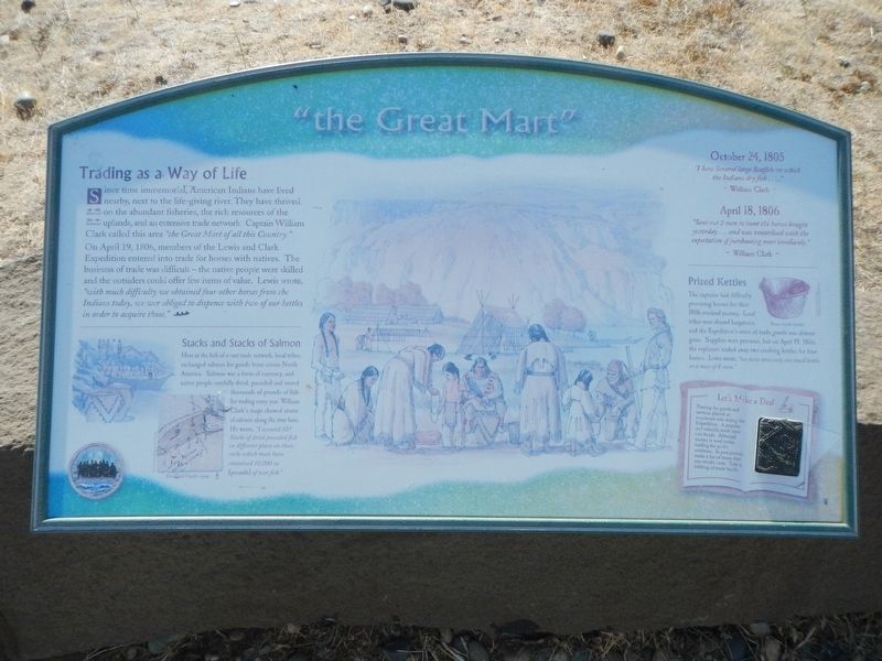
"the Great Mart"
Inscription.
Since time immemorial, American Indians have lived nearby, nest to the life-giving river. They have thrived on the abundant fisheries, the rich resources of the uplands, and an extensive trade network. Captain William Clark called this area "the Great Mart of all this Country." On April 19, 1806, members of the Lewis and Clark Expedition entered into trade for horses with natives. The business of trade was difficult - the native people were skilled and the outsiders could offer few items of value. Lewis wrote, "with much difficulty we obtained four other horses from the Indians today, we wer (sic) obliged to dispense with two of our kettles in order to acquire those."
Stacks and Stacks of Salmon
Here at the hub of a vast trade network, local tribes exchanged salmon for goods from across North America. Salmon was a form of currency, and native people carefully dried, pounded and stored thousands of pounds of fish for trading every year. William Clark's maps show stores of salmon along the river here. He wrote, "I counted 107 Stacks of dried pounded fish in different places on those rocks which must have contained 10,00 w. (pounds) of neet fish."
October 24, 1805
"I Saw Several large Scaffols on which the Indians dry fish ...." ~ William Clark ~
April 18, 1806
"Sent out 2 men to hunt the horses bought yesterday ... and was tanterlised with the expectation of purchaseing more imediately." ~ William Clark ~
Prized Kettles
The captains had difficulty procuring horsed for their 1806 overland journey. Local tribes were shrewd bargainers, and the Expedition's store of trade goods was almost gone. Supplies were precious, but on April 19, 1806 the explorers traded away two cooking kettles for four horses. Lewis wrote, "we have now only one small kettle to a mess of 8 men."
Let's Make a Deal
Trading for goods and services played an important role during the Expedition. A popular and valuable trade item was beads. Although money is used today, trading for goods continues. In your journal make a list of items that you would trade. The a rubbing of trade beads.
Erected by Lewis & Clark Expedition - Washington.
Topics and series. This historical marker is listed in these topic lists: Exploration • Native Americans. In addition, it is included in the Lewis & Clark Expedition series list. A significant historical date for this entry is April 19, 1806.
Location. 45° 38.434′ N, 121° 6.269′ W. Marker is near Dallesport, Washington, in Klickitat County. Marker can be reached from Columbia Hills Historical State Park Road near Lewis and Clark Highway (Washington Route 14) when traveling south. The marker is in the parking lot at the end of the road. Touch for map. Marker is in this post office area: Dallesport WA 98617, United States of America. Touch for directions.
Other nearby markers. At least 8 other markers are within 4 miles of this marker, measured as the crow flies. Sheltered Homelands (here, next to this marker); Long Narrows Challenge (here, next to this marker); Through the Short Narrows (a few steps from this marker); Horsethief Butte (within shouting distance of this marker); Columbia River Indians (approx. ¾ mile away); Preparing to leave the River (approx. 2.6 miles away); The Columbia Then & Now (approx. 3.6 miles away); To Market, to Market (approx. 3.6 miles away). Touch for a list and map of all markers in Dallesport.
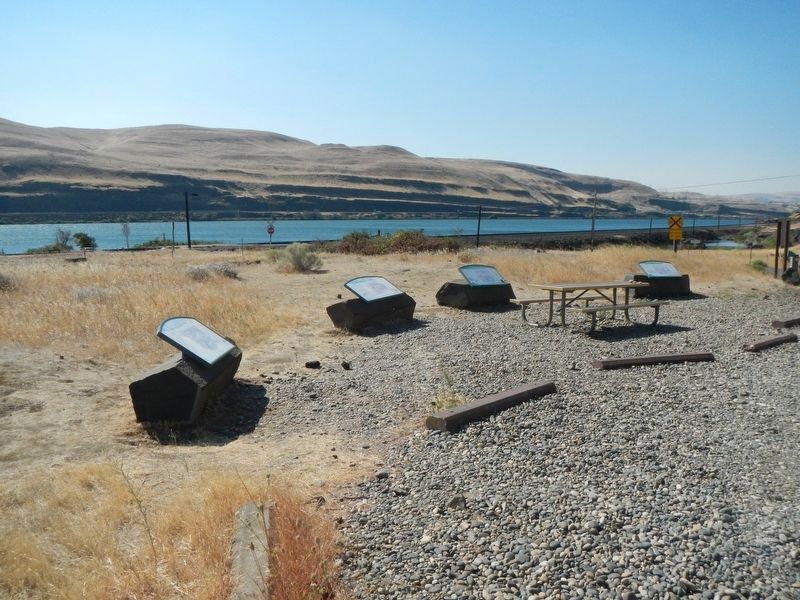
More about this marker. This marker is among a group at the end of the park road, down by the Columbia River.
Credits. This page was last revised on October 20, 2020. It was originally submitted on October 20, 2020, by Barry Swackhamer of Brentwood, California. This page has been viewed 133 times since then and 6 times this year. Photos: 1, 2. submitted on October 20, 2020, by Barry Swackhamer of Brentwood, California.

