Midtown in Nashville in Davidson County, Tennessee — The American South (East South Central)
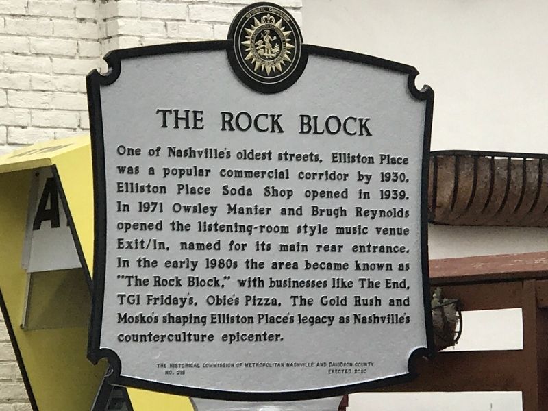
The Rock Block
Erected 2020 by The Historical Commission of Metropolitan Nashville and Davidson County. (Marker Number 218.)
Topics and series. This historical marker is listed in these topic lists: Arts, Letters, Music • Entertainment • Industry & Commerce • Roads & Vehicles. In addition, it is included in the Tennessee, The Historical Commission of Metropolitan Nashville and Davidson County series list. A significant historical year for this entry is 1930.
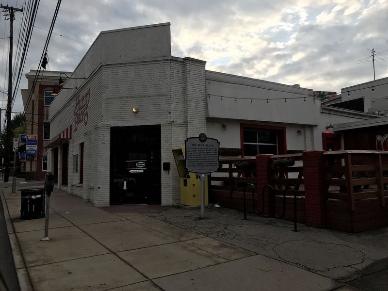
Location. 36° 9.074′ N, 86° 48.261′ W. Marker is in Nashville, Tennessee, in Davidson County. It is in Midtown. Marker is on Elliston Place just north of Louise Avenue, on the left when traveling north. Touch for map. Marker is at or near this postal address: 2208 Elliston Place, Nashville TN 37203, United States of America. Touch for directions.
Other nearby markers. At least 8 other markers are within walking distance of this marker. Nashville Academy of Medicine (about 600 feet away, measured in a direct line); Governors' Mansion (about 700 feet away); Vanderbilt University (approx. 0.2 miles away); Cornelius Vanderbilt (approx. 0.2 miles away); Saint Thomas Hospital (approx. 0.2 miles away); Wallace University School (approx. ¼ mile away); Vanderbilt University Gateposts (approx. 0.3 miles away); All the Park's a Stage (approx. 0.4 miles away). Touch for a list and map of all markers in Nashville.
Also see . . . Elliston Place Soda Shop (YouTube). From Nashville Public Television's Tennessee Crossroads series. (Submitted on October 20, 2020, by Duane and Tracy Marsteller of Murfreesboro, Tennessee.)
Credits. This page was last revised on February 7, 2023. It was originally submitted on October 20, 2020, by Duane and Tracy Marsteller of Murfreesboro, Tennessee. This page has been viewed 365 times since then and 51 times this year. Photos: 1, 2. submitted on October 20, 2020, by Duane and Tracy Marsteller of Murfreesboro, Tennessee. • Devry Becker Jones was the editor who published this page.

