Chatham in Barnstable County, Massachusetts — The American Northeast (New England)
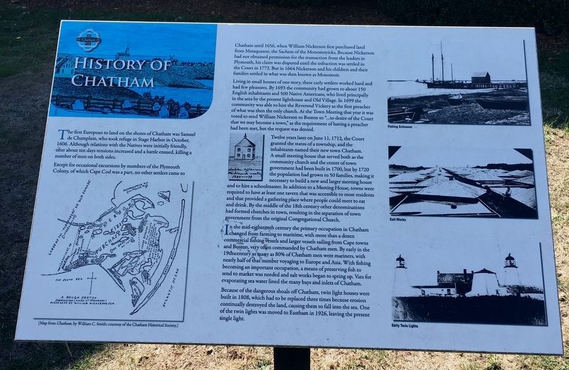
History of Chatham
The first European to land on the shores of Chatham was Samuel de Champlain, who took refuge in Stage Harbor in October, 1606. Although relations with the Natives were initially friendly, after about ten days tensions increased and a battle ensued, killing a number of men on both sides.
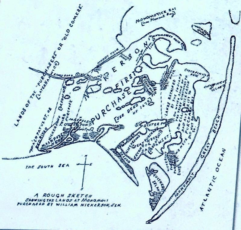
Except for occasional excursions by members of the Plymouth Colony, of which Cape Cod was a part, no other settlers came to Chatham until 1656, when William Nickerson first purchased land from Mataquason, the Sachem of the Monomoyicks. Because Nickerson had not obtained permission for the transaction from the leaders in Plymouth, his claim disputed until the infraction was settled in the Court in 1772. But in 1664 Nickerson and his children and their families settled in what was then known as Monomoit.
Living in small houses of one story, these early settlers worked hard and had few pleasures. By 1693 the community had grown to about 150 English inhabitants and 500 Native Americans, who lived principally in the area by the present lighthouse and Old Village. In 1699 the community was able to hire the Reverend Vickery as the first preacher of what was then the only church. At the Town Meeting that year it was voted to send William Nickerson to Boston to “… desire the Court that we may become a town,” as the requirement of having a preacher had been meet, but the request was denied.
Twelve years later on June 11, 1712, the Court granted the status of a township, and the inhabitants named their new town Chatham. A small meeting house that served both as the community church and the center of town government had been built in 1700, but by 1720 the population had grown to 50 families, making it necessary to build a new and larger meeting house and to hire a schoolmaster. In addition to a Meeting House, towns were required to have at least one tavern that was accessible to most residents and that provided a gathering place where people could meet to eat and drink. By the middle of the 18th century other denominations had formed churches in town, resulting in the separation of town government from the original Congregational Church.
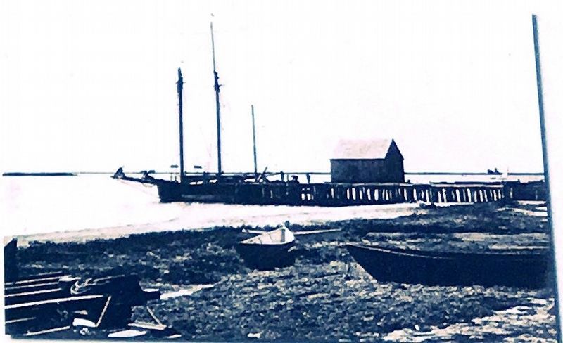
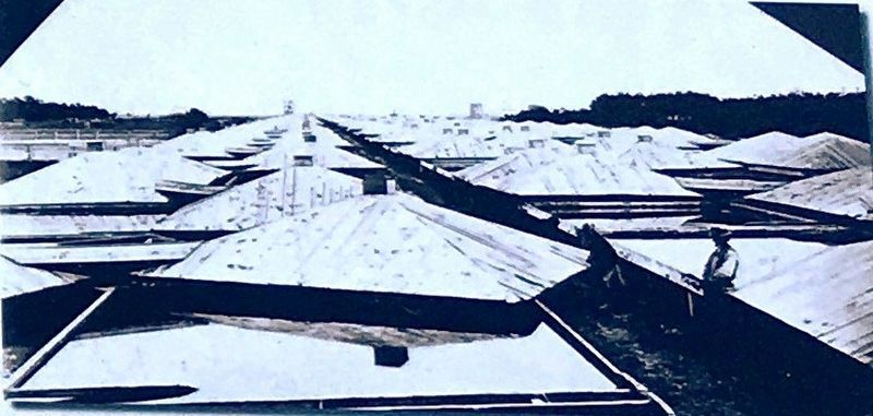
In the mid-eighteenth century the primary occupation in Chatham changed from farming to maritime, with more than a dozen commercial fishing vessels and larger vessels from Cape towns and Boston, very often commanded by Chatham men. By early in the 19th century as many as 80% of Chatham men were mariners, with nearly half of that number voyaging to Europe and Asia. With fishing becoming an important occupation, a means of preserving fish to send to market was needed and salt works began to spring up. Vats for evaporating sea water lined the many bays and inlets of Chatham.
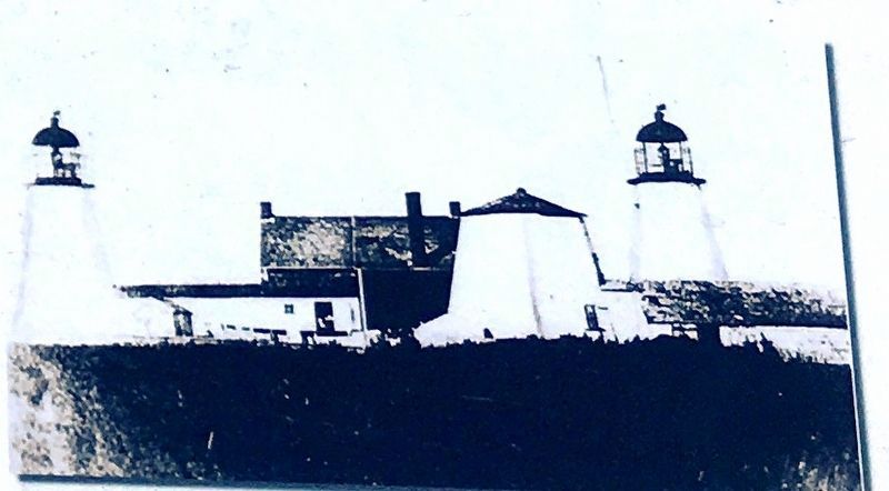
Because of the dangerous shoals off Chatham, twin light houses were built in 1808, which had to be replaced three times because of erosion continually destroyed the land, causing them to fall into the sea. One of the twin lights was moved to Eastham 1926, leaving the present single light.
Topics. This historical marker is listed in these topic lists: Colonial Era • Native Americans • Settlements & Settlers.
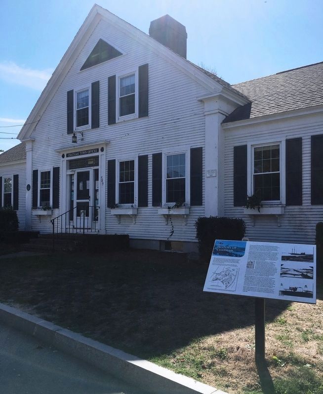
Location. 41° 40.858′ N, 69° 57.522′ W. Marker is in Chatham, Massachusetts, in Barnstable County. Marker is at the intersection of Main Street and Blackberry Lane, on the left when traveling north on Main Street. Located in front of Chatham Town Hall. Touch for map. Marker is at or near this postal address: 549 Main Street, Chatham MA 02633, United States of America. Touch for directions.
Other nearby markers. At least 8 other markers are within walking distance of this marker. A different marker also named History of Chatham (here, next to this marker); In Memory of the Pioneers of Chatham (within shouting distance of this marker); The Josiah Mayo House (within shouting distance of this marker); Chatham Civil War Monument (about 500 feet away, measured in a direct line); The Godfrey Windmill (approx. ¼ mile away); The Men Of Chatham (approx. 0.3 miles away); Chatham Railroad Depot (approx. 0.3 miles away); The Atwood School (approx. 0.4 miles away). Touch for a list and map of all markers in Chatham.
Credits. This page was last revised on October 25, 2020. It was originally submitted on October 20, 2020, by Brandon D Cross of Flagler Beach, Florida. This page has been viewed 265 times since then and 27 times this year. Photos: 1, 2, 3, 4, 5, 6. submitted on October 20, 2020, by Brandon D Cross of Flagler Beach, Florida. • Michael Herrick was the editor who published this page.
