Dallesport in Klickitat County, Washington — The American West (Northwest)
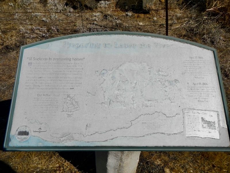
Preparing to leave the River
The Lewis and Clark Expedition prepared to depart the river in this area while eastbound in April 1806. The explorers wanted to obtain horses and proceed overland to the Nez Perce villages. To acquire the horses they were forced to barter some of their most prized possession.
Many tribes gathered here to trade and socialize and Lewis and Clark hoped they could easily buy horses from them. However, the native people of this region were experienced traders. During one transaction Clark paid "at least more than double" the expected price for four horses.
(this portion too damaged to read)
April 17, 1806
"I made a bargin with the Chief who has more horses than all the village besides for 2 horses Soon after he canseled his bargin, and we again bargined for 3 horses they were brought forward, and only one fit for Service (?) as I would not take the 3 he would not Sell the good one to me and we were off the bargin" ~ William Clark ~
April 15, 1806
"those people bantered the Skillutes to play at a Songular kind of game. In the Course of the day the Skillutes won all their beeds Skins arrows & c. ... this is a ver intricate game. ~ William Clark ~
(sidebar)
Let's Play a Game
(this portion too damaged to read)
Erected by Lewis & Clark Expedition - Washington.
Topics and series. This historical marker is listed in these topic lists: Exploration • Native Americans. In addition, it is included in the Lewis & Clark Expedition series list. A significant historical date for this entry is April 17, 1806.
Location. 45° 38.947′ N, 121° 9.423′ W. Marker is in Dallesport, Washington, in Klickitat County. Marker is at the intersection of Washington Route 14 and U.S. 197 on State Route 14. Touch for map. Marker is in this post office area: Dallesport WA 98617, United States of America. Touch for directions.
Other nearby markers. At least 8 other markers are within 4 miles of this marker, measured as the crow flies. Horsethief Butte (approx. 2.6 miles away); Through the Short Narrows (approx. 2.6 miles away); Sheltered Homelands (approx. 2.6 miles away); Long Narrows Challenge (approx. 2.6 miles away); "the Great Mart" (approx. 2.6 miles away); The History of the Columbia River Highway (approx. 2.6 miles away in Oregon); Columbia River Indians (approx. 2.8 miles away); The Lewis & Clark Expedition (approx. 3.3 miles away in Oregon). Touch for a list and map of all markers in Dallesport.
Credits. This page was last revised on October 21, 2020. It was originally submitted on October 21, 2020, by Barry Swackhamer of Brentwood, California. This page has been viewed 112 times since then and 4 times this year. Photos: 1, 2. submitted on October 21, 2020, by Barry Swackhamer of Brentwood, California.

