Near Wildersville in Henderson County, Tennessee — The American South (East South Central)
Raiders' Escape Route
Retreat from Parkers Crossroads
| — | Forrest's First West Tennessee Raid | — |
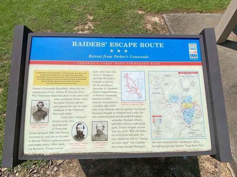
Photographed by Darren Jefferson Clay, July 24, 2021
1. Raiders' Escape Route Marker
Gen. Nathan Bedford Forrest led his cavalry brigade on a raid through West Tennessee, Dec. 15, 1862 - Jan. 3, 1863, destroying railroads and severing Gen. Ulysses S. Grant's supply line between Columbus, Kentucky and Vicksburg, Mississippi. Forrest crossed the Tennessee River at Clifton, defeated Union Col. Robert G. Ingersoll's cavalry at Lexington, captured Trenton and Union City, and ranged briefly into Kentucky. He raided back through Tennessee, evaded defeat at Parker's Crossroads, and crossed the river again at Clifton. Forrest's success forced Grant to switch his supply base to Memphis.
Parker's Crossroads Battlefield, where the last engagement of Gen. Nathan B. Forrest's First West Tennessee Raid took place is five and a half miles northwest of here. After
the battle Forrest and his men passed this way en route southeast to the Tennessee River and safety.
Union Gen. Ulysses S. Grant's army occupied this part of Tennessee in the spring of 1862, and Forrest launched his raid late in the year to disrupt Federal communications and supply routes. After reaching Kentucky, Forrest turned back, with Union Cols. Cyrus
this page online
Erected by Tennessee Civil War Trails.
Topics and series. This historical marker is listed in this topic list: War, US Civil. In addition, it is included in the Former U.S. Presidents: #18 Ulysses S. Grant, and the Tennessee Civil War Trails series lists. A significant historical date for this entry is December 31, 1862.
Location. 35° 47.796′ N, 88° 15.884′ W. Marker is near Wildersville, Tennessee, in Henderson County. It is on Camden Road (Tennessee Route 114) 1.7 miles south of Interstate
Photographed by Chris Hill, October 21, 2020
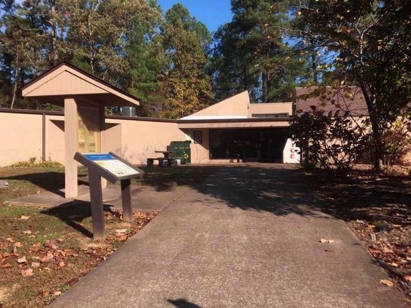
2. Raiders' Escape Route Marker at the entrance to the Natchez Trace State Park Headquarters

Regionally, this marker is in West Tennessee. It is also in the American South and specifically in the Upper South. Globally, it is in North America, the Western Hemisphere, the Western World, and the Anglosphere. Historically, it finds itself in what was once the territory of the Mississippian Culture, one of the Confederate States of America, and the Antebellum South.
Other nearby markers. At least 8 other markers are within 7 miles of this marker, measured as the crow flies: The Battle of Parker's Crossroads (approx. 6½ miles away); Enfilading the Line (approx. 6.7 miles away); Forrest Seizes the Advantage (approx. 6.7 miles away); Dunham Strikes Back (approx. 6.8 miles away); Casualties of War (approx. 6.8 miles away); A Fire Terrible In Its Intensity (approx. 6.8 miles away); A Lull in the Fighting (approx. 6.8 miles away); A Concealed Assault (approx. 6.8 miles away).
Credits. This page was last revised on July 24, 2021. It was originally submitted on October 21, 2020, by David Austin of Scotts Hill, Tennessee. This page has been viewed 431 times since then and 20 times this year. Photos: 1. submitted on July 24, 2021, by Darren Jefferson Clay of Duluth, Georgia. 2. submitted on October 21, 2020, by David Austin of Scotts Hill, Tennessee. • J. Makali Bruton was the editor who published this page.
