Maurertown in Shenandoah County, Virginia — The American South (Mid-Atlantic)
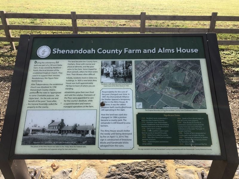
Shenandoah County Farm and Alms House
Shenandoah County • Industry with Plenty

Photographed By Devry Becker Jones (CC0), October 23, 2020
1. Shenandoah County Farm and Alms House Marker
During the colonial era, this park was part of a 230 acre Glebe Farm. It was owned by Beckford Parish, the local division of the established Anglican Church. They used it to support their minister, Revolutionary War figure Peter Muhlenberg.
After independence, the established church was dissolved. In 1798 Shenandoah County citizens petitioned the state to "appropriate to some Charitable purpose…the Glebe land…for the sole use and benefit of the poor." Soon after, the General Assembly ceded the property to the county.
The land became the County Farm. Orphans, those with mental and physical ailments, and the poor came to live here. Some stayed for short periods, others for their entire lives. Their life was often difficult.
Initially, residents lived in Glebe era buildings. In 1829 a new brick Alms House was built approximately 750 feet in front of where you are standing.
Inhabitants grew their own food and sold the surplus. Overseers of the Poor were appointed to care for the county's destitute, while a superintendent and matron managed operations at the farm.
Sidebar:
Responsibility for the care of the poor changed over time. In 1991 the Shenandoah Alliance for Shelter opened a temporary shelter in the Alms House. At one time, it was the oldest purpose-built county poorhouse still operating in the state.
How the land was used also changed. In 1984 a portion became the county park. The remainder is still leased to area farmers.
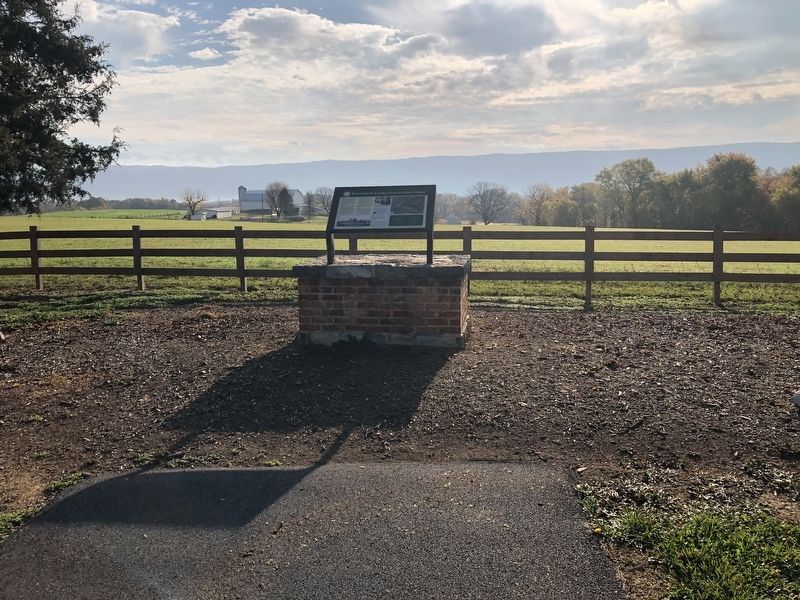
The Alms House would shelter the needy until being destroyed by fire on April 13, 2014. This sign is constructed of limestone blocks and handmade bricks salvaged from the ruins.
Significant Dates 1769 – Beckford Parish established what was then Frederick County.
1772 – Dunmore (now Shenandoah) County established. Peter Muhlenberg becomes first rector of Beckford Parish.
1774 – Glebe Farm created.
1798 – Citizens petition the state to give farm to county to benefit the poor.
1799 – Glebe Farm ceded to county.
1829 – New Alms House built to replace previous structure.
1850 – Superintendent and kitchen wings added.
1864 – Battle of Tom's Brook rages on part of County Farm property.
1909 – State Board of Charities & Corrections stated in survey that the County Farm was "one of the best institutions in the state." That year 31 people lived here.
1984 – Portion of farm designated as county park; now includes 68 acres.
1991 – Shenandoah Alliance for Shelter begins operation of temporary shelter for homeless families.
2014– Alms House destroyed by fire.Photographed By Devry Becker Jones (CC0), October 23, 20202. Shenandoah County Farm and Alms House Marker
Erected 2015 by Shenandoah County in partnership with the Shenandoah County Historical Society.
Topics. This historical marker is listed in these topic lists: Agriculture • Charity & Public Work • Churches & Religion • Parks & Recreational Areas. A significant historical date for this entry is April 13, 2014.
Location. 38° 55.933′ N, 78° 27.232′ W. Marker is in Maurertown, Virginia, in Shenandoah County. Marker can be reached from Park Lane, 0.3 miles south of Old Valley Pike (U.S. 11), on the left when traveling south. Touch for map. Marker is at or near this postal address: 296 Park Ln, Maurertown VA 22644, United States of America. Touch for directions.
Other nearby markers. At least 8 other markers are within 4 miles of this marker, measured as the crow flies. Toms Brook (approx. 0.2 miles away); a different marker also named Toms Brook (approx. ¼ mile away); Action of Toms Brook (approx. 0.8 miles away); "Snapp House" (approx. 3.2 miles away); Battle of Fisher's Hill (approx. 3.3 miles away); a different marker also named Battle of Fisher's Hill (approx. 3.9 miles away); Woodstock (approx. 4 miles away); a different marker also named Battle of Fisher's Hill (approx. 4.1 miles away).
Credits. This page was last revised on September 21, 2023. It was originally submitted on October 24, 2020, by Devry Becker Jones of Washington, District of Columbia. This page has been viewed 251 times since then and 23 times this year. Photos: 1, 2. submitted on October 24, 2020, by Devry Becker Jones of Washington, District of Columbia.
