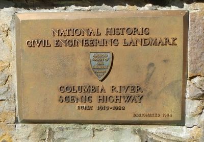
Near The Dalles in Wasco County, Oregon — The American West (Northwest)
The History of the Columbia River Highway
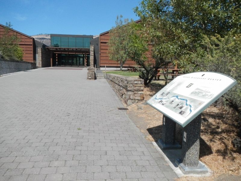
Gorge Discovery Center
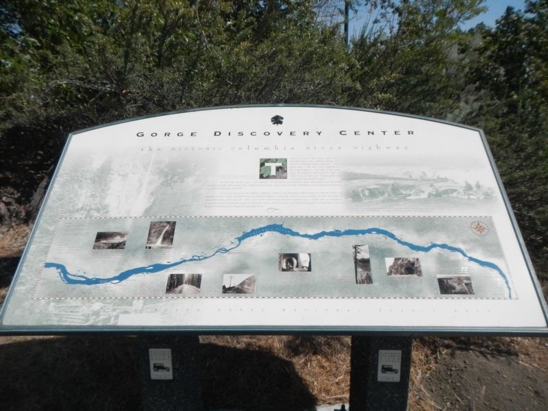
Photographed By Barry Swackhamer, August 13, 2020
1. The History of the Columbia River Highway Marker
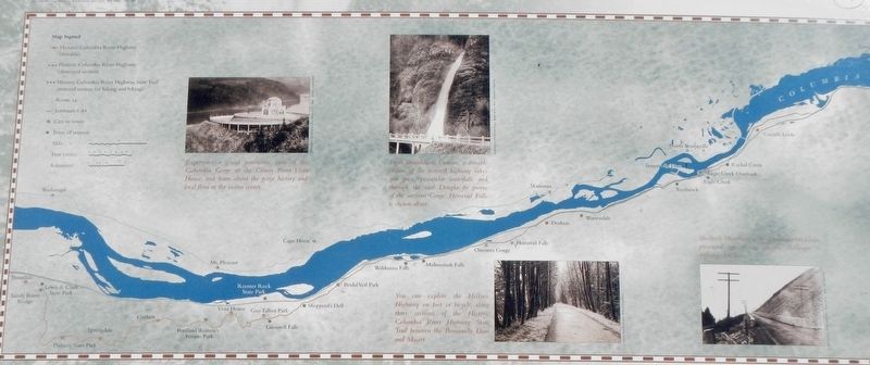
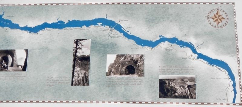
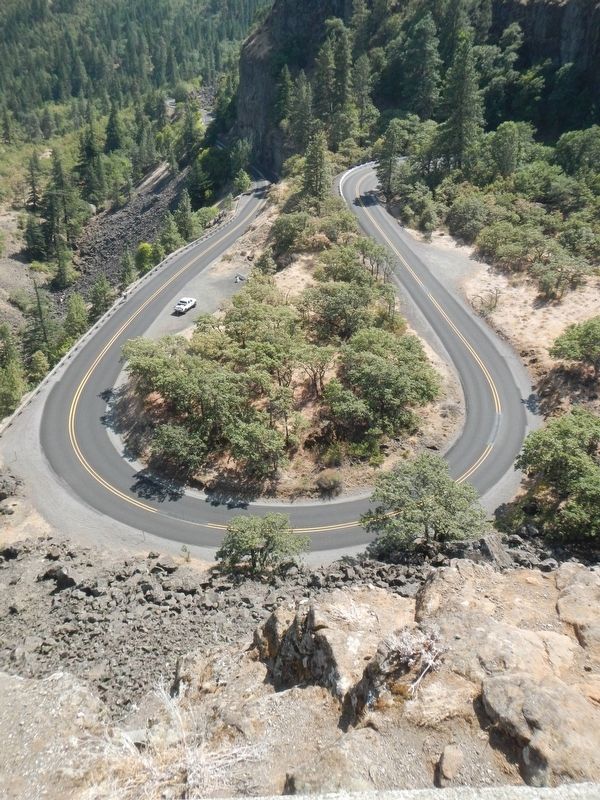
Captions: (Map and Pictures left to right) Experience a grand panoramic view of the Columbia Gorge at the Crown Point Vista House, and learn about the gorge history and local flora at the visitor center,; From Troutdale to Dodson, a drivable section of the restored highway takes you past spectacular waterfalls and through the cool Douglas-fir groves of the western Gorge. Horsetail Falls is shown above.; You can explore the Historic Highway on foot or bicycle, along three sections of the Historic Columbia River Highway State Trail between the Bonneville Dam and Mosier.; Shellrock Mountain with its constant landslides presented one of the greatest challenges to highway builders.; Mitchell Point - blasted out of solid rock - is "a place they said that couldn't be conquered but was." (tunnels in photo have been destroyed); Mt. Hood loop begins at Hood River and passes around the mountain, emerging again at Troutdale.; At Mosier, explore the pedestrian/bicycle-only section between Mosier and Hood River. This section includes the carefully restored Mosier Twin Tunnels.; Take time to stop at Rowena Crest, where the highway limbs in a series of graceful curves (the "Rowena Loop") to a spectacular vista.;
(photo, top right) For more than 10,000 years Native Americans lined the shore and braved the currents at Celilo Falls to plunge dip nets into massive runs of salmon, sturgeon and lamprey eels ascending the Columbia River. Celilo Falls is still a popular fishing spot.
In less than twenty years, a new highway was needed to accommodate larger automobiles and increasing commercial traffic that navigated the winding, narrow route. Soon sections of the old highway were bypassed as Interstate 84 replaced "the King of Roads"
A renewed interest in the Historic Highway surfaced and restoration efforts began in 1986 to restore and unearthed sections of this beautiful (a National Historic Landmark). Several scenic stretches are now accessible by automobile, foot and/or bicycle - this is one of the only sections that has remained open to traffic since its completion in 1922. If you're traveling the Gorge in search of scenery and history, you won't find a better place to look than along the Historic Columbia River Highway's graceful curves.
Erected by Columbia River Gorge National Scenic Area.
Topics. This historical marker is listed in this topic list: Roads & Vehicles. A significant historical year for this entry is 1986.
Location. 45° 39.239′ N, 121° 12.664′ W. Marker is near The Dalles, Oregon, in Wasco County. Marker is on Discovery Center Drive, aka Taylor-Frantz Road near U.S. 30. The marker is located at Gorge Discovery Center. Touch for map. Marker is at or near this postal address: 5000 Discovery Center Drive, The Dalles OR 97058, United States of America. Touch for directions.
Other nearby markers. At least 8 other markers are within 4 miles of this marker, measured as the crow flies. Preparing to leave the River (approx. 2.6 miles away in Washington); Importance of Salmon (approx. 3.4 miles away); The Lewis & Clark Expedition (approx. 3.4 miles away); The White Man Legend (approx. 3.4 miles away); Rumor of Attack (approx. 3.4 miles away); Trade Center for 10000 Years (approx. 3.4 miles away); Establishing Rock Fort (approx. 3˝ miles away); Archaeology of Lewis & Clark (approx. 3˝ miles away). Touch for a list and map of all markers in The Dalles.
Credits. This page was last revised on October 26, 2020. It was originally submitted on October 24, 2020, by Barry Swackhamer of Brentwood, California. This page has been viewed 184 times since then and 16 times this year. Photos: 1, 2, 3, 4, 5. submitted on October 24, 2020, by Barry Swackhamer of Brentwood, California. 6. submitted on October 25, 2020, by Barry Swackhamer of Brentwood, California.
