Near Hermiston in Umatilla County, Oregon — The American West (Northwest)
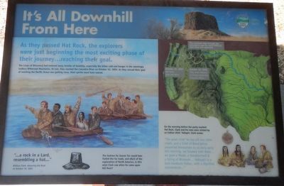
It's All Downhill From Here

Photographed By Barry Swackhamer, August 14, 2020
1. It's All Downhill From Here Marker
Captions: (map, upper right) The overland trail through the mountains was far more difficult than they expected.; October 16, 1805 - They were relieved to finally reach the Columbia River.; October 16, 1805 (sic) Hat Rock (you are here).
. The Corps of Discovery had endured months of hardship, especially the bitter cold and hunger in the seemingly endless Bitterroot Mountains. At last, they reached the Columbia River on October 16, 1805. As they sensed their goal of reaching the Pacific Ocean was getting closes, their spirits must have soared.
"...a rock in a Lard, resembling a hat..." William Clark, observing Hat Rock on October 19, 1805
The fashion for beaver fur round hats fueled the fur trade, and much of the exploration of North America. Is this what Clark saw when he came upon Hat Rock?
On the morning before the party reached Hat Rock, Clark and his men were visited by an Indian chief, Yellepit. Clark wrote:
"The great chief Yeo-lep-pit two other chiefs, and a Chief of Band below presented themselves to us verry early this morning. we Smoked with the... we gave a Medal, a Handkercheif & a String of Wompon... Yelleppit is a bold hansom Indian, with a dignified countenance..."
Erected by Oregon Parks and Recreation Department.
Topics and series. This historical marker is listed in these topic lists: Exploration • Natural Features • Waterways & Vessels. In addition, it is included in the Lewis & Clark Expedition series list. A significant historical date for this entry is October 19, 1805.
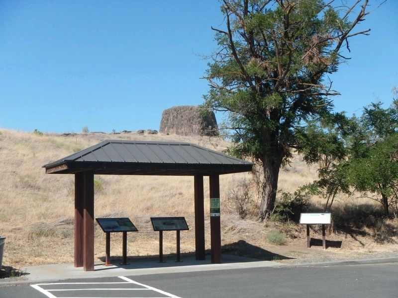
Location. 45° 55.178′ N, 119° 10.11′ W. Marker is near Hermiston, Oregon, in Umatilla County. Marker is on Marina Drive near Hat Rock State Park Road. The marker is at the Marina Drive parking lot in Hat Rock State Park. Touch for map. Marker is in this post office area: Hermiston OR 97838, United States of America. Touch for directions.
Other nearby markers. At least 8 other markers are within 9 miles of this marker, measured as the crow flies. Naamí Tiičám Ku Waqíšwit (here, next to this marker); A Team of Discovery (here, next to this marker); How Do You Make a Hat? (approx. ¼ mile away); The Umatilla Rapids (approx. 6.6 miles away); The Lewis and Clark Expedition (approx. 6.6 miles away); Cayuse, Umatilla and Walla Walla Homeland (approx. 6.6 miles away); Patímaša Tiičámna (approx. 6.6 miles away); Strangers "from the clouds" (approx. 8.9 miles away in Washington). Touch for a list and map of all markers in Hermiston.
Credits. This page was last revised on October 26, 2020. It was originally submitted on October 26, 2020, by Barry Swackhamer of Brentwood, California. This page has been viewed 198 times since then and 50 times this year. Photos: 1, 2. submitted on October 26, 2020, by Barry Swackhamer of Brentwood, California.
