Mount Bonnell Terrace in Austin in Travis County, Texas — The American South (West South Central)
Mount Bonnell
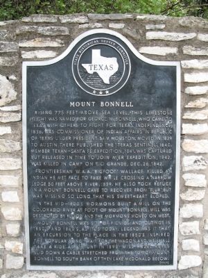
Rising 775 feet above sea level, this limestone height was named for George W. Bonnell, who came to Texas with others to fight for Texas independence, 1836. Was commissioner of Indian Affairs in Republic of Texas under president Sam Houston. Moved in 1839 to Austin; there published the "Texas Sentinel", 1840. Member Texan-Santa Fe expedition, 1841. Was captured but released in time to join Mier expedition, 1842. Was killed in camp on Rio Grande, Dec. 26, 1842.
Frontiersman W.A.A. "Bigfoot" Wallace killed an Indian he met face to face while crossing a narrow ledge 50 feet above river, 1839. He also took refuge in a Mount Bonnell cave to recover from "flux", but was missing so long his sweetheart eloped.
In the mid-1800's Mormons built a mill on the Colorado River at foot of Mount Bonnell. Mill was destroyed by flood and the Mormons moved on west.
Mount Bonnell was site of picnics and outings in 1850's and 1860's. As it is today. Legend has it that an excursion to the place in the 1850's inspired the popular song "Wait for the Wagon and We'll All Take a Ride". As a stunt in 1898, Miss Hazel Keyes slid down a cable stretched from the top of Mount Bonnell to south bank of then Lake McDonald below.
Erected 1969 by State Historical Survey Committee. (Marker Number 6473.)
Topics. This historical marker is listed in these topic lists: Arts, Letters, Music • Churches & Religion • Native Americans • Settlements & Settlers. A significant historical date for this entry is December 26, 1929.
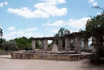
Location. 30° 19.29′ N, 97° 46.378′ W. Marker is in Austin, Texas, in Travis County. It is in Mount Bonnell Terrace. Marker is on Mount Bonnell Road, 0.2 miles south of Mount Bonnell Drive, on the right when traveling south. Touch for map. Marker is at or near this postal address: 3800 Mt Bonnell Road, Austin TX 78731, United States of America. Touch for directions.
Other nearby markers. At least 8 other markers are within one mile of this marker, measured as the crow flies. Covert Family Park Monument (a few steps from this marker); Rainey House (approx. 0.2 miles away); Laguna Gloria (approx. 0.6 miles away); Adjutants General (approx. 0.9 miles away); Texas in the Civil War (approx. 0.9 miles away); Camp Mabry Historic District (approx. 0.9 miles away); Major John B. Jones (approx. 1.1 miles away); William Steele (approx. 1.1 miles away). Touch for a list and map of all markers in Austin.
Also see . . .
1. Mount Bonnell, Wikipedia. (Submitted on June 21, 2009, by Richard Denney of Austin, Texas.)
2. Aerial views of Mount Bonnell and Vicinity (video). YouTube video.
(Submitted on April 1, 2017, by Frederick Bothwell of Georgetown, Texas.)
Additional commentary.
1. Mount Bonnell
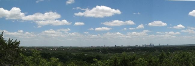
Mount Bonnell is often described as the highest point in Austin. While this may have been true in historic times when Austin was much smaller, today Mount Bonnell's elevation at its peak (marker quotes 775 feet above sea level) is less than that of several surrounding peaks, e.g. Mt. Barker, and in general is less than the Jollyville Plateau (max. elevation about 1100 feet about sea level), all part of modern day Austin.
— Submitted June 21, 2009, by Richard Denney of Austin, Texas.
Additional keywords. Church of Jesus Christ of Latter-Day Saints, Mormonism
Photographed By Frederick Bothwell, April 8, 2010
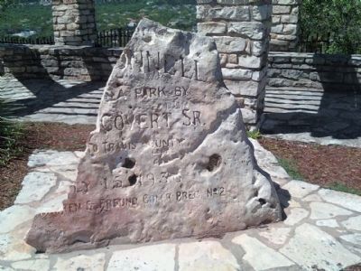
7. 2010 Condition of Marker Commemorating Establishment of the Park
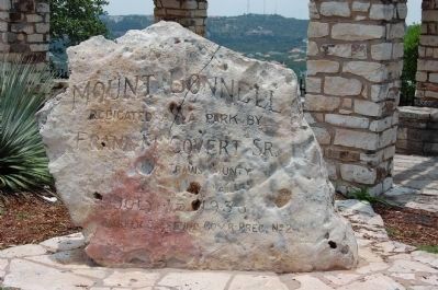
Mount Bonnell is the highest point in Covert Park which occupies land given to the citizens of Travis County Texas by the Covert family of Austin. The marker commemorating that gift has been vandalized and is unrepaired as of July 2010.
Credits. This page was last revised on February 1, 2023. It was originally submitted on June 21, 2009, by Richard Denney of Austin, Texas. This page has been viewed 4,005 times since then and 99 times this year. Last updated on October 29, 2020, by Richard Denney of Austin, Texas. Photos: 1, 2, 3, 4, 5. submitted on June 21, 2009, by Richard Denney of Austin, Texas. 6. submitted on December 21, 2009, by Keith Peterson of Cedar Park, Texas. 7. submitted on July 26, 2010, by Frederick Bothwell of Georgetown, Texas. • J. Makali Bruton was the editor who published this page.
