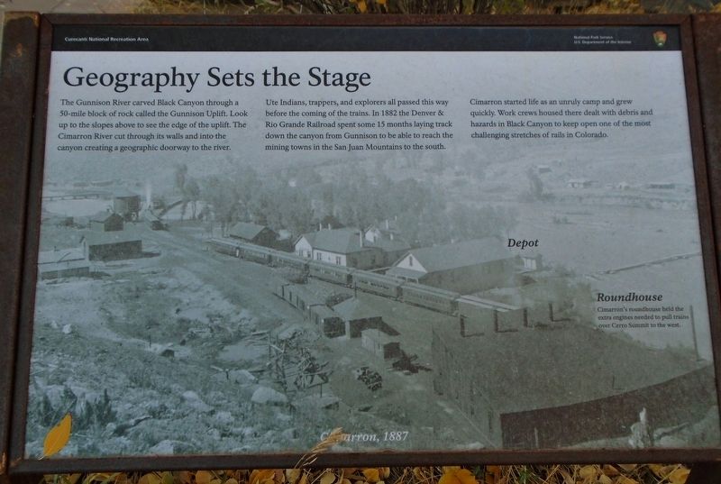
Geography Sets the Stage
The Gunnison River carved Black Canyon through a 50-mile block of rock called the Gunnison Uplift. Look up to the slopes above to see the edge of the uplift. The Cimarron River cut through its walls and into the canyon creating a geographic doorway to the river.
Ute Indians, trappers, and explorers all passed this way before the coming of the trains. In 1882 the Denver & Rio Grande Railroad spent some 15 months laying track down the canyon from Gunnison to be able to reach the mining towns in the San Juan Mountains to the south.
Cimarron started life as an unruly camp and grew quickly. Work crews housed there dealt with debris and hazards in Black Canyon to keep open one of the most challenging stretches of rails in Colorado.
[Background photo caption reads] Cimarron, 1887
[Highlighted on the photo are the]
• Depot
• Roundhouse - Cimarron's roundhouse held the extra engines needed to pull trains over Cerro Summit to the west.
Erected by National Park Service.
Topics. This historical marker is listed in these topic lists: Environment • Industry & Commerce • Railroads & Streetcars • Waterways & Vessels. A significant historical year for this entry is 1882.
Location. 38° 26.595′ N, 107° 33.305′
Other nearby markers. At least 8 other markers are within 11 miles of this marker, measured as the crow flies. Working on the Railroad (a few steps from this marker); Narrow Path to Prosperity (a few steps from this marker); From Mountain to Table (a few steps from this marker); All Aboard (approx. 0.7 miles away); Building a Dam (approx. 7.7 miles away); Light at the End of the Tunnel (approx. 7.7 miles away); Black Canyon of the Gunnison National Park (approx. 10.3 miles away); Pegmatite Dikes (approx. 10˝ miles away). Touch for a list and map of all markers in Cimarron.
Also see . . .
1. Historic Cimarron. (Submitted on October 29, 2020, by William Fischer, Jr. of Scranton, Pennsylvania.)
2. Narrow Gauge Railroad. (Submitted on October 29, 2020, by William Fischer, Jr. of Scranton, Pennsylvania.)
Credits. This page was last revised on October 29, 2020. It was originally submitted on October 29, 2020, by William Fischer, Jr. of Scranton, Pennsylvania. This page has been viewed 110 times since then and 7 times this year. Photos: 1, 2. submitted on October 29, 2020, by William Fischer, Jr. of Scranton, Pennsylvania.

