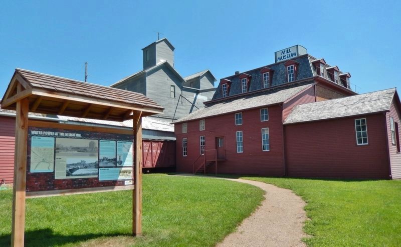
Neligh in Antelope County, Nebraska — The American Midwest (Upper Plains)
Water Power at the Neligh Mill
Water = Power
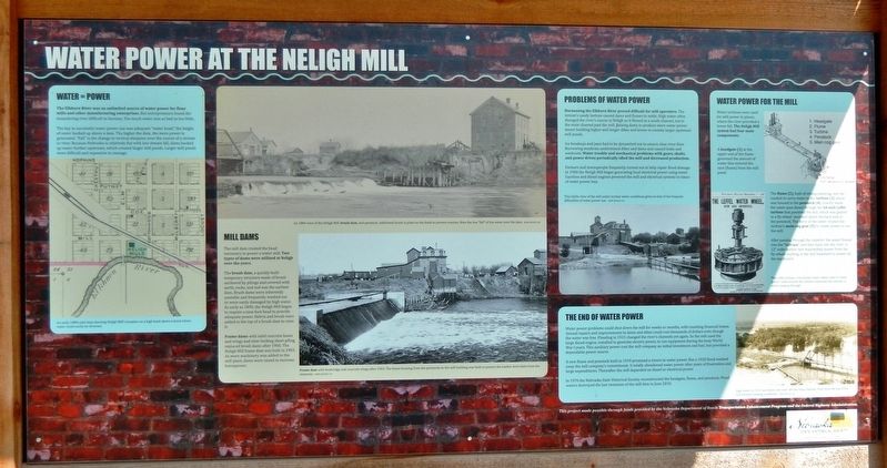
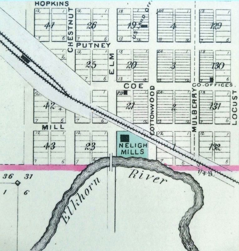
The Elkhorn River was an unlimited source of water power for flour mills and other manufacturing enterprises. But entrepreneurs found the meandering river difficult to harness. Too much water was as bad as too little.
The key to successful water power use was adequate "water head," the height of water backed up above a dam. The higher the dam, the more power is generated. "Fall" is the change in vertical elevation over the course of a stream or river. Because Nebraska is relatively flat with low stream fall, dams backed up water further upstream, which created larger mill ponds. Larger mill ponds were difficult and expensive to manage.
Mill Dams
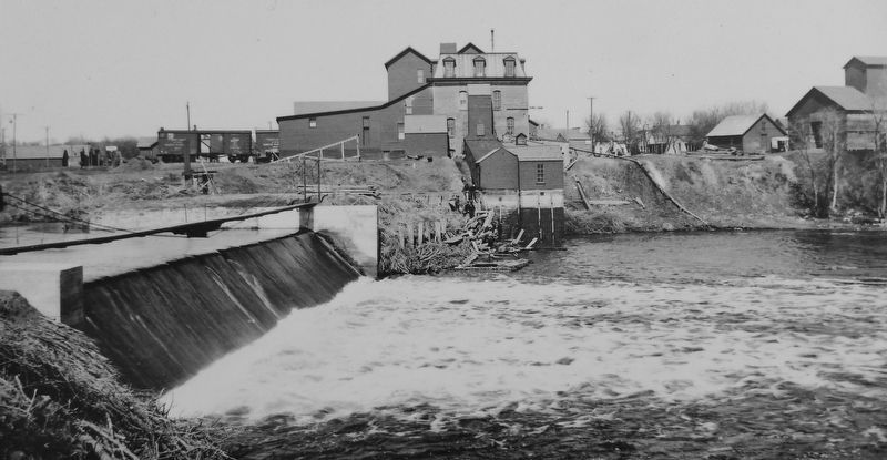
The mill dam created the head necessary to power a water mill. Two types of dams were utilized at Neligh over the years.
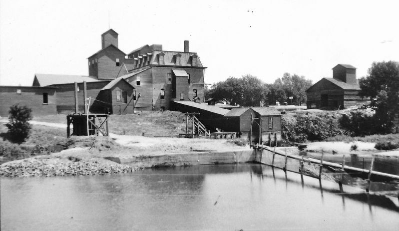
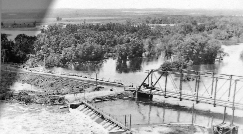
The brush dam, a quickly-built temporary structure made of brush anchored by pilings and covered with earth, rocks, and sod was the earliest dam. Brush dams were inherently unstable and frequently washed out or were easily damaged by high water. As early as 1890, the Neligh Mill began to require a nine-foot head to provide adequate power. Debris and brush were added to the top of a brush dam to raise it.
Frame dams with solid concrete bases and wings and inter-locking sheet piling replaced brush dams after 1900. The Neligh Mill frame dam was built in 1903. As more machinery was added to the mill plant, dams were raised to increase horsepower.
Problems of Water Power
Harnessing the Elkhorn River proved difficult for mill operators. The stream's sandy bottom caused dams and flumes to settle. High water often changed the river's course at Neligh so it flowed in a south channel, not in the main channel past the mill. Raising dams to produce more water power meant building higher and longer dikes and levees to contain larger upstream mill ponds.
Ice breakups and jams had to be dynamited out to ensure clear river flow. Burrowing muskrats undermined dikes and dams and caused leaks and washouts. Water trouble and mechanical problems with gears, shafts, and power drives periodically idled the mill and decreased production.
Farmers and townspeople frequently turned out to help repair flood damage. In 1900 the Neligh Mill began generating local electrical power using water. Gasoline and diesel engines powered the mill and electrical systems in times of water power loss.
The End of Water Power
Water power problems could shut down the mill for weeks or months, with resulting financial losses. Annual repairs and improvements to dams and dikes could cost thousands of dollars even though the water was free. Flooding in 1915 changed the river's
channels yet again. So the mill used the large diesel engine, installed to generate electric power, to run equipment during the busy World War I years. This auxiliary power cost the mill company an initial investment and fuel, but provided a dependable power source.
A new flume and penstock built in 1919 promised a return to water power. But a 1920 flood washed away the mill company's commitment. It totally abandoned water power after years of frustration and large expenditures. Thereafter the mill depended on diesel or electrical power.
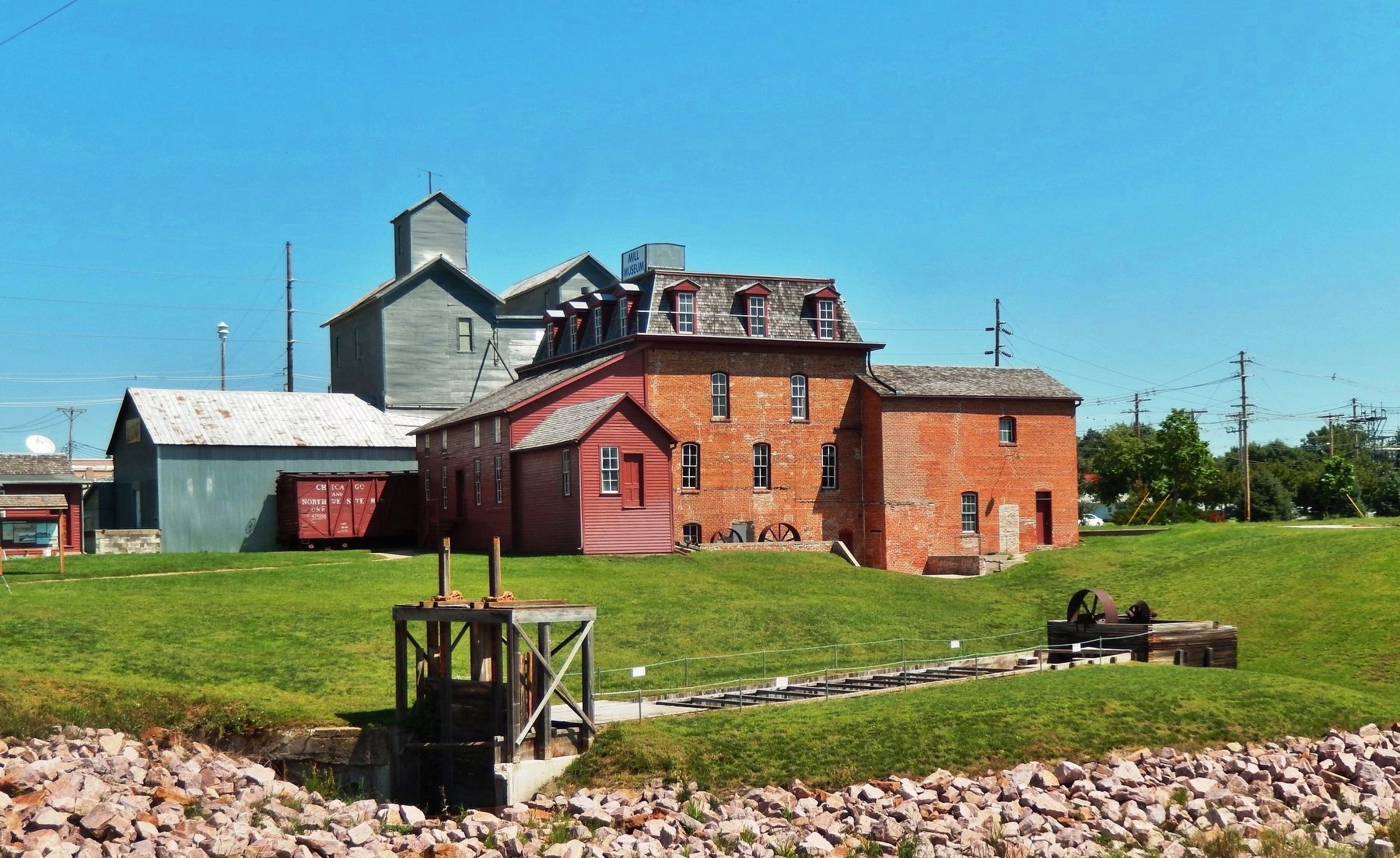
In 1976 the Nebraska State Historical Society reconstructed the headgate, flume, and penstock. Flood waters destroyed the last remnants of the mill dam in June 2010.
Erected by Nebraska State Historical Society, Nebraska Department of Roads, and Federal Highway Administration.
Topics. This historical marker is listed in these topic lists: Industry & Commerce • Waterways & Vessels. A significant historical year for this entry is 1884.
Location. 42° 7.571′ N, 98° 1.861′ W. Marker is in Neligh, Nebraska, in Antelope County. Marker is on N Street south of East 2nd Street, on the left when traveling south. Marker kiosk is located along the walkway on the west side of the Neligh Mill complex. Touch for map. Marker is in this post office area: Neligh NE 68756, United States of America. Touch for directions.
Other nearby markers. At least 8 other markers are within 12 miles
of this marker, measured as the crow flies. Trails, Rails, and Roads: Lifelines of a Mill (here, next to this marker); The Neligh Mill Bridge (a few steps from this marker); The Neligh Mills (a few steps from this marker); The Rainbow Fountain (about 600 feet away, measured in a direct line); Ponca Trail of Tears (approx. one mile away); Tilden, Nebraska (approx. 11.4 miles away); Tilden Veterans Memorial (approx. 11.6 miles away); Veterans Memorial Flag (approx. 11.6 miles away). Touch for a list and map of all markers in Neligh.
Regarding Water Power at the Neligh Mill. National Register of Historic Places #69000128.
Related markers. Click here for a list of markers that are related to this marker. Neligh Mill State Historic Site
Also see . . .
1. History of the Neligh Mill. Today the old mill is operated as a historic site by History Nebraska. It is the last complete nineteenth-century flour mill in Nebraska. Exhibits on the mill's history and operation are now found in the 1886 warehouse addition and in the 1915 addition that once housed the electrical power plant. The 1919 flume has been reconstructed, and on the river, the remains of the mill dam can be seen. (Submitted on November 2, 2020, by Cosmos Mariner of Cape Canaveral, Florida.)
2. Historic Photos of Neligh Mill
. (Submitted on November 2, 2020, by Cosmos Mariner of Cape Canaveral, Florida.)
7. Marker detail: Water Power for the Mill
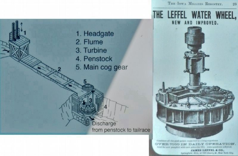
Water turbines were used for mill power in places where the river provided a lower fall. The Neligh Mill system had four main components:
A headgate (1) at the upper end of the flume governed the amount of water that entered the race (flume) from the mill pond. The flume (2), built of strong planking, was the conduit to carry water to the turbine (3) which was housed in the penstock (4). Gravity made the water pass down through the 64-inch Leffel turbine that powered the mill, which was geared to a fly-wheel mounted above the back wall of the penstock. The force of the water rotated the turbine's main cog gear (5) to create power to run the mill.
After passing through the impellor the water flowed into the "tailrace" and then back into the river. A 12" wide leather belt transmitted power from the fly-wheel shafting in the mill basement to power all the machinery.
The Leffel turbine (right), a horizontal water wheel used to create power. Gates around the turbine controlled the amount of water passing through.
Credits. This page was last revised on November 2, 2020. It was originally submitted on October 30, 2020, by Cosmos Mariner of Cape Canaveral, Florida. This page has been viewed 176 times since then and 11 times this year. Photos: 1, 2, 3, 4, 5, 6, 7, 8, 9. submitted on November 2, 2020, by Cosmos Mariner of Cape Canaveral, Florida.
