Near Groesbeck in Limestone County, Texas — The American South (West South Central)
Fort Parker Memorial Park
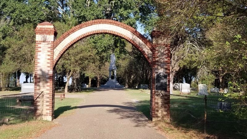
Site of the grave of victims of the massacre at Fort Parker by Comanche and Kiowa Indians on May 19, 1836, in which Cynthia Ann Parker and others were captured.
The trunk of the oak tree under which they were buried still stands, and the grave is marked by a granite slab.
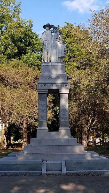
Also site of state monument to the pioneers erected in 1922 and the graves of other old settlers and veterans of the Texas War for Independence.
Limestone County Historical Society 1963
Erected 1963 by State Historical Survey Committee. (Marker Number 2002.)
Topics. This historical marker is listed in these topic lists: Cemeteries & Burial Sites • Forts and Castles • Native Americans • Settlements & Settlers. A significant historical date for this entry is May 19, 1836.
Location. 31° 32.861′ N, 96° 33.03′ W. Marker is near Groesbeck, Texas, in Limestone County. Marker is on Fort Park Memorial Cemetery Road, 0.4 miles east of Farm to Market Road 1245, on the right when traveling east. The marker is located on the right brick column of the arched front driveway to the cemetery. Touch for map. Marker is in this post office area: Groesbeck TX 76642, United States of America. Touch for directions.
Other nearby markers. At least 8 other markers are within 2 miles of this marker, measured as the crow flies. Mrs. C.D. Kelly (within shouting distance of this marker); Seth H. Bates (about 300 feet away, measured in a direct line); Old Fort Parker (approx. 1.1 miles away); Fort Parker (approx. 1.1 miles away); Groesbeck Independent School District (approx. 1.6 miles away); First Baptist Church of Groesbeck (approx. 1.8 miles away); Limestone County Memorial (approx. 1.9 miles away); Home County of Lafayette Lumpkin Foster (approx. 2 miles away). Touch for a list and map of all markers in Groesbeck.
Also see . . . Fort Parker Massacre. Wikipedia (Submitted on November 1, 2020, by James Hulse of Medina, Texas.)
Credits. This page was last revised on November 1, 2020. It was originally submitted on November 1, 2020, by James Hulse of Medina, Texas. This page has been viewed 348 times since then and 48 times this year. Photos: 1, 2, 3, 4. submitted on November 1, 2020, by James Hulse of Medina, Texas. • J. Makali Bruton was the editor who published this page.


