Near Fredericksburg in Spotsylvania County, Virginia — The American South (Mid-Atlantic)
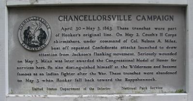
Chancellorsville Campaign
Photographed by Craig Swain, November 10, 2007
1. Chancellorsville Campaign Marker
Erected by United States Department of the Interior - National Park Service.
Topics. This historical marker is listed in this topic list: War, US Civil. A significant historical year for this entry is 1863.
Location. 38° 18.473′ N, 77° 37.923′ W. Marker is near Fredericksburg, Virginia, in Spotsylvania County. It is at the intersection of Plank Road / Germania Highway (State Highway 3) and Wiles Drive, on the right when traveling west on Plank Road / Germania Highway. Touch for map. Marker is in this post office area: Fredericksburg VA 22407, United States of America. Touch for directions.

Regionally,
this page online
Other nearby markers. At least 8 other markers are within walking distance of this marker: Union Earthworks (about 500 feet away, measured in a direct line); The Chancellor Slaves (approx. 0.2 miles away); Civilians in the Crossfire (approx. 0.2 miles away); Climactic Struggle (approx. 0.2 miles away); Lee's Greatest Triumph (approx. 0.2 miles away); The Chancellorsville Intersection (approx. 0.2 miles away); a different marker also named Battle of Chancellorsville (approx. 0.2 miles away); a different marker also named Chancellorsville Campaign (approx. 0.2 miles away). Touch for a list and map
Photographed by Craig Swain, November 10, 2007
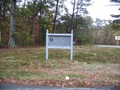
2. Chancellorsville Campaign Marker
Other markers no longer nearby. Battle of Chancellorsville (was approx. 0.2 miles away but has been permanently removed); Chancellorsville Home of Mrs. Sanford Chancellor (was approx. 0.2 miles away but has been permanently removed); Chancellorsville (was approx. 0.2 miles away but has been permanently removed); a different marker also named Battle of Chancellorsville (was approx. 0.2 miles away but has been replaced with another marker now near it).
Regarding Chancellorsville Campaign. This is one of several markers for the Battle of Chancellorsville at the Chancellorsville Intersection, scene of considerable fighting in the battle. See the Chancellorsville Intersection Virtual Tour by Markers in the links section for a listing of related markers on the tour.
Also see . . .
1. Battle of Chancellorsville. National Park Service site. (Submitted on November 30, 2007, by Craig Swain of Leesburg, Virginia.)
2. Chancellorsville Intersection Virtual Tour by Markers. The Chancellorsville Intersection portion of the battlefield (stop three on the driving tour of the
Photographed by Craig Swain, November 10, 2007
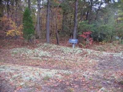
3. Federal Trenches
The earthworks behind the marker were erected by Couch's II Corps.
Credits. This page was last revised on February 2, 2023. It was originally submitted on November 30, 2007. This page has been viewed 1,359 times since then and 26 times this year. Last updated on November 2, 2020, by Bradley Owen of Morgantown, West Virginia. Photos: 1, 2, 3. submitted on November 30, 2007, by Craig Swain of Leesburg, Virginia. • J. Makali Bruton was the editor who published this page.
