Alief in Houston in Harris County, Texas — The American South (West South Central)
Dairy (Alief)
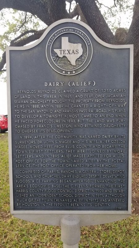
Reynolds Reynolds claimed a grant of 1250 acres of land in this area in 1861. Land developer Jacamiah Seaman Daugherty bought the property from Reynolds heirs in 1888. And in 1889 he granted a right-of-way to the San Antonio and Aransas Pass railroad. His plans to develop a townsite almost came to an end when he faced foreclosure in 1893, but the land was purchased by Francis I. Meston, who retained Daugherty to oversee its development
In 1894, after the community was named Dairy by its surveyors, Dr. John S. Magee and his wife Alief Ozelda Magee, moved here from Ellis County and became the town's first settlers. They were joined by more settlers, and in 1895 Alief Magee applied for a U.S. Post Office for the town. Named Alief by the Postal Service, the Post Office operated from her home.
Comprised of farms, ranches, a general store, depot, schools, and churches, Dairy endured despite devastating floods. Rice farming began after 1900, enhancing the area's economic base. The citizens formed the first Harris County Flood Control District in 1909 and established an Independent School District in 1911. Although much of the town (renamed Alief in 1917) was annexed by Houston in the 1970s, it retains its identity.
Erected 1991 by Texas Historical Commission. (Marker Number 10644.)
Topics. This historical marker is listed in these topic lists: Agriculture • Railroads & Streetcars • Settlements & Settlers. A significant historical year for this entry is 1250.
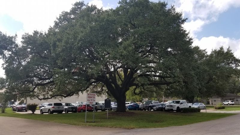
Location. 29° 42.736′ N, 95° 35.547′ W. Marker is in Houston, Texas, in Harris County. It is in Alief. Marker is at the intersection of 7th Street and G Street, on the right when traveling east on 7th Street. The marker is located in the old Alief township in front of an Alief I.S.D. building. Touch for map. Marker is at or near this postal address: 12101 7th Street, Houston TX 77072, United States of America. Touch for directions.
Other nearby markers. At least 8 other markers are within 6 miles of this marker, measured as the crow flies. Alief Cemetery (approx. one mile away); Edward King Tung Chen (approx. 2˝ miles away); Prairie Grove Cemetery (approx. 2.7 miles away); Rabindranath Tagore (approx. 3.4 miles away); Gray Lodge No. 329, A.F.& A.M. (approx. 3.8 miles away); Moore Log House (approx. 4.3 miles away); Early Settlers of Piney Point (approx. 4.6 miles away); John Taylor's Piney Point League (approx. 5.2 miles away). Touch for a list and map of all markers in Houston.
Also see . . . Alief, Texas atTexasEscapes.com. (Submitted on November 3, 2020, by James Hulse of Medina, Texas.)
Credits. This page was last revised on February 1, 2023. It was originally submitted on November 3, 2020, by James Hulse of Medina, Texas. This page has been viewed 284 times since then and 38 times this year. Photos: 1, 2. submitted on November 3, 2020, by James Hulse of Medina, Texas. • J. Makali Bruton was the editor who published this page.

