Near Winchester in Frederick County, Virginia — The American South (Mid-Atlantic)
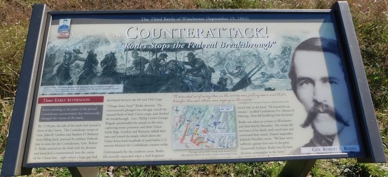
Counterattack!
“Rodes Stops the Federal Breakthrough”
— The Third Battle of Winchester (September 19, 1864) —
Time: Early Afternoon
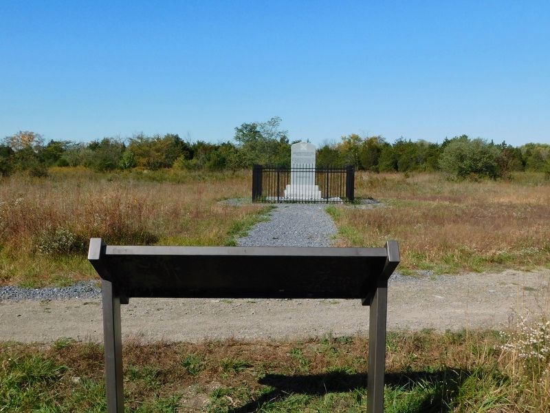
You're standing at the point of the pivotal Confederate counterattack that dramatically changed the course of the battle.
By 12:30 pm, the tide of the battle had turned in favor of the Union. The Confederate troops of Gen. John B. Gordon and Stephen D. Ramseur were falling back, pursued by jubilant Federals. Just in time for the Confederates, Gen. Robert E. Rodes arrived on the field with his division and launched a counterattack into the center of the Union line — right where a large gap had developed between the 6th and 19th Corps.
"Charge them, boys!" Rodes shouted. The counterattack plunged into the gap, struck the exposed flank of both Union corps, and checked the breakthrough. Gen. Phillip Cook's Georgia Brigade spearheaded the assault in this area, capturing many prisoners and three Union battle flags. Gordon and Ramseur rallied their men and joined the attack, which drove the Union forces back hundreds of yards before U.S. reserves blunted the Confederate counter strike.
Unfortunately for the southern cause, Rodes fell mortally wounded when a shell fragment struck him in the head. "He leaned for an instant," recalled Confederate Pvt. Marcus D. Herring, "then fell headlong from his horse."
Rodes was taken to a home in Winchester and died shortly thereafter. His troops did not learn of his death until much later and continued their attack. Famed mapmaker Jedidiah Hotchkis wrote, "We have never suffered a greater loss save in the great [Stonewall] Jackson. Rodes was the best division commander in the Army."
(caption)
Death of Rodes. This sketch showing Rode being loaded into an ambulance during the Confederate retreat is inaccurate. Rodes was dead by the time the Southerners retreated. (Image courtesy the Western Reserve Historical Society, Cleveland, Ohio)
Gen. Robert E. Rodes
This sign made possible through funds donated by the Millbrook High School Cross Country Team
Erected 2020 by Shenandoah Valley Battlefields Foundation.
Topics. This historical marker is listed in this topic list: War, US Civil. A significant historical date for this entry is September 19, 1864.
Location. 39° 11.859′ N, 78° 7.877′ W. Marker is near Winchester, Virginia, in Frederick County. Marker can be reached from Getty Lane, 0.2 miles north of Gateway Drive, on the left when traveling north. Marker is in the West Woods section of the Third Winchester Battlefield and can be reached most directly from the southern trailhead (located on Getty Lane) for the Third Battle of Winchester Trail.
Touch for map. Marker is at or near this postal address: 170 Getty Lane, Winchester VA 22603, United States of America. Touch for directions.
Other nearby markers. At least 8 other markers are within walking distance of this marker. Major General Robert Emmett Rodes (a few steps from this marker); Bloody Repulse (approx. 0.2 miles away); Breaking the Deadlock (approx. 0.2 miles away); Alabama (approx. ¼ mile away); The Cost of Battle (approx. ¼ mile away); Molineux's Stand (approx. ¼ mile away); Maine (approx. 0.3 miles away); A Perfect Sheet Of Lead (approx. 0.3 miles away). Touch for a list and map of all markers in Winchester.
Also see . . . The Third Battle of Winchester. The Shenandoah Valley Battlefields National Historic District (Submitted on October 31, 2020.)
Credits. This page was last revised on April 4, 2024. It was originally submitted on October 31, 2020, by Bradley Owen of Morgantown, West Virginia. This page has been viewed 216 times since then and 42 times this year. Last updated on April 4, 2024, by Jeremy Snow of Cedar City, Utah. Photos: 1, 2. submitted on October 31, 2020, by Bradley Owen of Morgantown, West Virginia. • Devry Becker Jones was the editor who published this page.

