Isle of Hope in Chatham County, Georgia — The American South (South Atlantic)
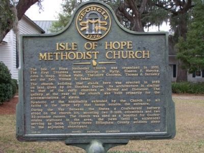
Isle of Hope Methodist Church
Photographed by Mike Stroud, January 2009
1. Isle of Hope Methodist Church Marker
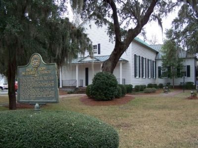
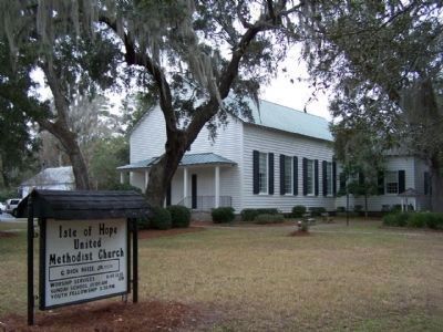
The church building that stands here was erected in 1859 on land given by Dr. Stephen Dupon. Its architecture is similar to that of the early churches at Midway and Ebenezer. The gallery at the rear of the church was built primarily for the accommodations of slaves.
Symbolic of the hospitality extended by the Church to all faiths is the large key that hangs outside the entrance.
During the War Between the States a Confederate battery stood on the church lot, mounting two 8-inch columbiads and two 32-pounder cannon. The church was used as a hospital for Confederates stationed in the area, the pews (still in existence) serving as beds. Thirty-three Effingham County soldiers sleep in the adjoining churchyard.
Erected 1962 by Georgia Historical Society. (Marker Number 025-83.)
Topics and series. This historical marker is listed in these topic lists: Religion & Religious Structures • War, US Civil.
this page online
Location. 31° 58.902′ N, 81° 3.554′ W. Marker is in Isle of Hope, Georgia, in Chatham County. It is on Parkersburg Road south of Holcomb Street, on the right when traveling west. Touch for map. Marker is at or near this postal address: 412 Parkersburg Rd, Savannah GA 31406, United States of America. Touch for directions.

Regionally, this marker is on the Coastal Plain, on the Georgia Coast and the Golden Isles, and in Greater Savannah. It is also in the American South, specifically in the Deep South, and on the Eastern Seaboard. Globally, it is in the North Atlantic Region, North America, the Western Hemisphere, the Western World, and the Anglosphere. Historically, it finds itself in what was once New Spain, the territory of the Mississippian Culture, one of the original Thirteen Colonies, one of the Confederate States of America, and the Antebellum South.
Other nearby markers. At least 8 other markers are within 3 miles of this marker, measured as the crow flies: Isle of Hope (approx. 0.6 miles away);
Photographed by Mike Stroud, January 18, 2009
2. Isle of Hope Methodist Church and Marker
Photographed by Mike Stroud, 2009
3. Isle of Hope Methodist Church
Credits. This page was last revised on November 24, 2019. It was originally submitted on February 8, 2009, by Mike Stroud of Bluffton, South Carolina. This page has been viewed 2,856 times since then and 28 times this year. Photos: 1, 2, 3. submitted on February 8, 2009, by Mike Stroud of Bluffton, South Carolina. • Craig Swain was the editor who published this page.
