Smithland in Livingston County, Kentucky — The American South (East South Central)
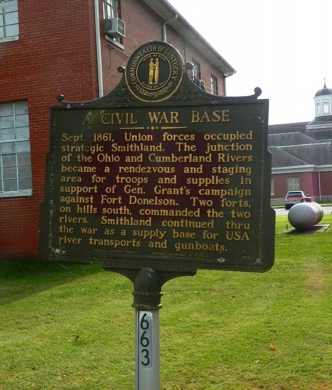
A Civil War Base
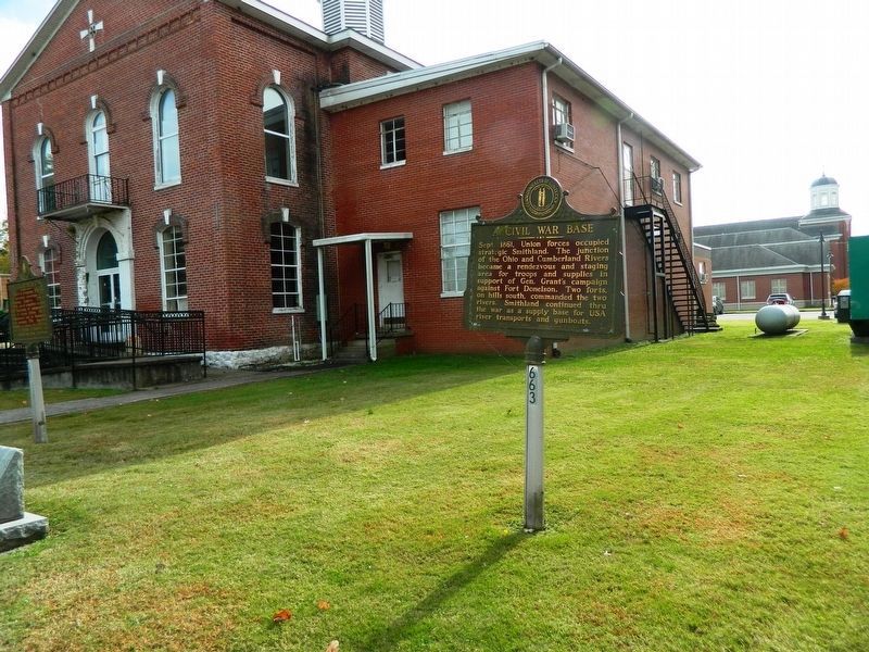
Sept. 1861, Union forces occupied strategic Smithland. The junction of the Ohio and Cumberland Rivers became a rendezvous and staging area for troops and supplies in support of Gen. Grant's campaign against Fort Donelson. Two forts, on hills south, commanded the two rivers. Smithland continued thru the war as a supply base for USA river transports and gunboats.
Erected 1964 by Kentucky Historical Society and Kentucky Department of Highways. (Marker Number 663.)
Topics and series. This historical marker is listed in this topic list: War, US Civil. In addition, it is included in the Kentucky Historical Society series list.
Location. 37° 8.349′ N, 88° 24.24′ W. Marker is in Smithland, Kentucky, in Livingston County. Touch for map. Marker is at or near this postal address: 351 Court Street, Smithland KY 42081, United States of America. Touch for directions.
Other nearby markers. At least 8 other markers are within 4 miles of this marker, measured as the crow flies. County Named, 1798 (here, next to this marker); Livingston County Courthouse (a few steps from this marker); Methodist Church (about 700 feet away, measured in a direct line); Dallam-Bush House (about 800 feet away); Federal Commissary Building (approx. 0.2 miles away); Confluence of the Cumberland and Ohio Rivers (approx. ¼ mile away); Ned Buntline / Gower House (approx. 0.3 miles away); Jefferson’s Sister (approx. 3.2 miles away). Touch for a list and map of all markers in Smithland.
More about this marker. The marker is on the northeast grounds of the historic old Livingston County Courthouse.
Also see . . .
1. Fort Donelson Campaign. (Submitted on November 7, 2020, by Thomas Onions of Olathe, Kansas.)
2. Livingston County Courthouse NHRP Application. (Submitted on November 7, 2020, by Thomas Onions of Olathe, Kansas.)
Additional commentary.
1. Importance of Smithland
The Cumberland River and the Tennessee River both flow northward towards the Ohio River making a natural highway towards the deep Confederacy. General Grant knew this. When Confederate General Leonidas Polk violated Kentucky's neutrality by seizing Columbus, Grant immediately countered by seizing Paducah and the mouth of the Tennessee and Smithland and the mouth of the Cumberland. This would enable, later, Grant to use armored steam-powered gunboats to soften Fort Henry on the Tennessee and Fort Donelson on the Cumberland.
— Submitted November 7, 2020, by Thomas Onions of Olathe, Kansas.
Credits. This page was last revised on November 9, 2020. It was originally submitted on November 7, 2020, by Thomas Onions of Olathe, Kansas. This page has been viewed 381 times since then and 53 times this year. Photos: 1, 2, 3. submitted on November 7, 2020, by Thomas Onions of Olathe, Kansas. • J. Makali Bruton was the editor who published this page.


