Monticello in Fairfield County, South Carolina — The American South (South Atlantic)
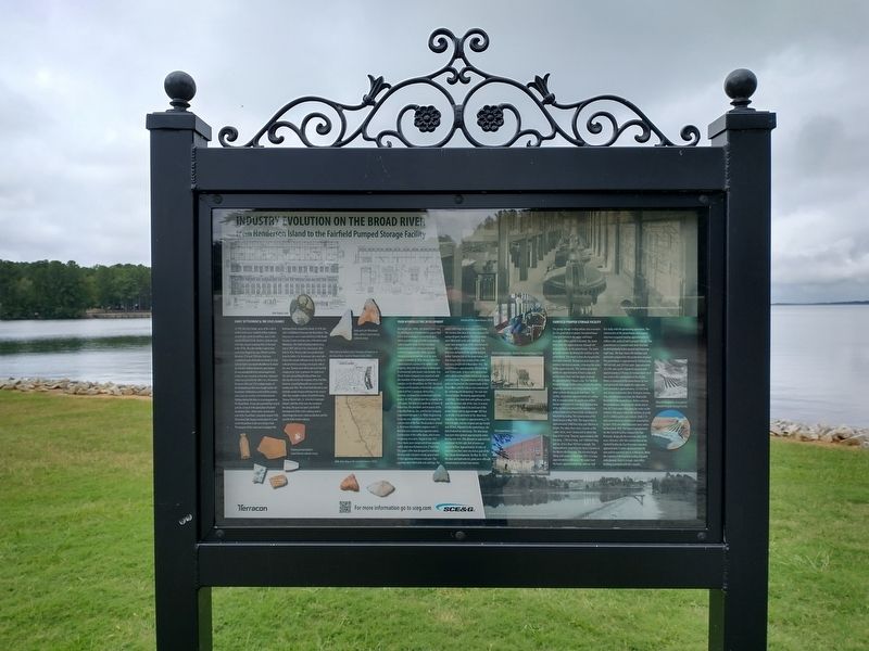
Industry Evolution on the Broad River
From Henderson Island to the Fairfield Pumped Storage Facility
In 1745, the Lyles family, some of the earliest settlers in the area, established their holdings on both sides of the Broad River, close to the mouth of Beaver Creek. Brothers, Ephraim and John Lyles, began acquiring titles to the land in the 1750s. The Lyles family is said to have come from Virginia by way of North Carolina. Between 1750 and 1780 Lyles Ford was established south of Henderson island. In 1764, Ephraim Lyles was reportedly killed at his home by Cherokee Indians; however, some believe he was actually killed by citizens loyal to the crown. As was common at that time, Ephraim’s estate was passed to his eldest son, Arromanus. Between 1780 and 1782 multiple battles of the Revolutionary War were fought within the boundaries of Newberry and Fairfield counties. Lyles Ford was used by several detachments fighting during this time as a crossing point on the Broad River. It was also reported that several patriots camped at the plantation of Colonel Arromanus Lyles, whose home was located east of the Broad River. Sometime around 1780, Arromanus Lyles began construction of a canal on the Broad River in the area of Lyles Ford. The purpose of this canal was to navigate flat bottomed boats around the shoals. In 1796, the Lyles established a ferry over the Broad River. This ferry was the most important ferry on the Broad because it connected the cities of Newberry and Winnsboro. The Ashford family took the ferry over in 1807 and ran it for several years after that. In 1816, Thomas Lyles was granted land from his father, Col. Arromanus Lyles near Lyles Ford at the mouth of Beaver Creek. By 1850, he is documented as owning several grist mills in the area. Thomas went on to represent Fairfield County in the State Legislature for eight years. The rea surrounding the Broad River was directly affected for the majority of the Civil War, however, actual fighting did not occur in the vicinity until 1865. Men from both Newberry and Fairfield counties began enlisting in the army in 1861. One notable resident of Fairfield County, Thomas Minter Lyles, Jr., served as Lieutenant Colonel, with five of his sons also serving in the army. The post war years saw further development of the state’s railway system, which helped increase cotton production and the growth of the textile industry.
(captions)
Early and Late Woodland lithic artifacts found during cultural survey.
Platt Showing Robert Lyles’ Purchase of Property on the Broad River. South of Beaver Creek (1816).
Historic period artifacts found during cultural survey.
Mills Atlas Map of the Fairfield District (1825).
Parr Hydroelectric Development
During the late 1800s,
the United States saw the development of hydroelectric power that led to new techniques and technologies, which provided ways to build on previously undeveloped lands. As the Columbia Canal’s potential for energy production had been tapped in the 1890s, forward thinking investors saw the need for new sources of power. In 1896, Henry Larkin Parr commissioned a survey of his father’s mill property along the Broad River to determine if commercial water power was feasible. Parr Shoals Power Company was organized with the intention of developing a hydropower complex on the Broad River. In 1907, Alester G. Furman and Associates of Greenville purchased control of Parr’s company. Henry Parr, however, continued his involvement with the project. In 1912, control over the company was sold again, this time to a syndicate of Edwin W. Robertson, the president and treasurer of the Columbia Railway, Gas, and Electric Company. Experienced designer J.G. White Engineering Company was commissioned to manage the construction of the Parr Shoals project. George G. Shed was the resident engineer and J.T. McLellan was construction superintendent. Construction of the coffer dams, which were temporary structures, began in July 1912. These dams were comprised of two wooden doffers that were between 6 to 27 feet high. The upper coffer was designed to hold back the river with crib piers evenly spaced with 12
foot openings between each pier. The openings were filled with rock and logs. The lower coffer kept the backwater away from the construction area. It too was constructed using crib piers; however, the crib sections were filled with earth and solid rock. The water was pumped out of the area between the two coffers and the foundation of the dam was anchored to the granite bedrock below. Construction of the powerhouse and dam began after one section of the coffer dam was completed in November 1912. The powerhouse is approximately 300 feet long and 52 feet wide. It has a steel substructure with a brick exterior finish laid in a six-course common bond. The powerhouse and six sluice gates are located on the eastern back of the Broad River and the tailrace was constructed by “widening and deepening” the east river channel below. Measuring approximately 2,000 feet, the main dam and spillway section span the western side of the river. A section of non-overflow dam is located east of the powerhouse and an approximate 300 foot earth dike is located west of the sluiceway. Together, the complex is approximately 2,715 feet in length, and the original average height was 39 feet. Adjacent to the powerhouse, the dam featured six sluiceways. The sluiceways had gates that opened approximately seven feet by nine feet. This allowed an approximate combined 14,400 cubic feet of water per
second to flow. Approximately 30 miles of transmission lines were erected as part of the Parr Shoals Development. On May 30, 1914, the dam and hydroelectric plant were officially commissioned and put into service.
(captions)
Historic photographs showing interior of Parr powerhouse (1914).
Interior of Parr Powerhouse (2016).
Historic photographs showing Parr Powerhouse (1914).
Parr Powerhouse (2016).
View of dam / spillway section, before installation of hinged gates (1975).
Fairfield Pumped Storage Facility
The pump storage facility utilizes two reservoirs for the generation of power; the powerhouse is located between the upper and lower reservoirs. When power is needed, the water flows from the upper reservoir through the large penstocks to the powerhouse. The water generates power by driving the turbines in the powerhouse. The water is then discharged into the lower reservoir. During low peak hours, the turbines function as pumps, returning the water to the upper reservoir. This system generates power for approximately 8 hours a day and pumps water back in the upper reservoir for approximately 9 hours a day. The Fairfield Pumped Storage Facility allows SCE&G the ability to quickly generate electricity, backing up the other systems during peak load hours. The facility can produce approximately 4.6 million kW, or enough power to supply one million homes with power for on hour. Construction of the facility necessitated the construction of four dams across Frees Creek, northeast of the existing facility. The construction of the dams began in May 1976. The largest dam is approximately 5,000 feet long and 180 feet in height. The other three dams, known as the saddle dams were constructed to divert the flow of the creek. They are approximately 900 feet long, 1,700 feet long, and 3,400 feet long, and are all less than 100 feet in height. The impoundment created by the dams is known as the Monticello Reservoir. The reservoir began filling with water in December 1977; it is now approximately 6,800 acres. The water level fluctuates approximately four and one-half feet daily with the generating operations. The construction of the powerhouse and support structures required moving approximately 12 million cubic yards of soil to prepare the site. The powerhouse is a concrete and steel structure, located primarily below ground and featuring eight bays. The bays house the turbines and generators required for the production of power. The powerhouse is approximately 520 feet long, 108 feet tall, and 150 feet wide. Approximately 323,700 cubic yards of poured concrete with approximately 6,570 tons of reinforcement steel was used in the construction of the facility. Water is conveyed to the powerhouse by four steel penstocks that supply the eight units. Each penstock is approximately 123 feet long and 26 feet in diameter. On a 14 degree decline, they extend southwest from the Monticello Reservoir to the powerhouse. Before entering the powerhouse, the penstocks divide into in two 18’-7-inch pipes that carry the water to the turbines. The water enters the turbines at a rate of 21.5 million gallons per minute. Units 1-4 were generating for commercial consumption by June 1978; the other four units were online by December 1978. The lower impoundment for the Fairfield facility enlarged the Parr Reservoir. Originally the reservoir was 1,850 acres. However, after the construction of the Fairfield facility the Parr Reservoir extended approximately 13 miles upstream from the dam and increased its size to 4,400 acres. While the majority of the Fairfield facility is located underground, there is a single-story office building associated with the complex.
(caption)
Aerial photographs of completed Fairfield Pumped Storage Facility
Erected by South Carolina Electric & Gas.
Topics. This historical marker is listed in these topic lists: Colonial Era • Industry & Commerce • Settlements & Settlers • Waterways & Vessels. A significant historical date for this entry is May 30, 1914.
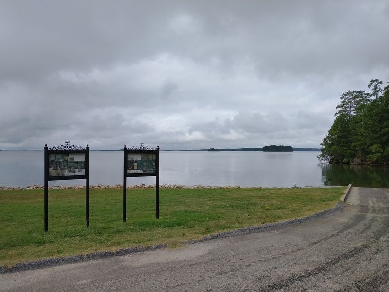
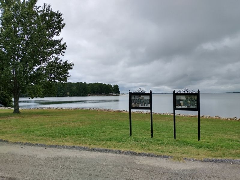
Location. 34° 19.642′ N, 81° 17.143′ W. Marker is in Monticello, South Carolina, in Fairfield County. Marker is on Monticello Road (State Highway 215) 0.3 miles north of Baltic Circle, on the left when traveling north. Marker is located at the boat ramp north of Lake Monticello Park. Touch for map. Marker is in this post office area: Jenkinsville SC 29065, United States of America. Touch for directions.
Other nearby markers. At least 8 other markers are within 8 miles of this marker, measured as the crow flies. A different marker also named Industry Evolution on the Broad River (here, next to this marker); Old Brick Church (approx. 1½ miles away); Kincaid-Anderson House (approx. 2.6 miles away); Nuclear Power (approx. 4½ miles away); The Oaks (approx. 5.9 miles away); Hope Rosenwald School (approx. 6 miles away); Peak (approx. 6.3 miles away); St. John's Church (approx. 7.1 miles away).
Credits. This page was last revised on November 11, 2020. It was originally submitted on November 10, 2020, by Tom Bosse of Jefferson City, Tennessee. This page has been viewed 208 times since then and 47 times this year. Photos: 1, 2, 3. submitted on November 10, 2020, by Tom Bosse of Jefferson City, Tennessee. • Bernard Fisher was the editor who published this page.


