Near Dover in Tuscarawas County, Ohio — The American Midwest (Great Lakes)
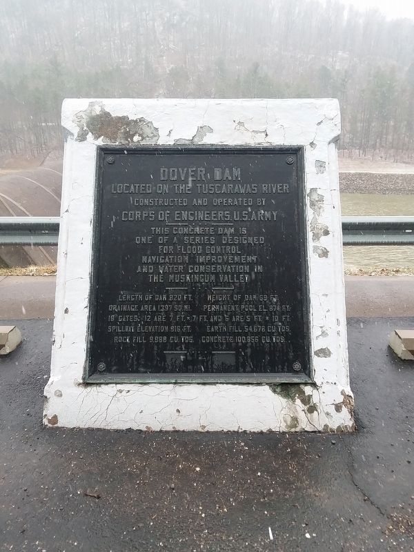
Dover Dam
Located on the Tuscarawas River
| — | Constructed and operated by Corps of Engineers, U.S. Army | — |
Photographed by Craig Doda, March 3, 2019
1. Dover Dam Marker
This concrete dam is one of a series designed for flood control navigation improvement and water conservation in the Muskingum Valley
Length of dam 820 ft.
Height of dam 69 ft.
Drainage area 1397 sq. mi.
Permanent pool el. 874 ft.
18 gates: 12 are 7, ft. x 7 ft. and 6 are 5 ft. x 10 ft.
Spillway elevation 916 ft.
Earth fill 54.678 cu. yds.
Rock fill 9,998 cu. yds.
Concrete 100.856 cu.yds.
Erected by U.S. Army Corps of Engineers.
Topics. This historical marker is listed in these topic lists: Charity & Public Work • Waterways & Vessels.
Location. 40° 33.483′ N, 81° 24.8′ W. Marker is near Dover, Ohio, in Tuscarawas County. It is on Ohio Route 800 one mile County Road 378, on the right when traveling north. Touch for map. Marker is at or near this postal address: 5153 OH-800, Dover OH 44622, United States of America. Touch for directions.

Regionally, this marker is in Amish Country. It is also in the American Midwest, in Appalachia, and specifically in Northern Appalachia. Globally, it is in North America, the Western Hemisphere, the Western
this page online
Other nearby markers. At least 8 other markers are within 4 miles of this marker, measured as the crow flies: Zoarville Station (approx. 1.8 miles away); Trailhead (approx. 3½ miles away); Ohio and Erie Canal (approx. 3½ miles away); Welcome To Zoar (approx. 3.7 miles away); The Zoar Hotel (approx. 3.8 miles away); The Cow Barn Foundation (approx. 3.8 miles away); Zoar Town Hall / Zoar and The Ohio & Erie Canal (approx. 3.8 miles away); Zoar Historic District (approx. 3.9 miles away).
Also see . . . Muskingum Watershed Conservancy District History. (Submitted on November 12, 2020, by William Fischer, Jr. of Reynoldsburg, Ohio.)
Photographed by Craig Doda, March 3, 2019
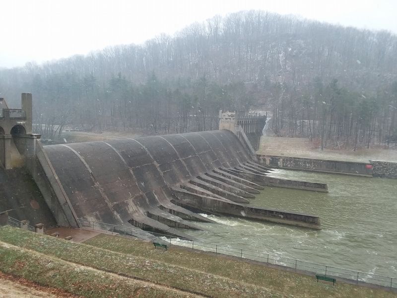
2. Dover Dam Marker
Credits. This page was last revised on November 12, 2020. It was originally submitted on November 12, 2020, by Craig Doda of Napoleon, Ohio. This page has been viewed 1,232 times since then and 81 times this year. Photos: 1, 2. submitted on November 12, 2020, by Craig Doda of Napoleon, Ohio. • Devry Becker Jones was the editor who published this page.
