Lower Chanceford Township near Holtwood in York County, Pennsylvania — The American Northeast (Mid-Atlantic)
Lock No. 12
Link with the Past
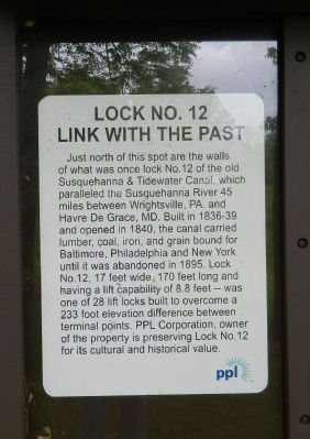
Photographed by Bill Pfingsten, May 16, 2011
1. Lock No. 12 Marker
Erected by PPL Corporation.
Topics and series. This historical marker is listed in these topic lists: Industry & Commerce • Waterways & Vessels. In addition, it is included in the Susquehanna and Tidewater Canal series list. A significant historical year for this entry is 1836.
Location. 39° 48.809′ N, 76° 19.746′ W. Marker is near Holtwood, Pennsylvania, in York County. It is in Lower Chanceford Township. It can be reached from River Road north of Holtwood Road (Pennsylvania
this page online

Regionally, this marker is in South-Central Pennsylvania, specifically in Pennsylvania Dutch Country, in the Susquehanna Valley, and in Greater Harrisburg. It is also in the American Northeast and in the Mid-Atlantic. Globally, it is in North America, the Western Hemisphere, the Western World, and the Anglosphere. Historically, it finds itself in what was once the Haudenosaunee (Iroquois) Confederacy and also one of the original Thirteen Colonies.
Other nearby markers. At least 8 other markers are within 3 miles of this marker, measured as the crow flies: Survivor of the Past (within shouting distance of this marker); The Locks (approx. 1.4 miles away); The Susquehanna & Tidewater Canal (approx. 1.4 miles away); The Canal Community (approx. 1½ miles away); The Canal Boats (approx. 1½ miles away); Muddy Run at Work (approx.
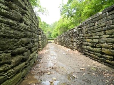
Photographed by Bill Pfingsten, May 16, 2011
2. Lock No. 12 looking north.
More about this marker. "PPL Corporation," has been "whited" out.
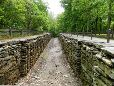
Photographed by Bill Pfingsten, May 16, 2011
3. Lock No. 12 looking south.
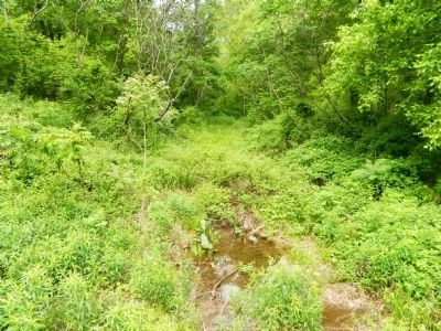
Photographed by Bill Pfingsten, May 16, 2011
4. Remains of the canal north of Lock 12.
Photographed by Bill Pfingsten, May 16, 2011
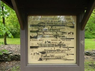
5. Diagram of a canal boat being raised and lowered in the lock.
Photographed by Carl Gordon Moore Jr., November 15, 2020
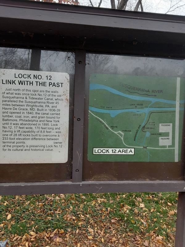
6. Lock No. 12 Marker
Firm name "whited" out; also, map to right included.
Credits. This page was last revised on February 7, 2023. It was originally submitted on May 16, 2011, by Bill Pfingsten of Bel Air, Maryland. This page has been viewed 5,858 times since then and 299 times this year. Last updated on November 13, 2020, by Carl Gordon Moore Jr. of North East, Maryland. Photos: 1, 2, 3, 4, 5. submitted on May 16, 2011, by Bill Pfingsten of Bel Air, Maryland. 6. submitted on November 16, 2020, by Carl Gordon Moore Jr. of North East, Maryland.
