Marker Logo HMdb.org THE HISTORICAL
MARKER DATABASE
“Bite-Size Bits of Local, National, and Global History”
Near Richmond in Henrico County, Virginia — The American South (Mid-Atlantic)
 

Richmond Defences

The Outer Line


Richmond Defences Marker image. Click for full size.
Photographed By Bernard Fisher, June 20, 2003
1. Richmond Defences Marker
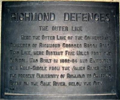
Inscription. Here the outer line of the Confederate defences of Richmond crossed Brook Road. This line, here distant five miles from the capitol, was built in 1862-64 and extended in a half-circle from the James River near the present University of Richmond to Chaffin’s Bluff on the same river, below the city.
 
Erected by Battlefield Markers Association. (Marker Number 33.)
 
Topics and series. This historical marker is listed in this topic list: War, US Civil. In addition, it is included in the Freeman Markers (Richmond Battlefields) series list.
 
Location. 37° 36.675′ N, 77° 27.416′ W. Marker is near Richmond, Virginia, in Henrico County. Marker is on Brook Road (U.S. 1) 0.4 miles Interstate 95, on the right when traveling north. Touch for map. Marker is in this post office area: Richmond VA 23227, United States of America. Touch for directions.
 
Other nearby markers. At least 8 other markers are within walking distance of this marker. Campaign of 1781 (here, next to this marker); Brook Road (here, next to this marker); Outer Fortifications (here, next to this marker); Stuart's Ride (about 400 feet away, measured in a direct line); Confederate Fortifications (about 500 feet away); The Fort Under Attack (about 500 feet away);
Paid Advertisement
Click on the ad for more information.
Please report objectionable advertising to the Editor.
Click or scan to see
this page online
Gabriel’s Insurrection (about 500 feet away); Gabriel's Rebellion (approx. 0.3 miles away). Touch for a list and map of all markers in Richmond.
 
Additional keywords. Freeman Markers, Richmond Battlefield Parks Corporation, Douglas Southall Freeman
 
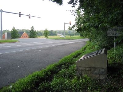
Richmond Defences Marker image. Click for full size.
Photographed By Bernard Fisher, June 20, 2003
2. Richmond Defences Marker
Brook Hill Fortifications image. Click for full size.
Photographed By Bernard Fisher, February 1, 2009
3. Brook Hill Fortifications
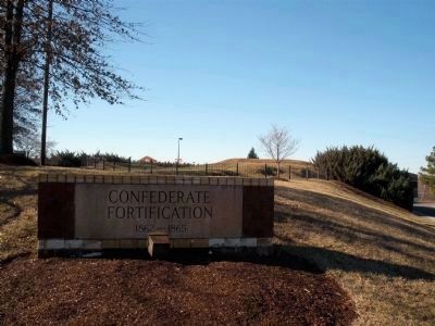
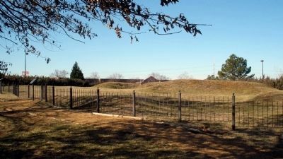
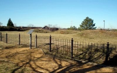
Five hundred feet to the west of the Freeman marker, in the Brook Run shopping center, are the remnants of the northernmost outer fortifications of Richmond.
Brook Hill Fortifications image. Click for full size.
Photographed By Bernard Fisher, February 1, 2009
4. Brook Hill Fortifications
Brook Hill Fortifications image. Click for full size.
Photographed By Bernard Fisher, February 1, 2009
5. Brook Hill Fortifications
Brook Run (Upham Brook) at Brook Road Bridge image. Click for full size.
Photographed By Bernard Fisher, February 1, 2009
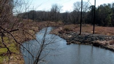
6. Brook Run (Upham Brook) at Brook Road Bridge
This stream, which gives the area its name, was a natural defensive barrier 500 yards north of the fort.
 
 
Credits. This page was last revised on June 16, 2016. It was originally submitted on December 8, 2008, by Bernard Fisher of Richmond, Virginia. This page has been viewed 1,371 times since then and 39 times this year. Last updated on February 10, 2009, by Bernard Fisher of Richmond, Virginia. Photos:   1, 2. submitted on December 8, 2008, by Bernard Fisher of Richmond, Virginia.   3, 4, 5, 6. submitted on February 6, 2009, by Bernard Fisher of Richmond, Virginia. • Craig Swain was the editor who published this page.
Share this page.  
Share on Tumblr
m=16007

CeraNet Cloud Computing sponsors the Historical Marker Database.
This website earns income from purchases you make after using our links to Amazon.com. We appreciate your support.
Paid Advertisement
May. 7, 2024