Near Chester in Chesterfield County, Virginia — The American South (Mid-Atlantic)
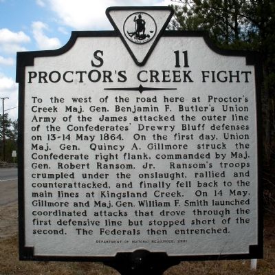
Proctor's Creek Fight
Erected 2001 by Department of Historic Resources. (Marker Number S-11.)
Topics and series. This historical marker is listed in this topic list: War, US Civil. In addition, it is included in the Virginia Department of Historic Resources (DHR) series list. A significant historical date for this entry is May 16, 1864.
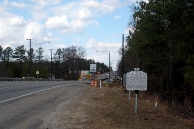
Location. 37° 22.817′ N, 77° 25.315′ W. Marker is near Chester, Virginia, in Chesterfield County. Marker is at the intersection of Jefferson Davis Highway (U.S. 1) and Route 288 (State Route 288), on the right on Jefferson Davis Highway. Touch for map. Marker is in this post office area: Richmond VA 23237, United States of America. Touch for directions.
Other nearby markers. At least 8 other markers are within 2 miles of this marker, measured as the crow flies. Into the "Bottle" (here, next to this marker); Halfway House (approx. 0.4 miles away); Half-Way House (approx. 0.4 miles away); a different marker also named The Half-Way House (approx. 0.4 miles away); Osbornes (approx. 0.8 miles away); Farrar's Island (approx. 0.8 miles away); Second Battle of Drewry's Bluff (approx. 1.2 miles away); Drewry’s Bluff Battlefield (approx. 1.2 miles away). Touch for a list and map of all markers in Chester.
Also see . . . CWSAC Battle Summary. Proctor’s Creek (Submitted on February 11, 2009, by Bernard Fisher of Richmond, Virginia.)
Credits. This page was last revised on June 16, 2016. It was originally submitted on February 11, 2009, by Bernard Fisher of Richmond, Virginia. This page has been viewed 1,686 times since then and 48 times this year. Photos: 1, 2. submitted on February 11, 2009, by Bernard Fisher of Richmond, Virginia. • Craig Swain was the editor who published this page.

