Amity Township near Douglassville in Berks County, Pennsylvania — The American Northeast (Mid-Atlantic)
Riverside Settlement and the Covered Bridge
Heritage Preserved by The Historic Preservation Trust of Berks County

Photographed By Devry Becker Jones (CC0), November 20, 2020
1. Riverside Settlement and the Covered Bridge Marker
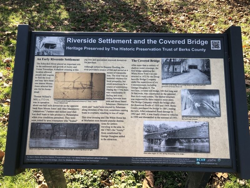
An Early Riverside Settlement
The Schuylkill River played an important role in the settlement and growth of Amity and Union Townships. A shallow crossing at this location allowed people and wagons to ford the river and may have been one reason Mouns Jones selected this site for his homestead.
Thomas Millard's Mill, c. 1712-14, was in operation about one-half mile downriver on the opposite bank from Muns Jones' and other Manatawny "plantations." Farmers and millers used shallow draft boats to take produce to Philadelphia when river conditions permitted. They were soon joined by area ironmasters who "boated" pig iron and specialized ironwork downriver for purchase.
Although subject to frequent flooding, the river provided a source of fish and served as a means of transportation. The river was an essential resource for local prosperity, but could sometimes be a source of controversy. During the 1730s there was considerable ill feeling and even rioting between boatmen and shore based fisherman. Obstructie weirs and "racks" were erected by fishermen along stretches of the river, sometimes causing boats to overturn, resulting in loss of cargo.
This river crossing and The White Horse Inn at Morlatton soon became popular destinations for settlers traveling in the area. In the 1760's the "Amity" Store established by George Douglass added to the attraction.
The Covered Bridge
After more than a century of shallow-water crossings, the first bridge spanning the White Horse Ford was constructed in 1832 by the Douglassville Bridge Company under the supervision of six Commissioners, including George Douglass II. The two-lane covered toll bridge, 340 feet long and 24 feet wide, was constructed on the patented Burr Arch truss system. The timber structure was supported by three massive stone piers. The Bridge Company rebuilt the bridge after disastrous floods of 1850 and 1869. Berks County purchased the bridge in 1885, ending the tolls. After substantial flood damage in 1902 and 1909, it was finally closed to vehicles in 1950 and dismantled in the summer of 1951.
Erected by The Historic Preservation Trust of Berks County.
Topics and series. This historical marker is listed in these topic lists: Bridges & Viaducts • Colonial Era • Settlements & Settlers • Waterways & Vessels. In addition, it is included in the Covered Bridges series list. A significant historical year for this entry is 1832.
Location. 40° 15.207′ N, 75° 43.722′ W. Marker is near Douglassville, Pennsylvania, in Berks County. It is in Amity Township. Marker can be reached from Old

Photographed By Devry Becker Jones (CC0), November 20, 2020
2. Riverside Settlement and the Covered Bridge Marker
Other nearby markers. At least 8 other markers are within walking distance of this marker. Michael Fulp House (within shouting distance of this marker); Mouns Jones House (within shouting distance of this marker); Swedish Pioneers (about 400 feet away, measured in a direct line); Old Swedes House (about 700 feet away); Morlatton Village Trailhead (about 700 feet away); Morlatton Vilage (about 700 feet away); George Douglass Home (about 800 feet away); Feuding Railroads (about 800 feet away). Touch for a list and map of all markers in Douglassville.
Credits. This page was last revised on February 7, 2023. It was originally submitted on November 21, 2020, by Devry Becker Jones of Washington, District of Columbia. This page has been viewed 171 times since then and 14 times this year. Photos: 1, 2. submitted on November 21, 2020, by Devry Becker Jones of Washington, District of Columbia.