Near Joaquin in Shelby County, Texas — The American South (West South Central)
Brookland Cemetery
Photographed by James Hulse, November 6, 2020
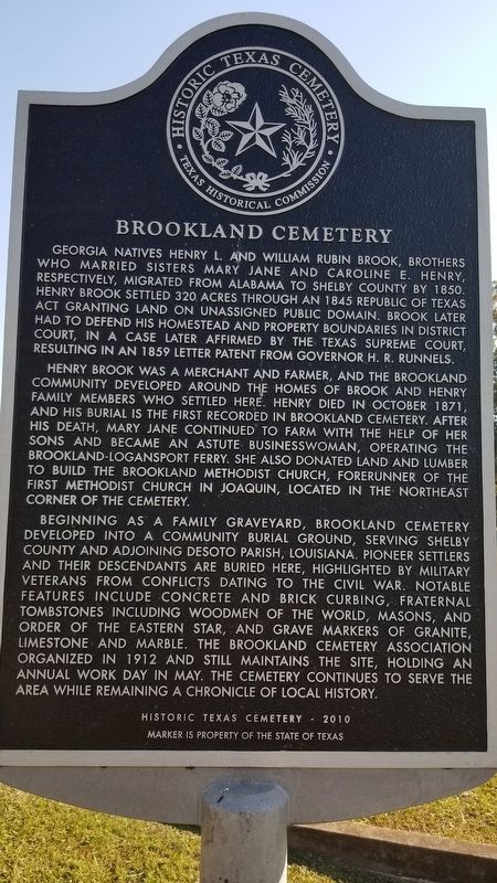
1. Brookland Cemetery Marker
Georgia natives Henry L. and William Rubin Brook, brothers who married sisters Mary Jane and Caroline E. Henry, respectively, migrated from Alabama to Shelby County by 1850. Henry Brook settled 320 acres through an 1845 Republic of Texas Act granting land on unassigned public domain. Brook later had to defend his homestead and property boundaries in district court, in a case later affirmed by the Texas Supreme Court, resulting in an 1859 letter patent from governor H. R. Runnels.
Henry Brook was a merchant and farmer, and the Brookland Community developed around the homes of Brook and Henry family members who settled here. Henry died in October 1871, and his burial is the first recorded in Brookland Cemetery. After his death, Mary Jane continued to farm with the help of her sons and became an astute businesswoman, operating the Brookland-Logansport ferry. She also donated land and lumber to build the Brookland Methodist Church, forerunner of the First Methodist Church in Joaquin, located in the Northeast corner of the cemetery.
Beginning as a family graveyard, Brookland Cemetery developed into a community burial ground, serving Shelby County and adjoining DeSoto Parish, Louisiana. Pioneer settlers and their descendants are buried here, highlighted by military veterans from conflicts dating to the Civil War. Notable features include concrete and brick curbing, fraternal tombstones including Woodmen of the World, Masons, and order of the Eastern Star, and grave markers of granite, limestone and marble. The Brookland Cemetery Association organized in 1912 and still maintains the site, holding an annual work day in May. The cemetery continues to serve the area while remaining a chronicle of local history.
Historic Texas Cemetery - 2010
Marker is property of the State of Texas
Erected 2010 by Texas Historical
this page online
Topics. This historical marker is listed in this topic list: Cemeteries & Burial Sites. A significant historical month for this entry is October 1871.
Location. 31° 58.235′ N, 94° 0.962′ W. Marker is near Joaquin, Texas, in Shelby County. It is at the intersection of U.S. 84 and Farm to Market Road 2787, on the right when traveling east on U.S. 84. Touch for map. Marker is in this post office area: Joaquin TX 75954, United States of America. Touch for directions.

Regionally, this marker is in the American South, specifically in the Deep South, and in the Piney Woods. Globally, it is in North America, a Gulf of Mexico state, the Western Hemisphere, the Western World, and the Anglosphere. Historically, it finds itself in what was once New Spain, the Republic of Texas, one of the Confederate States of America, and the Antebellum South.
Other nearby markers. At least 8 other markers are within 12 miles of this marker, measured as the crow flies: B.F. Morris and the Town of Joaquin (approx. 2.4 miles away); International Boundary Marker (approx. 4.7 miles away); a different marker also named International Boundary Marker
Photographed by James Hulse, November 6, 2020
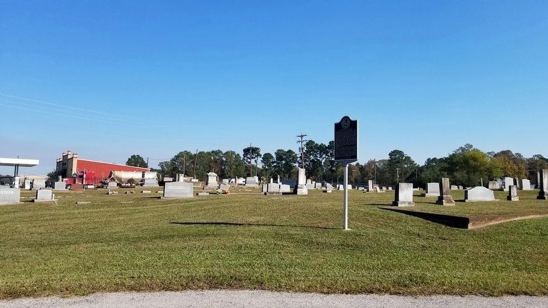
2. Brookland Cemetery and Marker
Another marker is no longer nearby. International Boundary (was approx. 4.6 miles away in Louisiana but has been confirmed missing).
Also see . . . Ferries on the Sabine. All things Sabine (Submitted on November 22, 2020, by James Hulse of Medina, Texas.)
Photographed by James Hulse, November 6, 2020
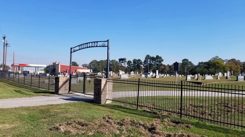
3. The front entrance to Brookland Cemetery with Marker in background.

Photographed by James Hulse, November 6, 2020
4. Brookland Cemetery sign - Established 1871
Credits. This page was last revised on April 25, 2021. It was originally submitted on November 21, 2020, by James Hulse of Medina, Texas. This page has been viewed 452 times since then and 64 times this year. Photos: 1, 2, 3, 4. submitted on November 22, 2020, by James Hulse of Medina, Texas. • J. Makali Bruton was the editor who published this page.
