Near Chester in Chesterfield County, Virginia — The American South (Mid-Atlantic)
The Battle of Trent’s Reach
Photographed by Bernard Fisher, February 9, 2009
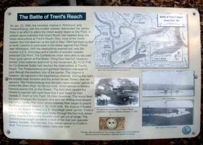
1. The Battle of Trent’s Reach Marker
this page online
This sign was sponsored by The Chester Station Camp Sons of Confederate Veterans and the Chesterfield Historical Society of Virginia.
Erected by Sons of Confederate Veterans and Chesterfield Historical Society of Virginia.
Topics and series. This historical marker is listed in this topic list: War, US Civil.
Photographed by Bernard Fisher, February 9, 2009
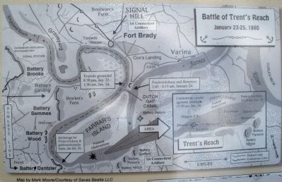
2. Map of the Battle of Trent’s Reach
Location. 37° 21.558′ N, 77° 23.496′ W. Marker is near Chester, Virginia, in Chesterfield County. It can be reached from Battery Dantzler Road 0.2 miles east of Old Satge Road. The marker is located near the bluff overlooking Trent's reach 500 feet north of the parking lot. Touch for map. Marker is in this post office area: Chester VA 23836, United States of America. Touch for directions.

Regionally, this marker is in the Piedmont, in Central Virginia, and in the Richmond Metropolitan Area. It is also in the American South, specifically in the Upper South, and on the Eastern Seaboard. Globally, it is in the North Atlantic Region, North America, the Western Hemisphere, the Western World, and the Anglosphere. Historically, it finds itself in what was once the territory of the Mississippian Culture, one of the original Thirteen Colonies, one of the Confederate States of America, and the Antebellum South.
Other nearby markers. At least 8 other markers are within walking distance

Photographed by Bernard Fisher, February 9, 2009
3. The Battle of Trent’s Reach Marker
More about this marker. On the upper right is a map detailing the “Battle of Trent’s Reach, January 23-25, 1865.” Map by Mark Moore courtesy of Savas Beatie LLC.
In the center is “An engraving of the Battle of Trent’s Reach published in Harper’s Weekly February 11, 1865.”
On the lower right is a photo of “USS Onondaga” and a photo of an “1865 view of Trent’s Reach.”
Also see . . .
1. Desperate Ironclad Assault at Trent's Reach. September 1995 issue of America's Civil War magazine. (Submitted on July 11, 2010.)
2. The Richmond Ironclads at Trent's Reach, James River (slide show).
Photographed by Bernard Fisher, February 9, 2009
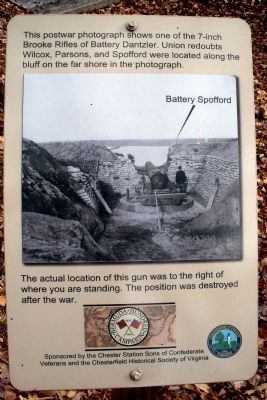
4. 7-inch Brooke Rifle marker
Photographed by Bernard Fisher, February 9, 2009
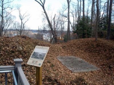
5. 7-inch Brooke Rifle gun platform
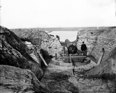
April 1865
6. 7-inch Brooke Rifle
James River, Va. Confederate gun emplacement at Howlett House, Trent's Reach. Library of Congress [LC-B8171-0019]
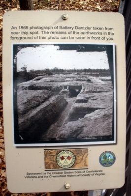
Photographed by Bernard Fisher, February 9, 2009
7. Remains of earthworks marker
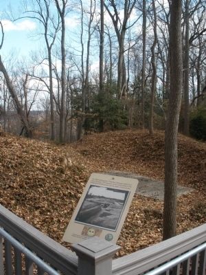
Photographed by Bernard Fisher, February 9, 2009
8. Remains of earthworks
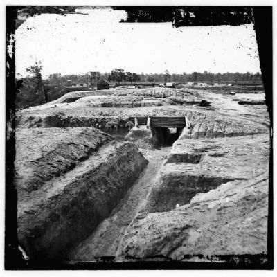
1865
9. Battery Dantzler earthworks
Dutch Gap Canal, James River, Virginia. Confederate fortifications. Library of Congress [LC-B811- 14]
Photographed by Bernard Fisher, February 9, 2009
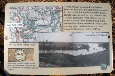
10. Trent’s Reach Union Gun Positions marker

Photographed by Bernard Fisher, February 9, 2009
11. View of Trent’s Reach on the James River
Apr 1865
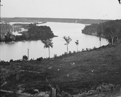
12. View of Trent’s Reach from Battery Dantzler
Dutch Gap Canal, James River, Virginia (vicinity). View of river from Confederate battery. Library of Congress [LC-B815- 22]
Credits. This page was last revised on January 11, 2021. It was originally submitted on February 12, 2009, by Bernard Fisher of Richmond, Virginia. This page has been viewed 5,770 times since then and 104 times this year. Last updated on January 9, 2021, by Bradley Owen of Morgantown, West Virginia. Photos: 1, 2, 3, 4, 5. submitted on February 12, 2009, by Bernard Fisher of Richmond, Virginia. 6. submitted on April 14, 2011, by Bernard Fisher of Richmond, Virginia. 7, 8. submitted on February 12, 2009, by Bernard Fisher of Richmond, Virginia. 9. submitted on April 14, 2011, by Bernard Fisher of Richmond, Virginia. 10, 11. submitted on February 12, 2009, by Bernard Fisher of Richmond, Virginia. 12. submitted on March 16, 2011, by Bernard Fisher of Richmond, Virginia.
