Potomac in Montgomery County, Maryland — The American Northeast (Mid-Atlantic)
Repairing the Breach at Anglers

Photographed By Devry Becker Jones (CC0), November 23, 2020
1. Repairing the Breach at Anglers Marker
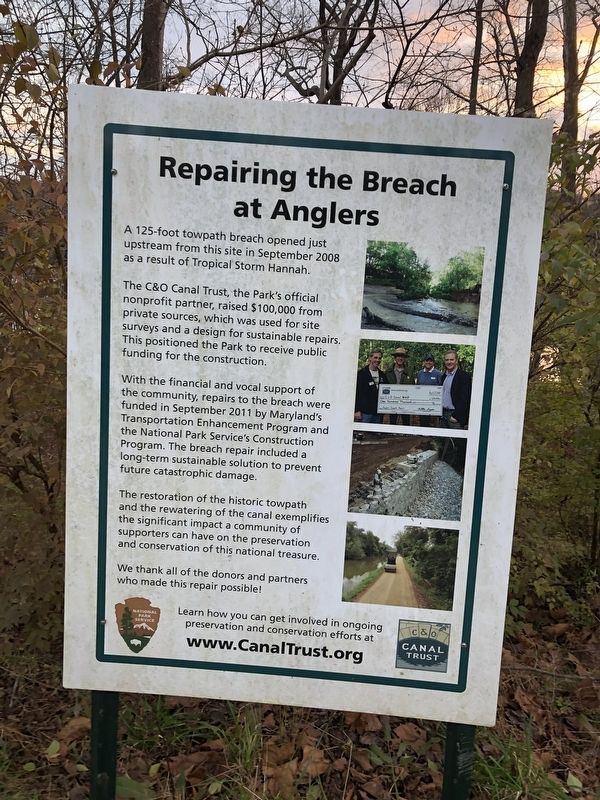
A 125-foot towpath breach opened just upstream from this site in September 2008 as a result of Tropical Storm Hannah.
The C&O Canal Trust, the Park's official nonprofit partner, raised $100,000 from private sources, which was used for site surveys and a design for sustainable repairs. This positioned the Park to receive public funding for the construction.
With the financial and vocal support of the community, repairs to the breach were funded in September 2011 by Maryland's Transportation Enhancement Program and the National Park Service's Construction Program. The breach repair included a long-term sustainable solution to prevent future catastrophic damage.
The restoration of the historic towpath and the rewatering of the canal exemplifies the significant impact of a community of supporters can have on the prevention and conservation of this national treasure.
We thank all of the donors and partners who made this repair possible!
Learn how you can get involved in ongoing preservation and conservation efforts at www.CanalTrust.org
Erected by National Park Service, U.S. Department of the Interior; The C&O Canal Trust.
Topics and series. This historical marker is listed in these topic lists: Charity & Public Work • Disasters • Parks & Recreational Areas • Waterways & Vessels. In addition, it is included in the Chesapeake and Ohio (C&O) Canal series list. A significant historical month for this entry is September 2008.
Location. 38° 58.884′ N, 77° 13.702′ W. Marker is in Potomac, Maryland, in Montgomery County. Marker is at the intersection of Chesapeake and Ohio Canal Towpath and Angler's Footbridge, on the left when traveling west on Chesapeake and Ohio Canal Towpath. Touch for map. Marker is at or near this postal address: 10790 Billy Goat Trail Section A, Potomac MD 20854, United States of America. Touch for directions.
Other nearby markers. At least 8 other markers are within 2 miles of this marker, measured as the crow flies. The Maryland Mine (approx. 0.9 miles away); Great Falls of the Potomac (approx. one mile away); Old Georgetown Pike Ancient Indian Trail (approx. 1.2 miles away in Virginia); The Floods (approx. 1.3 miles away); Great Falls Canal and Locks (approx. 1.3 miles away in Virginia); Mather Gorge (approx. 1.3 miles away in Virginia); The Company House (approx. 1.4 miles away in Virginia); Matildaville (approx. 1˝ miles away in Virginia). Touch for a list and map of all markers in Potomac.

Photographed By Devry Becker Jones (CC0), November 23, 2020
2. Repairing the Breach at Anglers Marker
Credits. This page was last revised on November 23, 2020. It was originally submitted on November 23, 2020, by Devry Becker Jones of Washington, District of Columbia. This page has been viewed 107 times since then and 8 times this year. Photos: 1, 2. submitted on November 23, 2020, by Devry Becker Jones of Washington, District of Columbia.