Near Chester in Chesterfield County, Virginia — The American South (Mid-Atlantic)
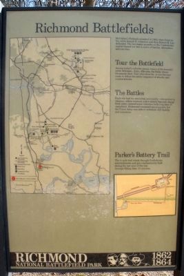
Richmond Battlefields
Parker's Battery Trail
— Richmond National Battlefield Park 1862, 1864 —
Tour the Battlefield
Among today’s suburbs remain traces of Richmond’s outer defenses-forts, rifle-pits, the fields where thousands died. Visit sites close by, or use the tour route to follow the entire sequence of attacks and counterattacks.
The Battles
Each site had its own lethal personality-troops lost in swamps, order misread, a last-minute bayonet charge. Both sides claimed some victories (with long lists of casualties). Richmond remained unconquered, but the Union Army was able to withdraw still healthy and numerous.
Parker’s Battery Trail
The ¼-mile trail winds through Confederate entrenchments and gun emplacements built during the last year of the war. Average hiking time: 15 minutes.
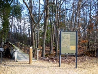
Erected by Richmond National Battlefield Park - National Park Service.
Topics. This historical marker is listed in this topic list: War, US Civil. A significant historical year for this entry is 1862.
Location. This marker has been replaced by another marker nearby. It was located near 37° 20.994′ N, 77° 23.691′ W. Marker was near Chester, Virginia, in Chesterfield County. Marker could be reached from Ware Bottom Spring Road, 0.1 miles east of Old Stage Road, on the right when traveling east. Touch for map. Marker was at or near this postal address: 1801 Ware Bottom Spring Road, Chester VA 23836, United States of America. Touch for directions.
Other nearby markers. At least 8 other markers are within walking distance of this location. Parker’s Battery (here, next to this marker); Boy Company (within shouting distance of this marker); a different marker also named The Boy Company (within shouting distance of this marker); Howlett Line (within shouting distance of this marker); a different marker also named Howlett Line (within shouting distance of this marker); a different marker also named Parker’s Battery (about 500 feet away, measured in a direct line); Remembrance (about 500 feet away); a different marker also named Parker's Battery (about 600 feet away). Touch for a list and map of all markers in Chester.
Related marker. Click here for another marker that is related to this marker. New Marker At This Location titled "Parker's Battery".
Credits. This page was last revised on July 14, 2022. It was originally submitted on February 12, 2009, by Bernard Fisher of Richmond, Virginia. This page has been viewed 1,454 times since then and 36 times this year. Photos: 1, 2, 3. submitted on February 12, 2009, by Bernard Fisher of Richmond, Virginia. • Craig Swain was the editor who published this page.


