Cumberland Township near Gettysburg in Adams County, Pennsylvania — The American Northeast (Mid-Atlantic)
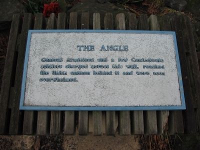
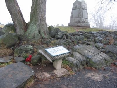
The Angle
Topics. This historical marker is listed in this topic list: War, US Civil. A significant historical month for this entry is July 1863.
Location. 39° 48.806′ N, 77° 14.184′ W. Marker is near Gettysburg, Pennsylvania, in Adams County. It is in Cumberland Township. Marker can be reached from Hancock Avenue, on the left when traveling north. Located at the "Angle" on Cemetery Ridge in Gettysburg National Military Park. Touch for map. Marker is in this post office area: Gettysburg PA 17325, United States of America. Touch for directions.
Other nearby markers. At least 8 other markers are within walking distance of this marker. 71st Pennsylvania Volunteers (a few steps from this marker); 72nd Pennsylvania Infantry (within shouting distance of this marker); Brigadier General Lewis Armistead, C.S.A. (within shouting distance of this marker); Battery A, Fourth U.S. Artillery (within shouting distance of this marker); Lt. Alonzo Cushing (within shouting distance of this marker); Twenty-Sixth North Carolina Regiment (within shouting distance of this marker); Defining Moments (within shouting distance of this marker); The Aftermath (within shouting distance of this marker). Touch for a list and map of all markers in Gettysburg.
Related markers. Click here for a list of markers that are related to this marker. Markers, Tablets and Monuments at the Angle.
Credits. This page was last revised on February 7, 2023. It was originally submitted on February 13, 2009, by Craig Swain of Leesburg, Virginia. This page has been viewed 3,283 times since then and 43 times this year. Photos: 1, 2. submitted on February 13, 2009, by Craig Swain of Leesburg, Virginia. 3. submitted on August 9, 2011, by Henry T. McLin of Hanover, Pennsylvania.


