Old Louisville in Jefferson County, Kentucky — The American South (East South Central)
Louisville Girls High School
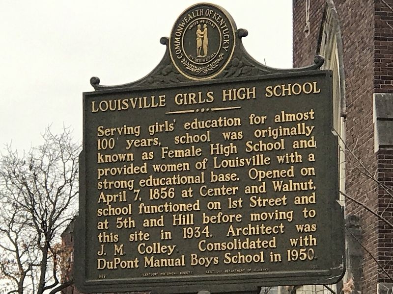
Photographed by Duane and Tracy Marsteller, November 26, 2020
1. Louisville Girls High School Marker
Erected by Kentucky Historical Society and Kentucky Department of Highways. (Marker Number 1851.)
Topics and series. This historical marker is listed in these topic lists: Education • Women. In addition, it is included in the Kentucky Historical Society series list. A significant historical date for this entry is April 7, 1856.
Location. 38° 13.375′ N, 85° 45.535′ W. Marker is in Louisville, Kentucky, in Jefferson County. It is in Old Louisville. It is at the intersection of West Lee Street and South 2nd Street (State Road 1020), on the right when traveling east on West Lee Street. Touch for map. Marker is at or near this postal address: 120 West Lee Street, Louisville KY 40208, United States of America. Touch for directions.

Regionally, this marker
this page online
Other nearby markers. At least 8 other markers are within walking distance of this marker: Freedom Park: A Journey to Freedom (approx. 0.2 miles away); Anne M. Braden (approx. 0.2 miles away); Dr. Rufus E. Clement (approx. 0.2 miles away); a different marker also named The Freedom Park: A Journey to Freedom (approx. 0.2 miles away); Dr. Eleanor Young Love (approx. 0.2 miles away); Dr. Joseph H. McMillan, Sr (approx. 0.2 miles away); Dr. Charles Henry Parrish, Jr. (approx. 0.2 miles away); a different marker also named Freedom Park: A Journey to Freedom (approx. 0.2 miles away). Touch for a list and map of all markers in Louisville.
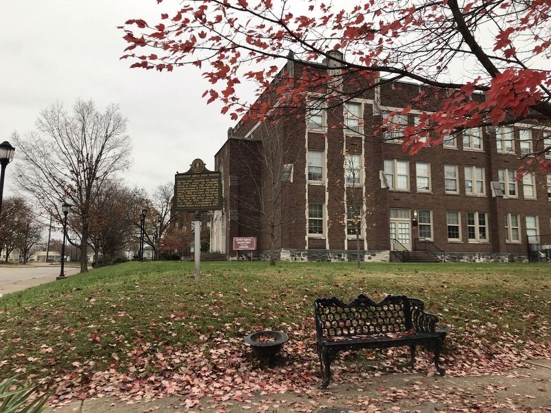
Photographed by Duane and Tracy Marsteller, November 26, 2020
2. Louisville Girls High School Marker
Credits. This page was last revised on February 12, 2023. It was originally submitted on December 1, 2020, by Duane and Tracy Marsteller of Murfreesboro, Tennessee. This page has been viewed 1,852 times since then and 121 times this year. Photos: 1. submitted on December 1, 2020, by Duane and Tracy Marsteller of Murfreesboro, Tennessee. 2. submitted on December 2, 2020, by Duane and Tracy Marsteller of Murfreesboro, Tennessee.
