Santa Barbara in Santa Barbara County, California — The American West (Pacific Coastal)
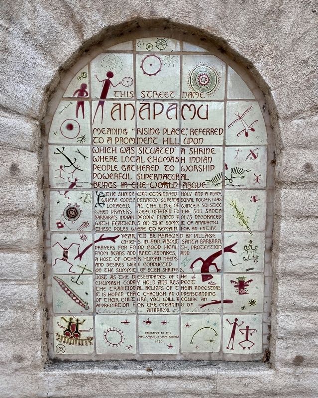
This Street Name Anapamu
This street name Anapamu meaning "Rising Place" referred to a prominent hill upon which was situated a shrine where local Chumash Indian people gathered to worship powerful supernatural beings in the world above. The shrine was considered holy and a place where concentrated supernatural power was located. At the time of winter solstice when prayers were offered to the sun, Santa Barbara's Indian people placed poles decorated with feathers on the summit of Anapamu. These poles were to remain for an entire year, to be renewed by village chiefs in and about Santa Barbara. Prayers for food, good health, protection from bears and rattlesnakes, and a host of other human needs and desires were conducted on the summit of such shrines. Just as the descendants of the Chumash today hold and respect the traditional beliefs of their ancestors, it is hoped that through an understanding of their culture, you will acquire an appreciation for the meaning of Anapamu.
Erected 1983 by City Council of Santa Barbara.
Topics. This historical marker is listed in these topic lists: Churches & Religion • Native Americans • Roads & Vehicles. A significant day of the year for for this entry is December 21.
Location. 34° 25.368′ N, 119° 42.313′ W. Marker is in Santa Barbara, California, in Santa Barbara County. Marker is on West Anapamu Street, on the right when traveling west. Touch for map. Marker is at or near this postal address: 26 West Anapamu Street, Santa Barbara CA 93101, United States of America. Touch for directions.
Other nearby markers. At least 8 other markers are within walking distance of this marker. Janssens-Orella Adobe House Site (about 600 feet away, measured in a direct line); Myron Hunt (about 700 feet away); Tympanum (about 700 feet away); Old Stagecoach Route (approx. 0.2 miles away); Santa Barbara County Courthouse (approx. 0.2 miles away); First Ruling Sovereign of Europe to Visit America (approx. 0.2 miles away); President Reagan Meets Queen Elizabeth II (approx. 0.2 miles away); a different marker also named Santa Barbara County Courthouse (approx. 0.2 miles away). Touch for a list and map of all markers in Santa Barbara.
Credits. This page was last revised on December 2, 2020. It was originally submitted on December 2, 2020, by Andrew Ruppenstein of Lamorinda, California. This page has been viewed 678 times since then and 155 times this year. Photos: 1, 2. submitted on December 2, 2020, by Andrew Ruppenstein of Lamorinda, California.

