Fort Benton in Chouteau County, Montana — The American West (Mountains)
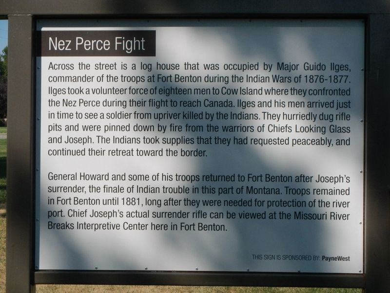
Nez Perce Fight
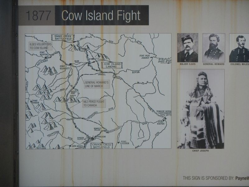
1877 Cow Island Fight
Photographed by Barry Swackhamer, August 22, 2020
1. Nez Perce Fight Marker
General Howard and some of his troops returned to Fort Benton after Joseph's surrender, the finale of Indian trouble in this part of Montana. Troops remained in Fort Benton until 1881, long after they were needed for protection of the river port. Chief Joseph's actual surrender rifle can be viewed at the Missouri Breaks Interpretive Center here in Fort Benton.
Erected by Fort Benton Chamber of Commerce.
Topics. This historical marker is listed in this topic list: Wars, US Indian.
Location. 47° 48.772′ N,
this page online

Regionally, this marker is in Central Montana, in Missouri River Country, and specifically in Russell Country. It is also in the American Mountain West and in the Lewis & Clark Corridor. Globally, it is in North America, the Western Hemisphere, the Western World, and the Anglosphere. Historically, it finds itself in what was once Rupert’s Land and also the Louisiana Purchase.
Other nearby markers. At least 8 other markers are within walking distance of this marker: Coulson's Steamboat Offices (within shouting distance of this marker); Great Northern Railway (within shouting distance of this marker); Whoop Up Trail (about 300 feet away, measured in a direct line); Old Fort Campbell (about 400 feet away); Fort LaBarge (about 500 feet away); Upriver Businesses (approx. 0.2 miles away); Stage Lines (approx. 0.2 miles away); Most Progressive in Montana
Photographed by Barry Swackhamer, August 22, 2020
2. Nez Perce Fight - 1877 Cow Island Fight Marker
Captions: (left) Map of Nez Perce and U.S. Army lines of march; (top right row) Major Ilges, General Howard, Colonel Miles; (lower right ) Chief Joseph.
Regarding Nez Perce Fight. The marker is located on the river front pathway between Missouri Breaks Interpretive Center and the historic downtown business district.
Credits. This page was last revised on December 3, 2020. It was originally submitted on December 3, 2020, by Barry Swackhamer of Brentwood, California. This page has been viewed 362 times since then and 40 times this year. Photos: 1, 2. submitted on December 3, 2020, by Barry Swackhamer of Brentwood, California.
