Near Mechanicsville in Hanover County, Virginia — The American South (Mid-Atlantic)
The Battle Opens
Cold Harbor Battlefield Park Walking Trail
Photographed by Bernard Fisher, February 15, 2009
1. The Battle Opens Marker
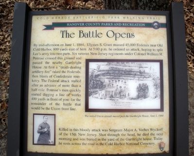
By mid-afternoon on June 1, 1864, Ulysses S. Grant massed 45,000 Federals near Old Cold Harbor, 800 yards east of here. At 5:00 p.m. he ordered an attack, hoping to split Lee’s army into two parts. Six veteran New Jersey regiments under Colonel William H. Penrose crossed this ground and passed the nearby Garthright House. At first a “death-dealing artillery fire” raked the Federals, then blasts of Confederate musketry. The Federal attack stalled after an advance of more than a half mile. Penrose’s men quickly started digging a line of works 400 yards in front of you; for the remainder of the battle that would be the Union front line.
Killed in this bloody attack was Sergeant-Major A. Vorhes Wyckoff of the 15th New Jersey. Shot through the head, he died the next morning and was buried in the yard of the Garthright house. Today he rests across the road in the Cold Harbor National Cemetery.
Erected by Hanover County Parks and Recreation, National Park Service.
Topics. This historical marker is listed in this topic list: War, US Civil. A significant historical month for this entry is June 1864.
Location. 37° 35.305′ N, 77° 16.642′ W.
this page online

Regionally, this marker is in Virginia’s Piedmont, in Central Virginia, and in the Richmond Metropolitan Area. It is also in the American South, specifically in the Upper South, and on the Eastern Seaboard. Globally, it is in the North Atlantic Region, North America, the Western Hemisphere, the Western World, and the Anglosphere. Historically, it finds itself in what was once the territory of the Mississippian Culture, one of the original Thirteen Colonies, one of the Confederate States of America, and the Antebellum South.
Other nearby markers. At least 8 other markers are within walking distance of this marker: Cold Harbor Battlefield Walking Trail (within shouting distance of this marker);
Photographed by Bernard Fisher, February 15, 2009
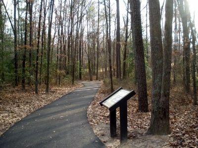
2. The Battle Opens Marker along the trail.
Walking trail via HMDb marker postings.
Click for more information.
Click for more information.
Another marker is no longer nearby. Field Hospital (was about 400 feet away but has been replaced with another marker now near it).
More about this marker. On the lower left is a photo of "Sergeant-Major A. Vorhes Wyckoff". On the left is a wartime sketch of the Union assault. The sketch carries the caption, "The initial Union assault moved past the Garthright House, June 1, 1864."
Also see . . .
1. Hanover County Parks and Recreation. Cold Harbor Battlefield Park (Submitted on February 17, 2009, by Bernard Fisher of Richmond, Virginia.)
2. Richmond National Battlefield Park. Cold Harbor (Submitted on February 17, 2009, by Bernard Fisher of Richmond, Virginia.)
3. CWSAC Battle Summary. Cold Harbor (Submitted on February 17, 2009, by Bernard Fisher of Richmond, Virginia.)
Credits. This page was last revised on February 2, 2025. It was originally submitted on February 17, 2009, by Bernard Fisher of Richmond, Virginia. This page has been viewed 1,575 times since then and 21 times this year. Photos: 1, 2. submitted on February 17, 2009, by Bernard Fisher of Richmond, Virginia. • Craig Swain was the editor who published this page.
