Near Mechanicsville in Hanover County, Virginia — The American South (Mid-Atlantic)
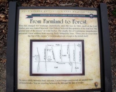
From Farmland to Forest
Cold Harbor Battlefield Park Walking Trail
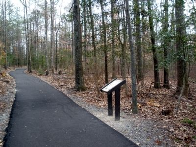
To move safely between front and rear, Union troops constructed six parallel lines of breastworks. You are standing between the 4th and 5th line of works.
Erected by Hanover County Parks and Recreation, National Park Service.
Topics. This historical marker is listed in this topic list: War, US Civil. A significant historical year for this entry is 1864.
Location. 37° 35.259′ N, 77° 16.633′ W. Marker is near Mechanicsville, Virginia, in Hanover County. Marker can be reached from Cold Harbor Road (State Highway 156) 0.2 miles east of Boatswain Lane, on the right when traveling east. This marker is located along a one-mile trail in the 50-acre Cold Harbor Battlefield Park. Touch for map. Marker is at or near this postal address: 6005 Cold Harbor Road, Mechanicsville VA 23111, United States of America. Touch for directions.
Other nearby markers. At least 8 other markers are within walking distance of this marker. Union Reserve Line (within shouting distance of this marker); The Battle Opens (about 300 feet away, measured in a direct line); Garthright House (about 500 feet away); Cold Harbor Battlefield Walking Trail (about 500 feet away); Preparation For Battle (about 500 feet away); A Dreadful Harvest (about 500 feet away); The Family Cemetery (about 500 feet away); Cold Harbor: June 2, 1864 (about 500 feet away). Touch for a list and map of all markers in Mechanicsville.
More about this marker. In the center is a sketch of six parallel lines of breastworks constructed by Union troops.
Also see . . .
1. Richmond National Battlefield Park. Cold Harbor (Submitted on February 17, 2009, by Bernard Fisher of Richmond, Virginia.)
2. CWSAC Battle Summary. Cold Harbor (Submitted on February 17, 2009, by Bernard Fisher of Richmond, Virginia.)
3. Cold Harbor Battlefield Park Walking Trail. This marker is one along the walking trail around a portion of the Cold Harbor Battlefield preserved by Hanover County Parks and Recreation. (Submitted on February 17, 2009, by Bernard Fisher of Richmond, Virginia.)
Credits. This page was last revised on September 30, 2022. It was originally submitted on February 17, 2009, by Bernard Fisher of Richmond, Virginia. This page has been viewed 1,226 times since then and 15 times this year. Photos: 1, 2. submitted on February 17, 2009, by Bernard Fisher of Richmond, Virginia. • Craig Swain was the editor who published this page.

