Big Sandy in Chouteau County, Montana — The American West (Mountains)
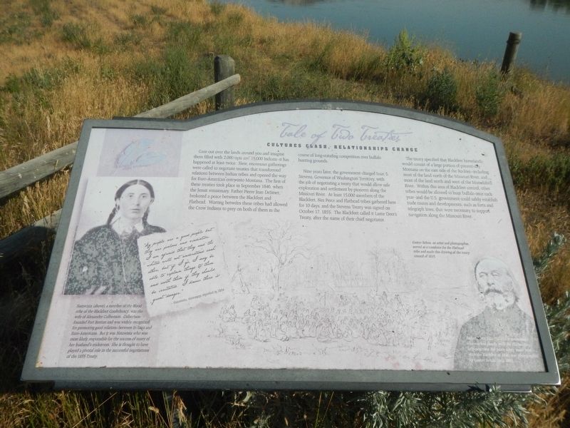
Tale of Two Treaties
Cultures Clash, Relationships Change

Photographed By Barry Swackhamer, August 23, 2020
1. Tale of Two Treaties Marker
Caption: (bottom right) Father Pierre Jean DeSmet, a missionary who worked closely with the Flatheads to help negotiate the peace treaty made here with the Blackfeet in 1846 was photographed by Gustav Sohon circa 1863.; Gustav Sohon, an artist and photographer, served as a translator for the Flathead tribe and made this drawing (background) of the treaty council in 1855.
Nine years later, the government charged Issac S. Stevens, Governor of Washington Territory, with the job of negotiating a treaty that would allow safe exploration and settlement by pioneers along the Missouri River. At least 15,000 members of the Blackfeet, Nez Perce and Flathead tribes gathered here for 10 days, and the Stevens Treaty was signed on October 17, 1855. The Blackfeet called it Lame Deer's Treaty, after the name of their chief negotiator.
The treaty specified that Blackfeet homeland would consist of a large portion of present-day Montana on the east side of the Rockies-including most of the land north of the Missouri River, and most of the land north and west of the Musselshell River. Within this area of Blackfeet control, other tribes would be allowed to hunt buffalo once each year-and the U.S. Government could safely establish trade routes and developments, such as forts and telegraph lines, that were necessary to support navigation along the Missouri River.
Natawista (above), a member of the Blood tribe of the Blackfoot Confederacy, was the wife of Alexander Culbertson. Culbertson founded Fort Benton and was widely recognized for promoting good relations between Indians and Euro-Americans. But it was Natawista who was most likely responsible for the success of many of her husband's endeavors. She is thought to have played a pivotal role in the successful negotiations of the 1855 Treaty.
"My people are a good people but they are jealous and vindictive. I am afraid that they are the whites will not understand each other, but if I go I may be able to explain things to them and sooth them if they should be irritated. I know there is great danger." -- Natawista, statement reported in 1854
Topics. This historical marker is listed in these topic lists: Native Americans • Wars, US Indian. A significant historical date for this entry is October 17, 1855.
Location. 47° 44.327′ N, 109° 37.327′ W. Marker is in Big Sandy, Montana, in Chouteau County. Marker can be reached from Judith Landing Road (State Highway 236).
The marker is at Judith Landing; where Judith Landing Road meets the Missouri River. Touch for map. Marker is in this post office area: Big Sandy MT 59520, United States of America. Touch for directions.
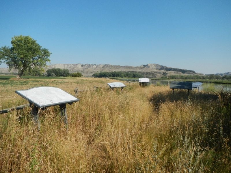
Other nearby markers. At least 8 other markers are within one mile of this marker, measured as the crow flies. Lewis and Clark National Historic Trail (here, next to this marker); Naturally Sustained Productivity (here, next to this marker); The Anglos Are Coming (here, next to this marker); Welcome to the Mountain Ranges (here, next to this marker); Camp Cooke (approx. ¼ mile away); The Judith River Formation (approx. 0.3 miles away); Fort Chardon (approx. 0.4 miles away); The Judith Landing (approx. one mile away). Touch for a list and map of all markers in Big Sandy.
More about this marker. The marker is located on a pathway leading east from the boat launch ramp.
Credits. This page was last revised on December 6, 2020. It was originally submitted on December 6, 2020, by Barry Swackhamer of Brentwood, California. This page has been viewed 172 times since then and 19 times this year. Photos: 1, 2. submitted on December 6, 2020, by Barry Swackhamer of Brentwood, California.
