Rush in Marion County, Arkansas — The American South (West South Central)
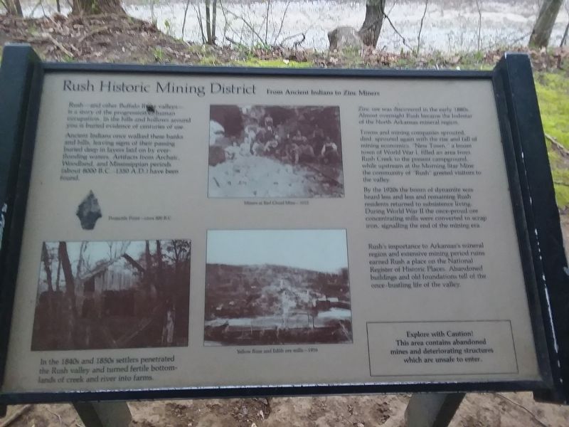
Rush Historic Mining District
From Ancient Indians to Zinc Miners
Rush—and other Buffalo River valleys— is a story of the progression human occupation. In the hills and hollows around you is buried evidence of centuries of use.
Ancient Indians once walked these banks and hills, leaving signs of their passing buried deep in layers laid on by ever- flooding waters. Artifacts from Archaic, Woodland, and Mississippian periods (about 8000 B.C.-1350 A.D.) have been found.
In the 1840s and 1850s settlers penetrated the Rush valley and turned fertile bottomlands of creek and river into farms.
Zinc ore was discovered in the early 1880s. Almost overnight Rush became the lodestar of the North Arkansas mineral region.
Towns and mining companies sprouted, died, sprouted again with the rise and fall of mining economics, "New Town," a boom town of World War I, filled an area from Rush Creek to the present campground, while upstream at the Morning Star Mine the community of "Rush" greeted visitors to the valley.
By the 1920s the boom of dynamite was heard less and less and remaining Rush residents returned to subsistence living. During World War II the once-proud ore concentrating mills were converted to scrap iron, signalling the end of the mining era.
Rush's importance to Arkansas's mineral region and extensive mining period ruins earned Rush a place on the National Register of Historic Places. Abandoned buildings and old foundations tell of the once-bustling life of the valley.
Erected by National Park Service, U.S. Department of the Interior.
Topics. This historical marker is listed in these topic lists: Industry & Commerce • Native Americans • Settlements & Settlers • War, World I.
Location. 36° 7.883′ N, 92° 34.083′ W. Marker is in Rush, Arkansas, in Marion County. Marker is on County Road 6035, 0.3 miles east of County Road 637, on the left when traveling east. Touch for map. Marker is in this post office area: Flippin AR 72634, United States of America. Touch for directions.
Other nearby markers. At least 8 other markers are within walking distance of this marker. Rush Mining District (here, next to this marker); Rush, The Town That Zinc Built (within shouting distance of this marker); Change and Renewal (within shouting distance of this marker); 200 Tons A Day (about 300 feet away, measured in a direct line); Mining Turkey Fat and Rosin Jack (about 400 feet away); Four-footed Link (about 400 feet away); Silver-lined Dreams (about 400 feet away); Company Village (about 400 feet away). Touch for a list and map of all markers in Rush.
Also see . . . Rush (Ghost Town). (Submitted on December 6, 2020, by Craig Doda of Napoleon, Ohio.)
Credits. This page was last revised on December 6, 2020. It was originally submitted on December 6, 2020, by Craig Doda of Napoleon, Ohio. This page has been viewed 115 times since then and 12 times this year. Photos: 1, 2. submitted on December 6, 2020, by Craig Doda of Napoleon, Ohio. • Devry Becker Jones was the editor who published this page.

