
Carbon in Eastland County, Texas — The American South (West South Central)
Carbon City Jail
Photographed by James Hulse, November 21, 2020
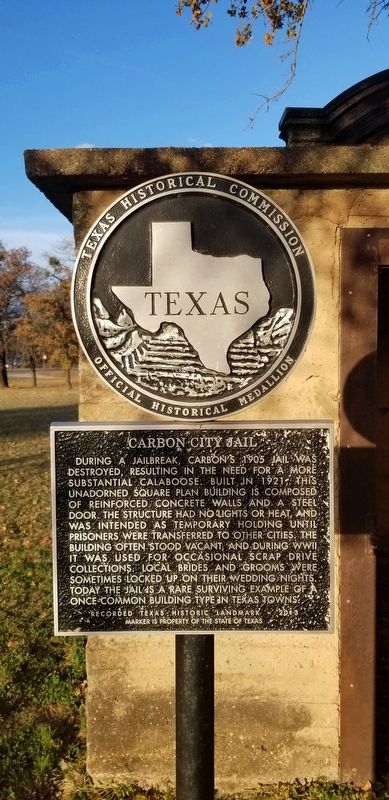
1. Carbon City Jail Marker
During a jailbreak, Carbon's 1905 Jail was destroyed, resulting in the need for a more substantial calaboose. Built in 1921 this unadorned square plan building is composed of reinforced concrete walls and a steel door. The structure had no lights or heat, and was intended as temporary holding until prisoners were transferred to other cities. The building often stood vacant, and during WWII it was used for occasional scrap drive collections. Local brides and grooms were sometimes locked up on their wedding nights. Today the jail is a rare surviving example of a once common building type on Texas towns.
Recorded Texas Historic Landmark - 2013
Marker is property of the State of Texas.
Erected 2013 by Texas Historical Commission. (Marker Number 17695.)
Topics. This historical marker is listed in this topic list: Law Enforcement. A significant historical year for this entry is 1905.
Location. 32° 16.28′ N, 98° 49.675′ W. Marker is in Carbon, Texas, in Eastland County. It is at the intersection of Collins Boulevard and 5th Street, on the left when traveling east on Collins Boulevard. Touch for map. Marker is in this post office area: Carbon TX 76435, United States of America. Touch for directions.

Regionally, this marker is in Big Country. Globally, it is in North America, a Gulf of Mexico state, the Western Hemisphere, the Western World, and the Anglosphere. Historically, it finds itself in what was once New Spain, the Comanchería, the Republic of Texas, and one of the Confederate States of America.
Other nearby markers. At least 8 other markers are within 9 miles of this marker, measured as the crow flies: Carbon Methodist Church Building (approx. 0.2 miles away); First Baptist Church (approx. ¼ mile away); Burkett House (approx. 8.1 miles away); Prairie Oil and Gas Company Housing (approx. 8.2
this page online
Also see . . . Early Twentieth Century Calabooses in the Texas Borderlands. Journal of Texas Archeology and History website entry (Submitted on December 7, 2020, by James Hulse of Medina, Texas.)
Photographed by James Hulse, November 21, 2020
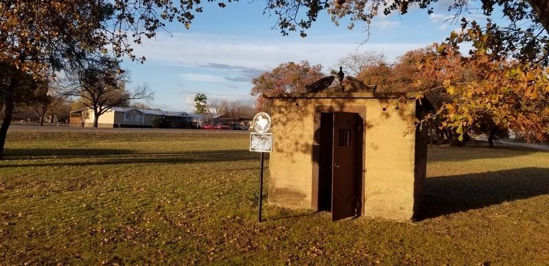
2. Carbon City Jail
This type of jail is called a calaboose due to its tiny size.
Photographed by James Hulse, November 21, 2020
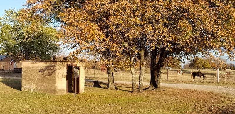
3. The Carbon City Jail from the street
Credits. This page was last revised on September 15, 2022. It was originally submitted on December 7, 2020, by James Hulse of Medina, Texas. This page has been viewed 647 times since then and 37 times this year. Photos: 1, 2, 3. submitted on December 7, 2020, by James Hulse of Medina, Texas. • J. Makali Bruton was the editor who published this page.
