
Hollidaysburg in Blair County, Pennsylvania — The American Northeast (Mid-Atlantic)
John Blair
1766-1832
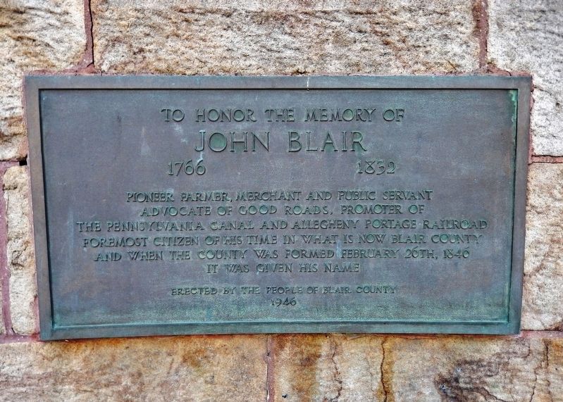
Photographed by Cosmos Mariner, September 1, 2016
1. John Blair Marker
John Blair
1766-1832
Pioneer farmer, merchant and public servant
advocate of good roads, promoter of
the Pennsylvania Canal and Allegheny Portage Railroad
foremost citizen of his time in what is now Blair County
and when the county was formed February 26th, 1846
it was given his name
Erected 1946 by the People of Blair County.
Topics and series. This historical marker is listed in these topic lists: Railroads & Streetcars • Waterways & Vessels. In addition, it is included in the Pennsylvania Canal series list. A significant historical date for this entry is February 26, 1846.
Location. 40° 25.821′ N, 78° 23.541′ W. Marker is in Hollidaysburg, Pennsylvania, in Blair County. It can be reached from Union Street north of Allegheny Street, on the left when traveling north. Marker is mounted at eye-level on the courtyard wall on the east side of the Blair County Court House. Touch for map. Marker is at or near this postal address: 423 Allegheny St, Hollidaysburg PA 16648, United States of America. Touch for directions.

Regionally, this marker is in the American Northeast, in the Mid-Atlantic, in Appalachia, and
this page online
Other nearby markers. At least 8 other markers are within walking distance of this marker: Pioneer Family (here, next to this marker); Civil War Memorial (within shouting distance of this marker); The William Krelitz Building (about 600 feet away, measured in a direct line); First High School (about 700 feet away); Adam Holliday (about 700 feet away); Blair County (approx. 0.2 miles away); Daniel Hale Williams (approx. 0.2 miles away); Canal Basin (approx. 0.3 miles away). Touch for a list and map of all markers in Hollidaysburg.
Also see . . .
1. Blair County History. Before the county's formation the area was located on the Frankstown Path and was dangerous to settle because of threats from Indians. It was visited by the Catholic priest Prince Demetrius Gallitzin. The Blair family appeared after the Revolution and led the movement to form the county. (Submitted on December 7, 2020, by Cosmos Mariner of Cape Canaveral, Florida.)
2. Hollidaysburg, Pennsylvania (Wikipedia). Hollidaysburg became the main transfer point between the Pennsylvania Canal and the Portage Railroad, a gateway to western Pennsylvania. The canal and Portage Railroad spurred industrial and commercial development in Hollidaysburg in the 1830s. In 1836, Hollidaysburg was established as a borough. When Blair County was organized in 1846, the Borough of Hollidaysburg was designated the county seat. (Submitted on December 7, 2020, by Cosmos Mariner of Cape Canaveral, Florida.)
Credits. This page was last revised on December 19, 2023. It was originally submitted on December 7, 2020, by Cosmos Mariner of Cape Canaveral, Florida. This page has been viewed 1,415 times since then and 111 times this year. Photo 1. submitted on December 7, 2020, by Cosmos Mariner of Cape Canaveral, Florida.
Editor’s want-list for this marker. A wide shot of the marker in context. • Can you help?
