Near Roy in Fergus County, Montana — The American West (Mountains)
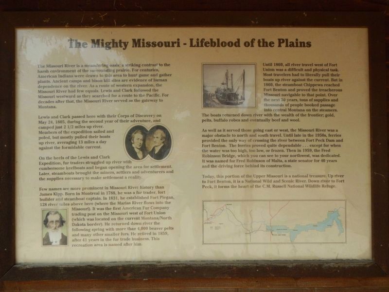
The Mighty Missouri - Lifeblood of the Plains
Inscription.
The Missouri River is a meandering oasis; a striking contrast to the harsh environment of the surrounding prairie For centuries, American Indians were drawn to this area to hunt game and gather plants. Ancient camps and bison kill sites are evidence of human dependance on the river. As a route of western expansion, the Missouri River had few equals. Lewis and Clark followed the Missouri westward as they searched for a route to the Pacific. For decades after that, the Missouri River served as a gateway to Montana.
Lewis and Clark passed here with their Corps of Discovery on May 24, 1805, during the second year of their adventure, and camped just 2 1/2 miles up river. Members of the expedition sailed and poled, but mostly pulled their boats up river, averaging 13 miles a day agains the formidable current.
On the heels of the Lewis and Clark Expedition, fur traders struggled up river with cumbersome keelboats and began opening the area for settlement. Later, steamboats brought the miners, settlers and adventurers and the supplies necessary to make settlement a reality.
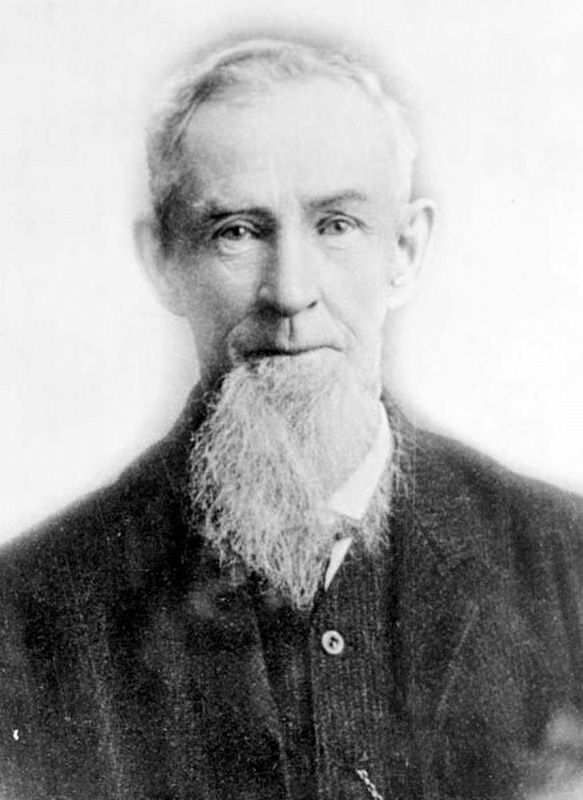
Few names are more prominent in Missouri River history than James Kipp. Born in Montreal in 1788, he was a fur trader, fort builder and steamboat captain. In 1831, he established Fort Piegan, 128 river miles above here (where the Marias River flows into the Missouri). It was the first American Fur Company trading post on the Missouri west of Fort Union (which was located on the current Montana/North Dakota border). He returned down river the following spring with more than 4,000 beaver pelts and many other smaller furs. He retired in 1859, after 41 years in the fur trade business. This recreation area is named after him.
Until 1860, all river travel west of Fort Union was a difficult and physical task. Most travelers had to literally pull their boats up river against the current. But in 1860, the steamboat Chippewa reached Fort Benton and proved the treacherous Missouri navigable to that point. Over the next 30 years, tons of supplies and thousands of people booked passage into central Montana on the steamer. The boats returned down river with the wealth of the frontier; gold, pelts, buffalo robes and eventually beef and wool.
As well as it served those going east of west, the Missouri River was a major obstacle to north and south travel. Until late in the 1950s, ferries provided the only way of crossing the river between Fort Peck Dam and Fort Benton. The ferries proved quite dependable...except for when the water was too high, too low, or frozen. Then in 1959, the Fred Robinson Bridge, which you can see to you northwest, was dedicated. It was named for Fred Robinson of Malta, a state senator for 40 years and the

Photographed By Barry Swackhamer, August 24, 2020
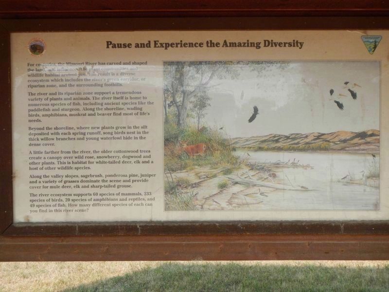
2. Pause and Experience the Amazing Diversity
For centuries, the Missouri River has carved and shaped the land and influenced the plant communities and wildlife habitat around you. The result is a diverse ecosystem which includes the river's green corridor, or riparian zone, and the surrounding hills.
The river and its riparian zone support a tremendous variety of plants and animals. The river itself is home to numerous species of fish, including ancient species like the paddlefish and sturgeon. Along the shoreline, wading birds, amphibians, muskrats and beaver find most of life's needs.
Beyond the shoreline, where new plants grow in the silt deposited with each spring runoff, song birds nest in the thick willow branches and young waterfowl hide in the dense cover.
A little farther from the river, the older cottonwood trees create a canopy over wild rose, snowberry, dogwood and other plants. This is habitat for white-tailed deer, elk and a host of other wildlife species.
Along the valley slopes, sagebrush, ponderosa pine, juniper and a variety of grasses dominate the scene and provide cover for mule deer, elk and sharp-tailed grouse.
The river ecosystem supports 60 species of mammals, 233 species of birds, 20 species of amphibians and reptiles, and 49 species of fish. How many different species of each can you find in this river scene?
Today, this portion of the Upper Missouri is a national treasure. Up river to Fort Benton, it is a National Wild and Scenic River. Down river to Fort Peck, it forms the heart of the C.M. Russell National Wildlife Refuge. Pause and Experience the Amazing Diversity
Erected by Department of the Interior, Bureau of Land Management.
Topics. This historical marker is listed in these topic lists: Natural Features • Waterways & Vessels. A significant historical date for this entry is May 24, 1805.
Location. 47° 37.413′ N, 108° 40.945′ W. Marker is near Roy, Montana, in Fergus County. Marker can be reached from U.S. 191, on the right when traveling north. This marker is located where U.S. Highway 191 crossed the Missouri River, in the campground of the James Kipp Recreation Area. Touch for map. Marker is in this post office area: Roy MT 59471, United States of America. Touch for directions.
Other nearby markers. At least 3 other markers are within 13 miles of this marker, measured as the crow flies. A Fine Day for a Sail (approx. half a mile away); The Little Rocky Mountains (approx. 12.1 miles away); a different marker also named The Little Rocky Mountains (approx. 12.1 miles away).
Also see . . . James Kipp – Long Time Fur Trader -- Legends of America. “In the
summer of 1832, Mr. George Catlin was a guest in my fort at the Mandan village, observing and learning the customs of the interesting and peculiar people, and painting the portraits of their celebrated men, of which he had many and with great exactness.” (Submitted on December 7, 2020, by Barry Swackhamer of Brentwood, California.)
Credits. This page was last revised on December 7, 2020. It was originally submitted on December 7, 2020, by Barry Swackhamer of Brentwood, California. This page has been viewed 161 times since then and 16 times this year. Photos: 1, 2, 3, 4. submitted on December 7, 2020, by Barry Swackhamer of Brentwood, California.


