Fort Peck in Valley County, Montana — The American West (Mountains)
Powerful Afterthoughts
Hydroelectric Power at Fort Peck Dam
Photographed by Barry Swackhamer, August 26, 2020
1. Powerful Afterthoughts Marker
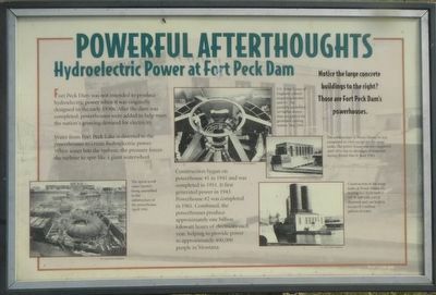
Captions: (bottom left) The spiral scroll cases (center) being assembled in the substructure of the powerhouse, April 1941.; (top center) U.S. Army Corps of Engineers colonel inspects generator unit #1. The partially assembled air baffles shown here are part of the generator cooling system. May 1943.; (middle right) The substructure of Power House #1 was completed in 1943 except for the surge tanks. The power house was not completed until 1951 due to shortages of materials during World War II. June 1943.; (bottom right) Construction of the surge tanks at Power House #2 in progress. Each tank is 147 ft. tall with a 65 ft. diameter and can hold in excess of 3 million gallons of water.
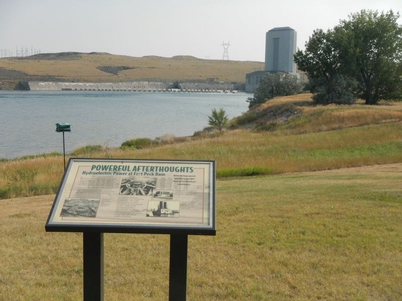
Fort Peck Dam was not intended to produce hydroelectric power when it was originally designed in the early 1930s. After the dam was completed, powerhouses were added to help meet the nation's growing demand for electricity.
Water from Fort Peck Lake is diverted to the powerhouses to create hydroelectric power. When water hits the turbine, the pressure forces the turbine to spin like a giant waterwheel.
Construction began on powerhouse #1 in 1941 and was completed in 1951. It first generated power in 1943. Powerhouse #2 was completed in 1961. Combined, the powerhouses produce approximately one billion kilowatt hours of electricity each year, helping to provide power to approximately 400,000 people in Montana.
Erected by U.S. Army Corps of Engineers.
Topics. This historical marker is listed in these topic lists: Charity & Public Work • Waterways & Vessels. A significant historical year for this entry is 1941.
Location. 48° 0.604′ N, 106° 25.275′ W. Marker is in Fort Peck, Montana, in Valley County. It can be reached from Yellowstone Road near Winter Harbor, on the left when traveling east. The marker is located
this page online

Regionally, this marker is in Missouri River Country. It is also in the American Mountain West, in the Lewis & Clark Corridor, on the prairies, on the Great Plains, and specifically on the Northern Plains. Globally, it is in North America, the Western Hemisphere, the Western World, and the Anglosphere. Historically, it finds itself in what was once Rupert’s Land and also the Louisiana Purchase.
Other nearby markers. At least 8 other markers are within walking distance of this marker: Diverting the Mighty Missouri (here, next to this marker); Town Built for a Dam (a few steps from this marker); Boomtowns on the Outskirts (a few steps from this marker); Ponderosa Pine (within shouting distance of this marker); Dredging Up The Earth To Build A Dam (about 300 feet away, measured in a direct line); In Memory (approx. one mile away); Built with Muscle and Muck (approx. one mile away); Fort Peck Dam (approx. one mile away). Touch for a list and map of all markers
Photographed by Barry Swackhamer, August 26, 2020
2. Powerful Afterthoughts Marker
Credits. This page was last revised on July 26, 2026. It was originally submitted on December 7, 2020, by Barry Swackhamer of Brentwood, California. This page has been viewed 398 times since then and 44 times this year. Photos: 1, 2. submitted on December 7, 2020, by Barry Swackhamer of Brentwood, California.
