Fort Peck in Valley County, Montana — The American West (Mountains)
Built with Muscle and Muck
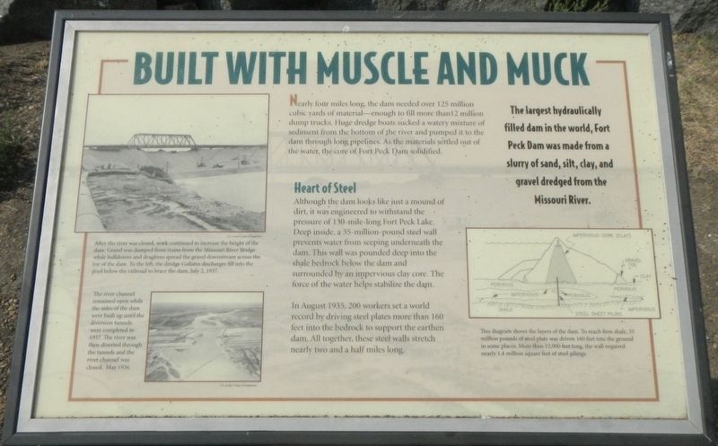
Nearly four miles long, the dam needed over 125 million cubic yards of material-enough to fill more than 12 million dump trucks. Huge dredge boats sucked a watery mixture of sediment from the bottom of the river and pumped it to the dam through long pipelines. As the material settled out of the water, the core of Fort Peck Dam solidified.
Heart of Steel Although the dam looks like just a mound of dirt, it was engineered to withstand the pressure of 130-mile-long Fort Peck Lake. Deep inside, a 35-million-pound steel wall prevents water from seeping underneath the dam. This wall was pounded deep into the shale bedrock below the dam and surrounded by an impervious clay core. The force of the water helps stabilize the dam.
In August 1935, 200 workers set a world record by driving steel plates more than 160 feet into the bedrock to support the earthen dam. All together, these steel walls stretch nearly two and a half miles long.
Erected by U.S. Army Corps of Engineers.
Topics. This historical marker is listed in this topic list: Natural Features.
Location. 48° 0.499′ N, 106° 24.016′ W. Marker is in Fort Peck, Montana, in Valley County. Marker is at the intersection of Yager Road and State Highway 24, on the left when traveling south on Yager Road. Touch for map. Marker is in this post office area: Fort Peck MT 59223, United States of America. Touch for directions.
Other nearby markers. At least 8 other markers are within 2 miles of this marker, measured as the crow flies. Fort Peck Dam (here, next to this marker); The Slide of '38 (here, next to this marker); In Memory (here, next to this marker); Boomtowns on the Outskirts (approx. one mile away); Town Built for a Dam (approx. one mile away); Powerful Afterthoughts (approx. one mile away); Diverting the Mighty Missouri (approx. one mile away); Fort Peck Administration Building (approx. 2.1 miles away). Touch for a list and map of all markers in Fort Peck.
Credits. This page was last revised on December 8, 2020. It was originally submitted on December 8, 2020, by Barry Swackhamer of Brentwood, California. This page has been viewed 130 times since then and 12 times this year. Photos: 1, 2. submitted on December 8, 2020, by Barry Swackhamer of Brentwood, California.

