Near Lorman in Jefferson County, Mississippi — The American South (East South Central)
Civil War Skirmish
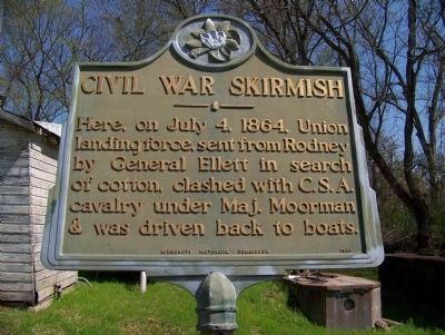
March 16, 2008
1. Civil War Skirmish Marker
Erected 1964 by Mississippi Historical Commission.
Topics and series. This historical marker is listed in this topic list: War, US Civil. In addition, it is included in the Mississippi State Historical Marker Program series list. A significant historical month for this entry is July 1766.
Location. Marker has been reported missing. It was located near 31° 50.175′ N, 91° 2.768′ W. Marker was near Lorman, Mississippi, in Jefferson County. It was at the intersection of State Highway 552 and Lower Mississippi Great River Road (Interstate 61), on the right when traveling west on State Highway 552. Touch for map. Marker was in this post office area: Lorman MS 39096, United States of America. Touch for directions.

Regionally, this marker was in Southwest Mississippi and in Natchez Trace Corridor. It was also in the American South, specifically in the Deep South, and in the Great River Road Region. Globally, it was in North America, a Gulf of Mexico
this page online
Other nearby markers. At least 8 other markers are within 7 miles of this location, measured as the crow flies: Coleman's Crossroads (about 600 feet away, measured in a direct line); Lorman (approx. 1.1 miles away); Red Lick (approx. 3.4 miles away); Alcorn Agricultural And Mechanical College (approx. 6.1 miles away); Oakland Memorial Chapel (approx. 6.2 miles away); Oakland College (approx. 6.2 miles away); The Original Campus (approx. 6.2 miles away); The Chapel (approx. 6.2 miles away). Touch for a list and map of all markers in Lorman.
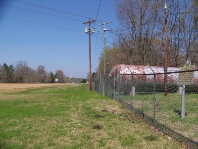
March 16, 2008
2. Civil War Skirmish Marker
Credits. This page was last revised on December 24, 2020. It was originally submitted on March 20, 2008, by Gordon Bruce Schulze Jr. of Kingston, Oklahoma. This page has been viewed 2,571 times since then and 53 times this year. Last updated on December 8, 2020, by Darren Jefferson Clay of Duluth, Georgia. Photos: 1, 2. submitted on March 20, 2008. • Bernard Fisher was the editor who published this page.
