Four Oaks in Johnston County, North Carolina — The American South (South Atlantic)
Mower’s Charge Reaches Johnston’s Headquarters
Inscription.
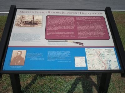
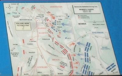
In the field in front of you skirmishers from the 64th Illinois, armed with Henry repeating rifles, overran Gen. Joseph E. Johnston’s headquarters, forcing the general and his staff to flee on foot toward Bentonville (to your left). Maj. Gen. Joseph Mower had set out to do a “little reconnaissance” of the Confederate left flank on the morning of March 21, 1865. Due to driving rain and difficult terrain (deep swamps, briars, and dense undergrowth), it took Fuller’s and Tillson’s brigades nearly an hour to reach the Confederate lines.
“It was a terrible job getting over the swamp, sinking in to the knees and sometimes to the hips….”
Pvt. Abel Stilwell, 64th Illinois.
“In our front the marsh was so deep, and such a tangle of vines, that all mounted officers were speedily on foot.”
- Col. Charles Sheldon, 18th Missouri.
Mower’s advance – nearly cutting off Johnston’s only avenue of retreat across Mill Creek – was halted by a counterattack by Confederate Gen. William Hardee. The Federals captured an abandoned artillery caisson of Earle’s Battery and Johnston’s headquarters, including his personal effects and several staff horses. Without adequate support, Mower was called back by General Sherman. Mower’s retreat allowed Johnston to withdraw his army (including the wounded) across Mill Creek bridge and fall back to Smithfield, thus ending the Battle of Bentonville.
“One gun of [William] Earle’s Battery…commanded by Capt. Earle in person, opened, and Gen. Law rode directly to it in a gallop, and seeing the moving line of Yankee infantry, said: ‘Capt. Earle, get your gun out here.’ This was done, but the reserve caisson, in turning got into a tree between the wheel and the limber chest….The enemy…swept our line back until it reached our field hospital on the side of the road leading to the bridge, and in sight of it.”
Maj. James G. Holmes, staff of Gen. Evander Law.
“I suppose, General, after I get into position, there will be no objection to my making a little reconnoisance [sic].”
Maj. Gen. Joseph A. Mower to Maj. Gen. Francis B. Blair Jr., March 21, 1865.
“[We] form line of battle in a heavily wooded country and move forward….Nothing joins our extreme left – skirmishers engaged – as we advance rebel batteries shell us – we push forward rapidly – [striking a] line of rebels behind log breastworks; [we were] onto them so quick we captured half of them….Our skirmishers got into Joe Johnston’s headquarters tents.”
Lt. Matthew H. Jamison, 10th Illinois.
Erected 2005 by North Carolina Civil War Trails.
Topics. This historical marker is listed in this topic list: War, US Civil. A significant historical date for this entry is March 21, 1865.
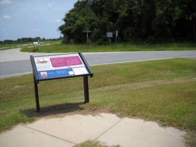
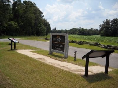
Location. 35° 20.798′ N, 78° 17.632′ W. Marker is in Four Oaks, North Carolina, in Johnston County. Marker is at the intersection of Westbrook Lowgrounds Road (County Route 1189) and Bentonville Road (County Route 1197), on the right when traveling east on Westbrook Lowgrounds Road. Touch for map. Marker is at or near this postal address: 121 Westbrook Lowgrounds Rd, Four Oaks NC 27524, United States of America. Touch for directions.
Other nearby markers. At least 8 other markers are within walking distance of this marker. Village of Bentonville (a few steps from this marker); Hardee’s Counterattack (a few steps from this marker); Johnston’s Headquarters (a few steps from this marker); Johnston Establishes His Headquarters (about 400 feet away, measured in a direct line); a different marker also named Village of Bentonville (approx. ¼ mile away); Bentonville (approx. ¼ mile away); Confederate Works (approx. half a mile away); Mill Creek (approx. 0.6 miles away). Touch for a list and map of all markers in Four Oaks.
More about this marker. The top section of the marker contains an artist’s rendering of Mower’s attack, March 21, 1865 (from Frank Leslie’s Illustrated Newspaper), a picture of ‘The Henry repeating rifle [which] has been called “a rifle that you could load on Sunday and shoot all week long,” because it could hold as many as sixteen shots in its magazine.' The bottom section of the marker contains a battle map,
a photo of Union Maj. Gen. Joseph Mower, 1st Division, XVII Corps (from Library of Congress).
Related markers. Click here for a list of markers that are related to this marker. Take a tour of the Roadside Exhibits erected on the Battle of Bentonville for the 140th anniversary of the battle, on March 14, 2005.
Credits. This page was last revised on May 10, 2023. It was originally submitted on March 1, 2008, by Bill Coughlin of Woodland Park, New Jersey. This page has been viewed 1,662 times since then and 24 times this year. Last updated on May 9, 2023, by Michael Buckner of Durham, North Carolina. Photos: 1. submitted on March 1, 2008, by Bill Coughlin of Woodland Park, New Jersey. 2. submitted on August 12, 2010, by Bill Coughlin of Woodland Park, New Jersey. 3. submitted on March 1, 2008, by Bill Coughlin of Woodland Park, New Jersey. 4. submitted on August 12, 2010, by Bill Coughlin of Woodland Park, New Jersey. 5. submitted on March 1, 2008, by Bill Coughlin of Woodland Park, New Jersey. • J. Makali Bruton was the editor who published this page.
