Water: Sculpting The Landscape
Ha Ha Tonka State Park
— Missouri State Parks —
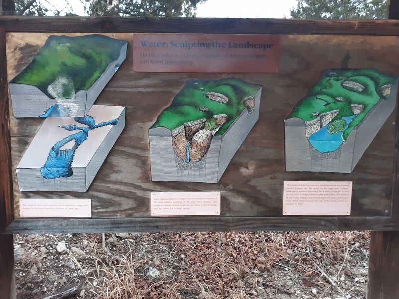
Ha Ha Tonka is a classic example of what geologists call karst topography
This cutaway shows how ground water dissolved a large cave System in dolomite bedrock millions of years ago.
After regional uplift, lowering of the water table, and erosion of the land surface, portions of the cave roof collapsed. This created a chasm several sinkholes, an island a natural bridge. and an outlet for a large spring.
The chasm in which you are now standing and the surrounding Natural features are the result of this large-scale collapse.
Subsequent erosion soothed the scarred landscape as soils
accumulated and vegetation became established. The water of
Ha Ha Tonka Spring pools behind small mill dams constructed
in the 1830s, then flows into the Lake of the Ozarks which was
created in 1931.
Erected by Missouri Department of Natural Resources.
Topics. This historical marker is listed in these topic lists: Charity & Public Work • Industry & Commerce • Natural Features • Waterways & Vessels. A significant historical year for this entry is 1931.
Location. 37° 58.517′ N, 92° 46.017′ W. Marker is in Ha Ha Tonka, Missouri, in Camden County. Marker is on Natural Bridge Road, half a mile west of State Highway D
Other nearby markers. At least 4 other markers are within walking distance of this marker. The Water Tower (within shouting distance of this marker); Snyder's Legacy (within shouting distance of this marker); One Man's Dream (within shouting distance of this marker); American Indians, Trappers and Settlers (within shouting distance of this marker).
Credits. This page was last revised on December 10, 2020. It was originally submitted on December 10, 2020, by Craig Doda of Napoleon, Ohio. This page has been viewed 110 times since then and 12 times this year. Photos: 1, 2. submitted on December 10, 2020, by Craig Doda of Napoleon, Ohio. • Devry Becker Jones was the editor who published this page.

