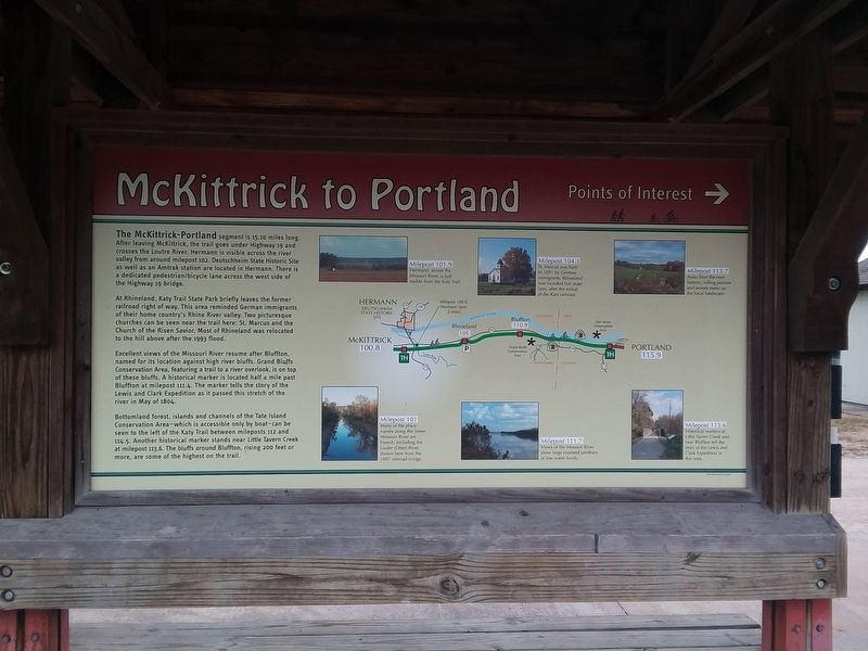
McKittrick to Portland
Points of Interest
— Katy Trail State Park —
The McKittrick-Portland segment is 15.10 miles long. After leaving McKittrick, the trail goes under Highway 19 and crosses the Loutre River. Hermann is visible across the river valley from around milepost 102. Deutschheim State Historic Site as well as an Amtrak station are located in Hermann. There is a dedicated pedestrian/bicycle lane across the west side of the Highway 19 bridge.
At Rhineland, Katy Trail State Park briefly leaves the former railroad right of way. This area reminded German immigrants of their home country's Rhine River valley. Two picturesque churches can be seen near the trail here: St. Marcus and the Church of the Risen Savior. Most of Rhineland was relocated to the hill above after the 1993 flood.
Excellent views of the Missouri River resume after Bluffton, named for its location against high river bluffs. Grand Bluffs Conservation Area, featuring a trail to a river overlook, is on top of these bluffs. A historical marker is located half a mile past Bluffton at milepost 111.4. The marker tells the story of the Lewis and Clark Expedition as it passed this stretch of the river in May of 1804.
Bottomland forest, islands and channels of the Tate Island Conservation Area-which is accessible only by boat-can be seen to the left of the Katy Trail between mileposts 112 and 114.5. Another
historical marker stands near Little Tavern Creek at milepost 113.6. The bluffs around Bluffton, rising 200 feet or more, are some of the highest on the trail.[Captions:]
Milepost 101
Many of the place names along the lower Missouri River are French, including the Loutre (Otter) River, shown here from the 1897 railroad bridge.
Milepost 101.9
Hermann, across the Missouri River, is just visible from the Katy Trail.
Milepost 104.3
St. Marcus was built in 1891 by German immigrants. Rhineland was founded five years later, after the arrival of the Katy railroad.
Milepost 111.7
View of the Missouri River show large exposed sandbars at low water levels.
Milepost 113.6
Historical markers at Little Tavern Creek and near Bluffton tell the story of the Lewis and Clark Expedition in this area.
Milepost 113.7
Away from the river bottom, rolling pasture and woods make up the local landscape.
Erected by Missouri Department of Natural Resources.
Topics and series. This historical marker is listed in these topic lists: Churches & Religion • Railroads & Streetcars • Settlements & Settlers • Waterways & Vessels. In addition, it is included in the Katy Trail State Park, and the Lewis & Clark Expedition series lists. A significant historical month for this entry is May 1804.
Location. 38° 44.033′ N, 91° 26.667′ W. Marker is in McKittrick, Missouri, in Montgomery County. Marker is on Sterline Street, 0.1 miles west of Walnut Street, on the left when traveling west. The marker is in the parking lot of the Katy Trail State Park, McKittrick Area. Touch for map. Marker is at or near this postal address: 500 Walnut St, Hermann MO 65041, United States of America. Touch for directions.
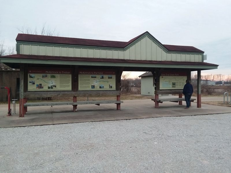
Other nearby markers. At least 8 other markers are within 2 miles of this marker, measured as the crow flies. McKittrick to Treloar (here, next to this marker); 25th Anniversary (a few steps from this marker); Capt. Steven Neil Bezold (about 300 feet away, measured in a direct line); Gasconade County Courthouse (approx. 1.9 miles away); The Maria Waechter House (approx. 1.9 miles away); Pioneer Trails Juncture (approx. 1.9 miles away); Hermann: Germania's Liberator (approx. 1.9 miles away); The Lewis and Clark Expedition Across Missouri (approx. 1.9 miles away). Touch for a list and map of all markers in McKittrick.
Credits. This page was last revised on December 10, 2020. It was originally submitted on December 10, 2020, by Craig Doda of Napoleon, Ohio. This page has been viewed 134 times since then and 18 times this year. Photos: 1, 2. submitted on December 10, 2020, by Craig Doda of Napoleon, Ohio. • Devry Becker Jones was the editor who published this page.

