Near Stanton in Mercer County, North Dakota — The American Midwest (Upper Plains)
Hidatsa Village

Photographed By Barry Swackhamer, August 28, 2020
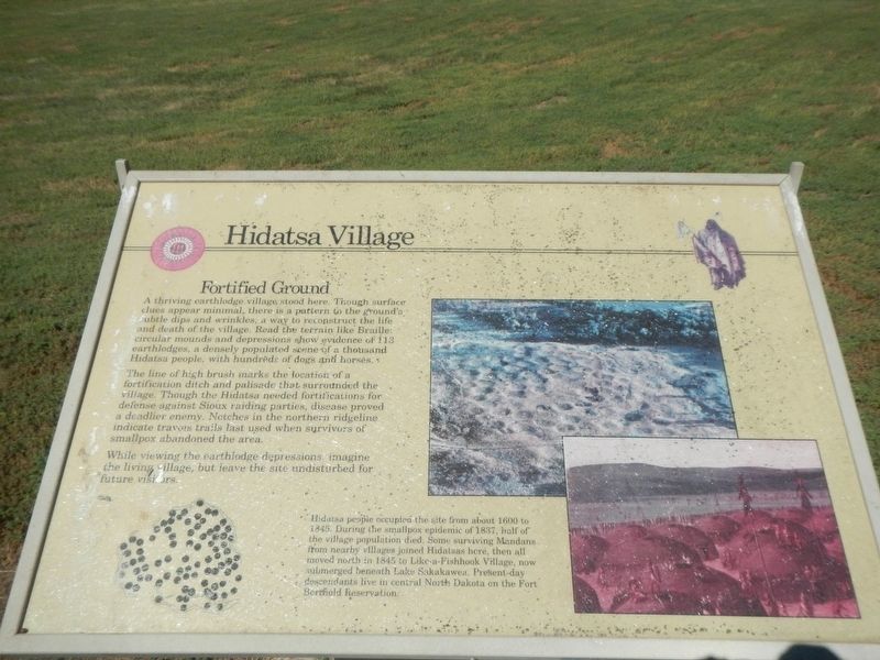
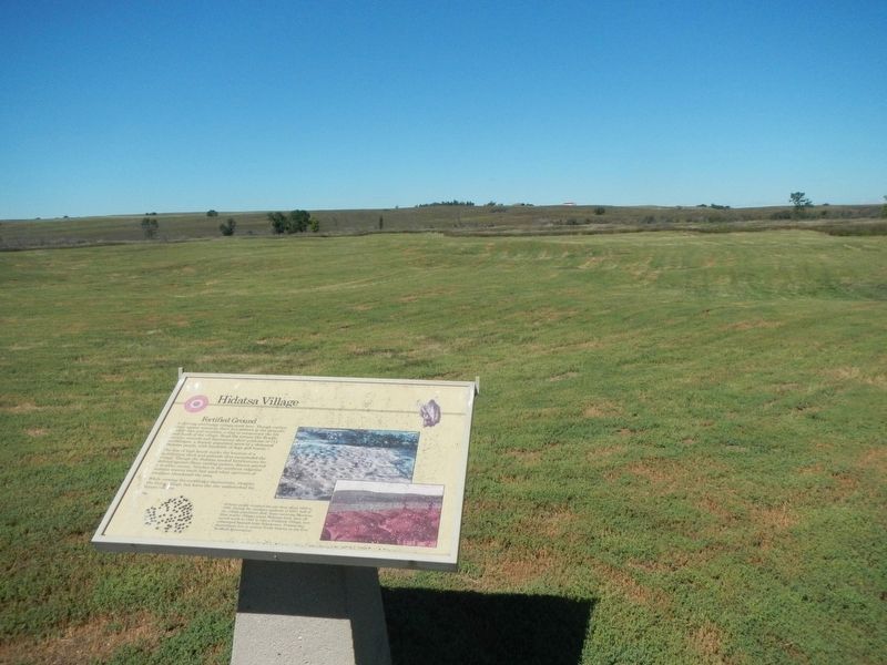
1. Hidatsa Village Marker
Caption: (bottom center) Hidatsa people occupied the site from about 1600 to 1845. During the smallpox epidemic of 1837, half of the village population died. Some surviving Mandans from nearby villages joined Hidatsas here, then all moved north in 1845 to Like-a-Fishhook Village, now submerged beneath Lake Sakakawea. Present-day descendants live in central North Dakota of the Fort Berthold Reservation.
A thriving earthlodge village stood here. Though surface clues appear minimal, there is a pattern to the ground's subtle dips and wrinkles, a way to reconstruct the life and death of the village. Read the terrain like Braille: circular mounds and depressions show evidence of 113 circular mounds and depressions show evidence of a thousand Hidatsa people, with hundreds of dogs and horses.
The line of high brush marks the location of a fortification ditch and palisade that surrounded the village. Though the Hidatsa needed fortifications for defense against Sioux raiding parties, disease proved a deadlier enemy. Notches in the northern ridgeline indicated travois trails last used when survivors of smallpox abandoned the area.
While viewing the earthlodge depressions, imagine the living village, but leave the site undisturbed for future visitors.
Erected by Department of the Interior, National Parks Service.
Topics. This historical marker is listed in these topic lists: Anthropology & Archaeology • Native Americans.
Location. 47° 21.683′ N, 101° 23.271′ W. Marker is near Stanton, North Dakota, in Mercer County. Marker can be reached from County Road 18 near County Road 37, on the left when traveling east. The Big Hidatsa Village Site is about 1 mile north of the Knife River Indian Villages Interpretive Center. From the parking lot on County Road 18 it is a 1/4 mile walk in to the Big Hidatsa Village Site. Touch for map. Marker is in this post office area: Stanton ND 58571, United States of America. Touch for directions.
Other nearby markers. At least 8 other markers are within 2 miles of this marker, measured as the crow flies. River-Centered (approx. 1˝ miles away); Awatixa Village (approx. 1˝ miles away); Cutbank Archeaology (sic) (approx. 1˝ miles away); Feeding the River (approx. 1.6 miles away); Middens (approx. 1.9 miles away); Awatixa Xi'e Village (approx. 2 miles away); Hidatsa Garden (approx. 2.1 miles away); Lewis & Clark at the Knife River Indian Villages (approx. 2.1 miles away). Touch for a list and map of all markers in Stanton.
Credits. This page was last revised on December 11, 2020. It was originally submitted on December 11, 2020, by Barry Swackhamer of Brentwood, California. This page has been viewed 107 times since then and 10 times this year. Photos: 1, 2. submitted on December 11, 2020, by Barry Swackhamer of Brentwood, California.
