Missouri Valley in Harrison County, Iowa — The American Midwest (Upper Plains)
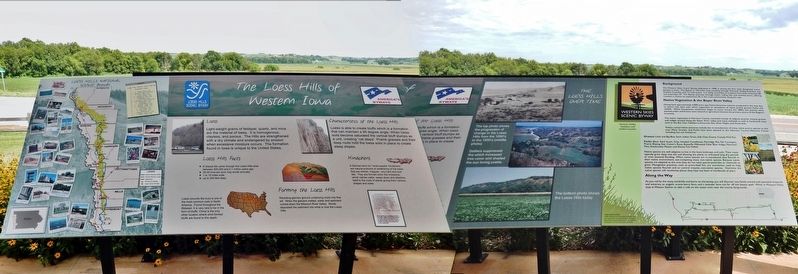
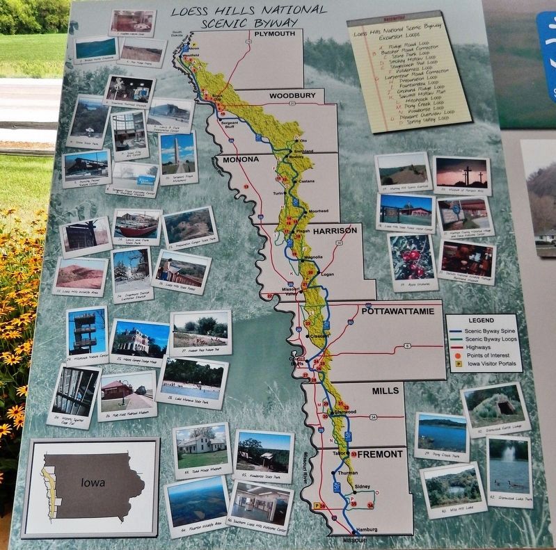
Loess Hills of Western Iowa
Loess
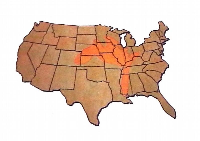
Light-weight grains of feldspar, quartz, and mica are the material of loess. It is homogenous, clayless, and porous. The Hills are strengthened with a dry climate and endangered by erosion when excessive moisture occurs. The formation found in Iowa is unique to the United States.
Loess Hills Facts
• 6 Glacial tills came through the Loess Hills area between 500,000 and 2.1 million years ago
• 30-40 tons per acre may erode annually
• 1 to 15 miles wide
• up to 200 feet deep
Forming the Loess Hills
Receding glaciers ground underlying rocks into fine silt. When the glaciers melted, water and sediment rushed down the Missouri River Valley. Winds deposited the sediment into what is now the Loess Hills.
Characteristics of the Loess Hills
Loess is able to create bluffs which is a formation that can maintain a 90 degree angle. When loess soils become saturated the vertical bluff slumps as a unit, creating "cat steps". Prairie grasses and their deep roots hold the loess soils in place to create steep slopes.
Kindchens
A German term for “small people” Kindchens are natural products of weathering of the loess that are whitish, irregular, very hard and rock like. They are formed when the limestone, which carries water, seeps down and attaches itself to the roots of plants giving them various shapes and sizes.
”…situated off the L. Point opposite An extensive Prairie on the S. S. This Prairie I call Ball (bald) patted Prairie, from a range of Ball Hills parrelel to the river & at from 3 to 6 miles distant from it, and extends as far up & Down as I Can See. We Camped in a point of woods on the L. S. above the Lower point of the Island…”
—William Clark, July 16, 1804
While traveling up the Missouri River, Clark described a “Bald-Pated Prairie” in his journal. This located them on the Missouri-Iowa boundary close to present day Waubonsie State Park in the Loess Hills.
Western Skies Scenic Byway
Background
The Western Skies Scenic Byway, dedicated in 1998, is among the first state designated scenic byways in Iowa. The Byway is 142-miles long, traveling through Harrison, Shelby, Audubon, and Guthrie Counties, and 14 rural towns. It is easily accessible to travelers from both Interstate 80 and Interstate 29. The Byway journeys through Iowa's rolling hills and working farms, offering travelers a chance to experience life in the rural communities along the way.
Native Vegetation & the Boyer River Valley
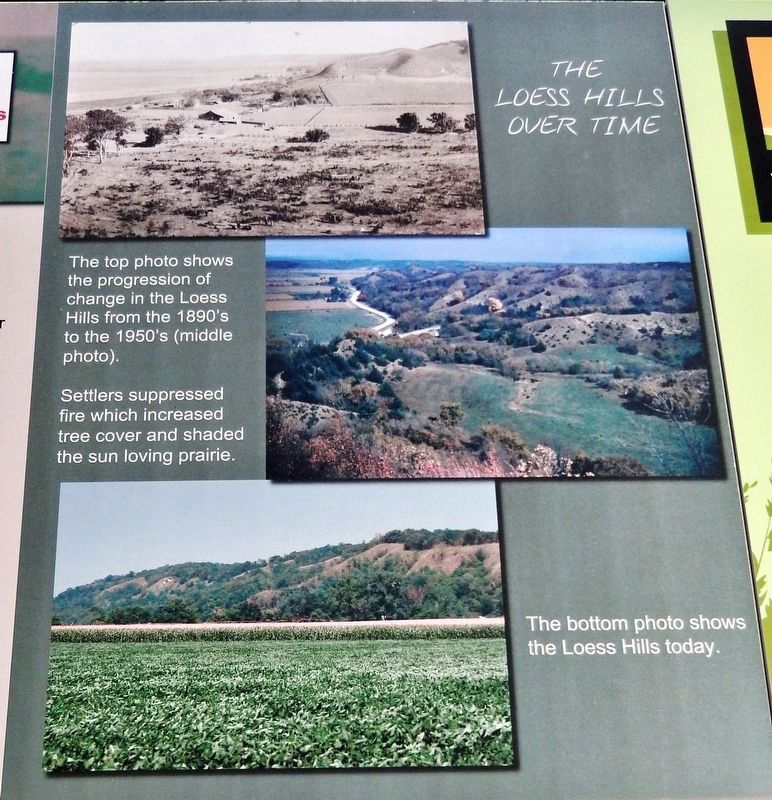
Dating back approximately 4,000 years ago, Native American cultures prospered in this area due to Iowa's rich, dark soils which supported an abundance of native prairie grasses, forbs, and wildlife. When European settlement began to occur around the 1800s, the prairies were plowed under and forests were cleared as agriculture became the primary source of the Region’s economy.
The native vegetation In Harrison County consisted mostly of tallgrass prairies. Swamp grasses and sedges existed along the Boyer River valley and many wetlands as well as hardwood trees such as the Bur Oak, Hackberry, American Elm, Silver Maple, and Green Ash.
Today's conservation practices include the re-introduction of many native prairie species to this area. Many Grasses and Forbs have been planted at the Harrison County Welcome Center including, but not limited to:
Grasses: Little and Big Blue Stem, Indian Grass, Side Oats Grama, Canada Wild Rye.
Forbs: Black Eyed Susan, Gray Headed Coneflower, Partridge Pea, Tall Coreopsis, Prairie Blazing Star, Culver's Root, Butterfly Milkweed, False Blue Indigo, Mountain Mint, Rattlesnake Master, and Showy Tick Trefoil.
Native species are well adaptive to live in the Iowa landscape and soils. Their roots typically grow deep into the soil allowing the plants to withstand long dry periods or even seasonal flooding. When native species are re-introduced they flourish in their native environment, out-competing many
non-native species. Because native species are adapted to this area they do not need special pesticides or chemicals to grow. Management practices, such as prescribed fire, are sometimes used to help native species flourish and to control invasive, non-native species. Overtime the native species will recolonize places they have not been in hundreds of years.
Along the Way
As you roll by the many windmills and barns on the byway, you will discover two family owned and operated vineyards and wineries, an organic aronia berry farm, and a lavender farm not far off the beaten path. While in Missouri Valley stop at Watson Station to take a ride on the steam train near the county fairgrounds.
Project Sponsored by:
Golden Hills Resource Conservation & Development
Iowa Department of Natural Resources through a Natural Resource Based Opportunity Grant (NRBOG)
Photographs © Emily Haase; Golden Hills RC&D
Topics and series. This historical marker is listed in these topic lists: Environment • Exploration • Native Americans • Settlements & Settlers. In addition, it is included in the Lewis & Clark Expedition series list. A significant historical date for this entry is July 16, 1804.
Location. 41° 35.004′ N, 95° 50.819′ W. Marker is in Missouri Valley, Iowa, in Harrison County. Marker
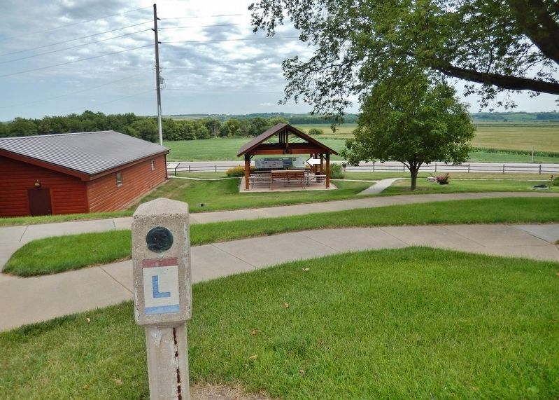
can be reached from Lincoln Highway (U.S. 30) just west of Monroe Avenue, on the right when traveling west. Marker is located in an interpretive kiosk at the Harrison County Historical Village & Iowa Welcome Center, overlooking the Lincoln Highway. Touch for map. Marker is at or near this postal address: 2931 Monroe Avenue, Missouri Valley IA 51555, United States of America. Touch for directions.
Other nearby markers. At least 8 other markers are within 11 miles of this marker, measured as the crow flies. 3389 Miles from New York to San Francisco... Join the Ride! (here, next to this marker); Terracing in the Loess Hills (a few steps from this marker); Agriculture in the Loess Hills (a few steps from this marker); Missouri Valley Veterans' Memorial (approx. 3.6 miles away); Lewis and Clark Campsite Area (approx. 9 miles away in Nebraska); Steamboat Bertrand (approx. 10.4 miles away in Nebraska); The Lewis and Clark Expedition (approx. 11 miles away in Nebraska); Up the Missouri (approx. 11 miles away in Nebraska). Touch for a list and map of all markers in Missouri Valley.
Also see . . . Journals of the Lewis & Clark Expedition - July 16, 1804. (Submitted on December 13, 2020, by Cosmos Mariner of Cape Canaveral, Florida.)
Credits. This page was last revised on December 14, 2020. It was originally submitted on December 12, 2020, by Cosmos Mariner of Cape Canaveral, Florida. This page has been viewed 208 times since then and 28 times this year. Photos: 1. submitted on December 12, 2020, by Cosmos Mariner of Cape Canaveral, Florida. 2, 3, 4, 5, 6. submitted on December 13, 2020, by Cosmos Mariner of Cape Canaveral, Florida.
