Near Stanton in Mercer County, North Dakota — The American Midwest (Upper Plains)
Winter Villages and Lodges
Fort Clark State Historic Site
Inscription.
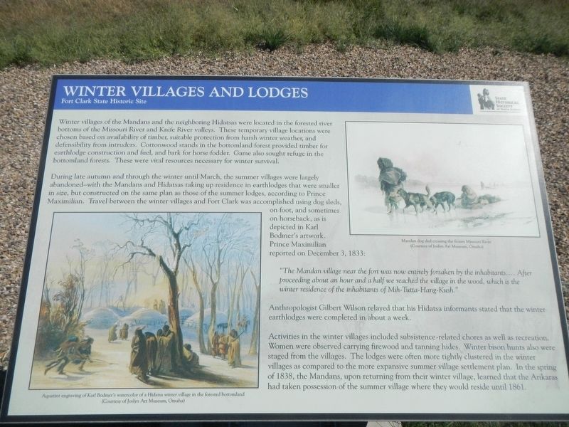
Winter villages of the Mandans and the neighboring Hidatsas were located in the forested river bottoms of the Missouri River and Knife River valleys. These temporary village locations were chosen based on availability, suitable protection form harsh winter weather, and defensibility from intruders. Cottonwood stands in the bottomland forest provided timber for earthlodge construction and fuel, and bark for horse fodder. Game also sought refuge in the bottomland forests. These were vital resources necessary for winter survival.
During late autumn and through the winter until March, the summer villages were largely abandoned-with the Mandans and Hidatsas taking up residence in earthlodges that were smaller in size, but constructed on the same plan as those of the summer lodges, according to Prince Maximilian. Travel between the winter villages and Fort Clark was accomplished using dog sleds, on foot, and sometimes on horseback, as is depicted in Karl Bodmer's artwork. Prince Maximilian reported on December 3, 1833:
"The Mandan village near the fort was now entirely forsaken by the inhabitants.... After proceeding about an hour and a half we reached the village in the wood, which is the winter residence of the inhabitants of Mih-Tutta-Hang-Kush."
Anthropologist Gilbert Wilson relayed that his Hidatsa informants stated that the winter earthlodges were completed in about a week.
Activities in the winter villages included subsistence-related chores as well as recreation. Women were observed carrying firewood and tanning hides. Winter bison hunts also were staged from villages. The lodges were often more tightly clustered in the winter villages as compared to the more expansive summer village settlement plans. In the spring of 1838, the Mandans, upon returning from their winter village, learned that the Arikaras had taken possession of the summer village where they would reside until 1861.
Erected by State Historical Society of North Dakota.
Topics. This historical marker is listed in these topic lists: Anthropology & Archaeology • Native Americans.
Location. 47° 15.115′ N, 101° 16.351′ W. Marker is near Stanton, North Dakota, in Mercer County. Marker can be reached from 37th Avenue Southwest near 12th Street Southwest (State Highway 200), on the right when traveling north. The marker is located at the Fort Clark State Historic Site. Touch for map. Marker is in this post office area: Stanton ND 58571, United States of America. Touch for directions.
Other nearby markers. At least 8 other markers are within walking distance of this marker. Missouri Valley Environs (a few steps from this marker); Stone Shelter (a few steps from this marker); Fort Clark (circa 1830-1860)
(within shouting distance of this marker); The People (within shouting distance of this marker); Corrals (about 300 feet away, measured in a direct line); Pierre Garreau's Lodge (about 400 feet away); Earthlodges (about 400 feet away); Geophysics and Archaeology (about 500 feet away). Touch for a list and map of all markers in Stanton.
Credits. This page was last revised on December 13, 2020. It was originally submitted on December 13, 2020, by Barry Swackhamer of Brentwood, California. This page has been viewed 116 times since then and 13 times this year. Photos: 1, 2. submitted on December 13, 2020, by Barry Swackhamer of Brentwood, California.

