
Near Stanton in Mercer County, North Dakota — The American Midwest (Upper Plains)
Smallpox and the Central Plaza
Fort Clark State Historic Site
Photographed by Barry Swackhamer, August 28, 2020
1. Smallpox and the Central Plaza Marker
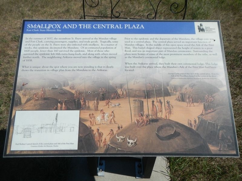
Captions: (background) George Catlin painted this view of the central plaza. Note the Ark of the First Man, located in the center of the plaza.; (bottom left) Karl Bodmer's pencil sketch of the central plaza and Ark of the First Man.
What is unique about the spot were you are now standing is that it clearly shows the transition in village plan from the Mandans to the Arikaras.
Prior to the epidemic and the departure of the Mandans, the village core was used as a central plaza. The central plaza served an important function of Mandan villages. In the middle of this open space stood the Ark of the First Man. This barrel-shaped object represented the height of waters in a great flood, and was an important part of Mandan ceremonies. Surrounding the plaza were homes of some of the most prominent members of the tribe,
this page online
Erected by State Historical Society of North Dakota.
Topics. This historical marker is listed in these topic lists: Anthropology & Archaeology • Indigenous Peoples and Communities.
Location. 47° 15.214′ N, 101° 16.416′ W. Marker is near Stanton, North Dakota, in Mercer County. It can be reached from 37th Avenue Southwest near 12th Street Southwest (State Highway 200), on the right when traveling north. The marker is located at the Fort Clark State Historic Site. Touch for map. Marker is in this post office area: Stanton ND 58571, United States of America. Touch for directions.

Regionally, this marker is in North Dakota’s Mandan, Hidatsa, and Arikara Nation, in the Standing Rock Sioux Tribe, and on the Missouri Plateau. It is also in the American Lewis & Clark Corridor, on the prairies, and on the Northern Plains. Globally, it is in North America, the Western
Photographed by Google maps, December 14, 2020
2. Smallpox and the Central Plaza Marker
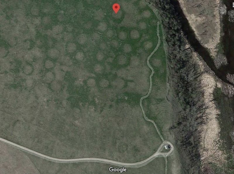
The stone shelter is at the bottom.
Other nearby markers. At least 8 other markers are within walking distance of this marker: Fort Mandan Overlook (within shouting distance of this marker); Mandans and Arikaras of the Village (within shouting distance of this marker); Earthlodges (within shouting distance of this marker); Palisade Wall (about 600 feet away, measured in a direct line); Stone Shelter (about 600 feet away); Corrals (about 600 feet away); Winter Villages and Lodges (about 700 feet away); Missouri Valley Environs (about 700 feet away). Touch for a list and map of all markers in Stanton.
Credits. This page was last revised on December 14, 2020. It was originally submitted on December 14, 2020, by Barry Swackhamer of Brentwood, California. This page has been viewed 216 times since then and 17 times this year. Photos: 1, 2. submitted on December 14, 2020, by Barry Swackhamer of Brentwood, California.
