Near Stanton in Mercer County, North Dakota — The American Midwest (Upper Plains)
Palisade Wall
Fort Clark State Historic Site
Inscription.
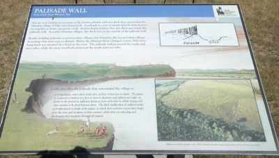
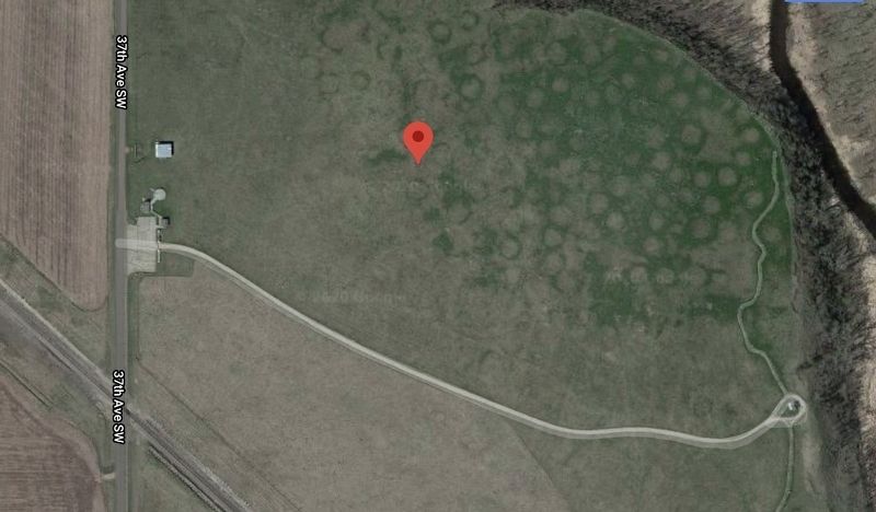
You are now looking at a portion of the former palisade wall and the ditch that surrounded the Mandan village of Mih-tutta-hang-kush. A palisade is a row of closely spaced vertical posts set together to form a protective wall. Archaeologists belief that this ditch was inside the palisade wall. At earlier Mandan villages, the ditch was on the outside of the palisade wall.
Besides building palisades to protect their village, the Mandans also located their villages in settings that were easy to defend. Before the Missouri River changed course, Mih-tutta-hang-kush was situated on a bend in the river. The palisade wall protected the south and west sides, while the steep river bank protected the north and east sides.
Catlin describes the palisade that surrounded the village as:
a strong piquet, and a ditch inside of it, of three or four feet in depth. The piquet is composed of timbers of a foot or more in diameter, and eighteen feet high, set firmly in the ground at sufficient distance from each other to admit of guns and other missiles to be fired between them. The ditch (unlike that of civilized modes of fortifications) is inside of the piquet, in which their warriors screen their bodies for the view and weapons of their enemies, whilst they are reloading and discharging their weapons through the piquets.
Erected by State Historical Society of North Dakota.
Topics. This historical marker is listed in these topic lists: Forts and Castles • Native Americans.
Location. 47° 15.208′ N, 101° 16.564′ W. Marker is near Stanton, North Dakota, in Mercer County. Marker can be reached from 37th Avenue Southwest near 12th Street Southwest (State Highway 200), on the right when traveling north. The marker is located at the Fort Clark State Historic Site. Touch for map. Marker is in this post office area: Stanton ND 58571, United States of America. Touch for directions.
Other nearby markers. At least 8 other markers are within walking distance of this marker. Mih-tutta-hang-kush (meaning East Village or First Village) (about 400 feet away, measured in a direct line); Fort Clark Historic Site (about 600 feet away); Fort Clark in the International Fur Trade (about 600 feet away); Smallpox and the Central Plaza (about 600 feet away); Earthlodges (about 700 feet away); Mandans and Arikaras of the Village (about 800 feet away); Fort Mandan Overlook (about 800 feet away); Corrals (approx. 0.2 miles away). Touch for a list and map of all markers in Stanton.
Credits. This page was last revised on December 14, 2020. It was originally submitted on December 14, 2020, by Barry Swackhamer of Brentwood, California. This page has been viewed 127 times since then and 19 times this year. Photos: 1, 2. submitted on December 14, 2020, by Barry Swackhamer of Brentwood, California.

