Madame Sherri Forest
Welcome to the Madam Sherri Forest
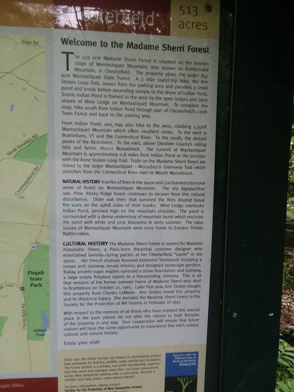
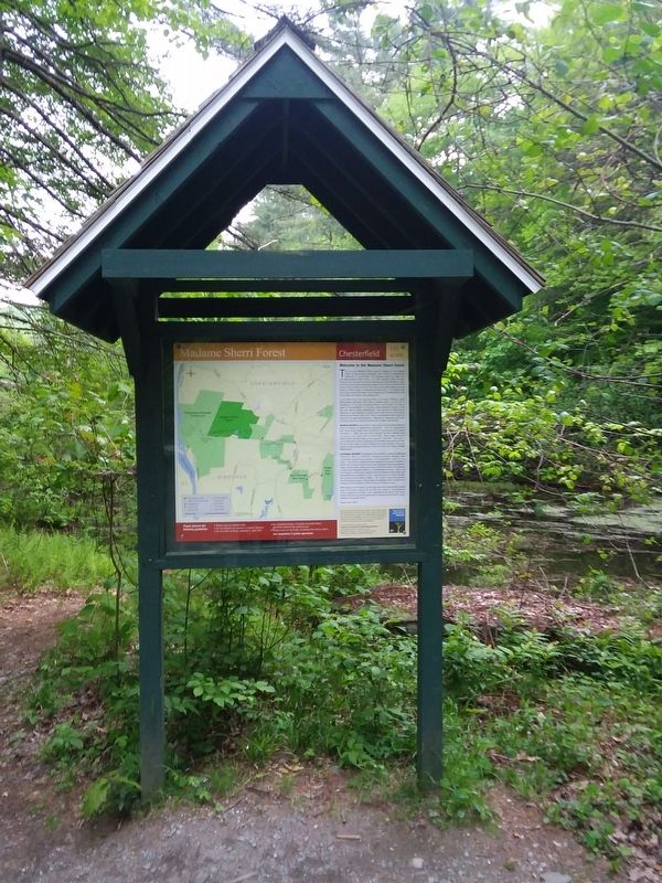
The 513 acre Madame Sherri Forest is situated on the eastern slope of Wantastiquet Mountain, also known as Rattlesnake Mountain, in Chesterfield. The property abuts the larger 847 acre Wantastiquet State Forest. A 2 mile round-trip hike, the Ann Stokes Loop Trail, leaves from the parking area and parallels a small pond and brook before ascending steeply to the shore of Indian Pond. Scenic Indian Pond is framed to the west by the open ledges and talus slopes of Mine Ledge on Wantastiquet Mountain. To complete the loop, hike south from Indian Pond through part of Chesterfield's Cook Town Forest and back to the parking area.
From Indian Pond, you, may also hike to the west, climbing 1,356ft Wantastiquet Mountain which offers excellent views. To the west is Brattleboro, VT and the Connecticut River. To the south, the distant peaks of the Berkshires. To the east, above Cheshire County's rolling hills and farms, Mount Monadnock. The summit of Wantastiquet Mountain is approximately o.8 miles from Indian Pond at the junction with the Anne Stokes Loop Trail. Trails on the Madame Sherri forest are linked to the larger Wantastiquet Monadnock Greenway Trail which stretches from the Connecticut River east to Mount Monadnock.
Natural History A series of fires in the 1940s and 50s burned extensive areas of
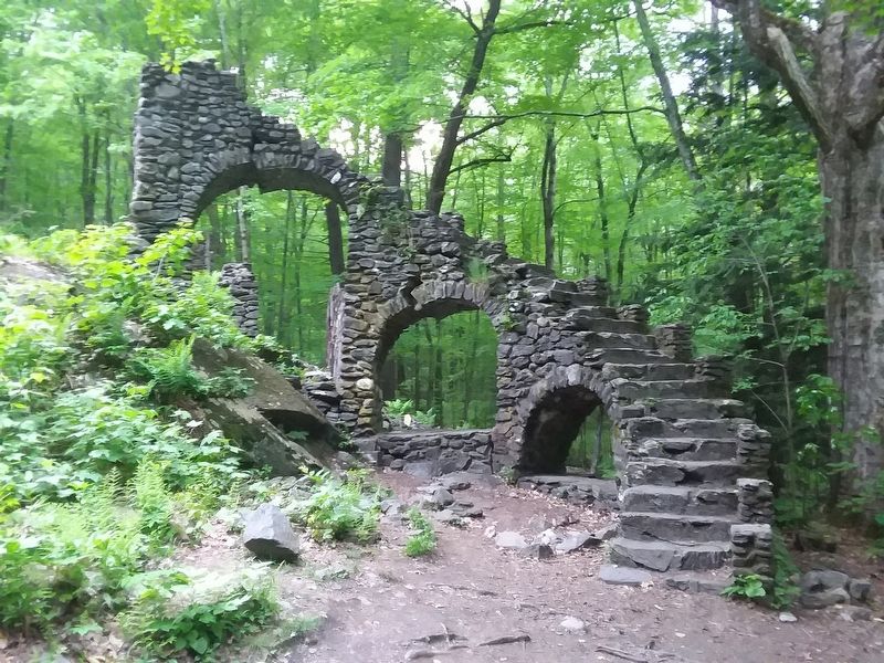
forest on Wantastiquet Mountain. The dry Appalachian oak- Pine- Rocky Ridge forest continues to recover from this natural disturbance. Older oak trees that survived the fires display basal fire scars on the uphill sides of their trunks. Mine Ledge overlooks Indian Pond, perched high on the mountain shoulder. The pond is surrounded with a dense understory of mountain laurel which encircles the pond with white and pink blossoms in early summer. The talus slopes of Wantastiquet Mountain were once home to Eastern Timber Rattlesnakes.Cultural History The Madame Sherri Forest is named for Madame Antoinette Sherri, a Paris-born theatrical costume designer who entertained lavishly during parties at her Chesterfield "castle” in the 1920s. Her French chateau featured extensive stonework including a roman arch stairway, ornate interior, and designed landscape gardens. Today, ancient sugar maples surround a stone foundation and stairway, a large empty fireplace tapers to a freestanding chimney. This is all that remains of the former summer home of Madame Sherri who died in Brattleboro on October 21, 1965. Later that year, Ann Stokes bought this property from Charles LeMaire. Ann Stokes loved this property and its theatrical legacy. She donated the Madame Sherri Forest to the Society for the Protection of NH Forests in February of 1991.
With respect
to the memory of all those who have enjoyed this special place in the past: please do not alter the natural or built features of the property in any way. Your cooperation will ensure that future visitors will have the same opportunity to experience this site's unique cultural and natural history.
Enjoy your visit!
Topics. This historical marker is listed in these topic lists: Architecture • Arts, Letters, Music • Horticulture & Forestry • Women. A significant historical month for this entry is February 1991.
Location. 42° 51.89′ N, 72° 31.074′ W. Marker is in West Chesterfield, New Hampshire, in Cheshire County. Marker is at the intersection of Gulf Road and Egypt Road, on the right when traveling south on Gulf Road. Parking is opposite the intersection. The marker lies along trail to Madame Sherri Mansion Ruins. Touch for map. Marker is at or near this postal address: 43 Egypt Rd, Chesterfield NH 03443, United States of America. Touch for directions.
Other nearby markers. At least 8 other markers are within 3 miles of this marker, measured as the crow flies. Brattleboro Veterans Monument (approx. 2.2 miles away in Vermont); Centre Congregational Church (approx. 2.2 miles away in Vermont); Memorial Tree (approx. 2.2 miles away in Vermont); Brattleboro Civil War Monument (approx. 2.2 miles away in Vermont); The First Building of the Centre Congregational Church
Credits. This page was last revised on February 16, 2023. It was originally submitted on December 14, 2020, by Craig Doda of Napoleon, Ohio. This page has been viewed 196 times since then and 11 times this year. Photos: 1, 2, 3, 4. submitted on December 14, 2020, by Craig Doda of Napoleon, Ohio. • Devry Becker Jones was the editor who published this page.


